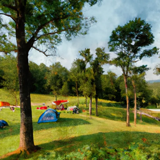
Tsali Recreation Area Campground
Community Reviews
Been here? Share the conditions.
Reviews, ratings & photos are added in the free Snoflo iOS app — rate a spot, tag the conditions, and your visit is verified by location. Add or manage your reviews from the app.
Tsali Recreation Area
The campground amenities at Tsali Recreation Area include 40 campsites, each equipped with a picnic table, fire ring, and grill. The campground is available on a first-come, first-served basis, and reservations are not accepted. There are no hookups for RVs, but potable water and restrooms with flush toilets are available on-site.
One quirky fact about the area is that the Tsali Recreation Area is named after a Cherokee Indian who refused to be relocated to Oklahoma in the 1800s. He was executed for his resistance, but his name lives on in this beautiful area of North Carolina.
The best time to visit Tsali Recreation Area is during the spring or fall when the temperatures are mild and the leaves are changing colors. In the spring, temperatures range from the mid-50s to the mid-70s, while in the fall, temperatures range from the mid-40s to the mid-60s. Overall, the Tsali Recreation Area is a fantastic camping destination for those seeking a peaceful retreat in the midst of nature.
What's on-site at Tsali Recreation Area
Key facilities Snoflo tracks for this campground. Confirm with the operator before booking -- amenities can change seasonally.
Plan your trip down to the hour
Same weather feed Snoflo's iOS app uses -- updated continuously from NOAA / yr.no.
Next 5 days, hour by hour
Temperature line with weather symbols on top, snow + rain accumulation as columns, humidity as a dotted line.
5-day forecast table
Every 3 hours, broken out across temperature, snow, rain, humidity, and wind. Each cell is colour-coded relative to the column min/max so trends jump out at a glance.
| Time | Condition | Temp (°F) | Snow (in) | Rain (in) | Humidity (%) | Wind (mps) | Wind dir |
|---|---|---|---|---|---|---|---|
| Loading detailed forecast… | |||||||
15-day temperature & precipitation
Daily temperatures, snow, and rain projected over the next two weeks. Hover any point for the full breakdown.
Other campgrounds in the area
Snoflo-tracked campsites within driving distance of Tsali Recreation Area, with reservations status.
| Campground | Reservations | Toilets | View |
|---|---|---|---|
| 10 Ledbetter Ridge | ✗ | ✗ | → |
| 9 Anthony Creek | ✗ | ✗ | → |
| #09 Anthony Creek | ✗ | ✗ | → |
| Anthony Creek Horse Camp | ✗ | ✗ | → |
| Cades Cove Campground | ✗ | ✗ | → |
| Cades Cove Group Campground | ✗ | ✗ | → |
Nearby streamflow
USGS streamgauges within reach of Tsali Recreation Area -- pulled live from the National Water Information System.
| Streamgauge | Discharge | View |
|---|---|---|
| Little River Above Townsend | 636 cfs | → |
| Cheoah River Nr Bearpen Gap Nr Tapoco | 319 cfs | → |
| Little River Near Maryville | 946 cfs | → |
| Little River Near Alcoa | 1,100 cfs | → |
| Tuckasegee River At Bryson City | 2,070 cfs | → |
| Little Tennessee River At Needmore | 635 cfs | → |
Nearby snow depths
NRCS SNOTEL stations within reach of Tsali Recreation Area -- relevant when planning a shoulder-season or alpine trip.
| SNOTEL station | Snowpack | 24h Snowfall | View |
|---|---|---|---|
| Bryson City 4 | 0.0 in | 0.0 in | → |
| New Found Gap | 2.9 in | 0.0 in | → |
| Gatlinburg | 0.0 in | 0.0 in | → |
| Dillard 0.7 Nnw | 0.0 in | 0.0 in | → |
| Germany Valley | 0.0 in | 0.0 in | → |
| Brevard | 0.0 in | 0.0 in | → |
Plan a longer trip
The closest parks, lakes, boat launches, and paddle runs so a camping night can grow into a full weekend.
Parks
- Swain County Park
- Great Smoky Mountains National Park
- Needmore Game Land
- Wilderness Joyce Kilmer-Slickrock
- Wilderness Citico Creek
- Wilderness Southern Nantahala
Boat launches
- Highway 28, Fontana Dam
- Fontana Road 12574, Robbinsville
- Cable Cove Road Graham County
- Cable Cove Road, Fontana Dam
- Meadow Branch Road Graham County
- Peery's Mill Park
Fishing spots
- Birchfield Branch
- Augerhole Branch
- Santeetlah Lake
- Massey Branch Fishing Pier
- Citico Creek
- Indian Boundary Lake
Points of interest
- Lone Grove Overlook
- Carter Shields Cabin
- Maple Branch Overlook
- Mccaulley Branch Overlook
- Bunting Branch Overlook
- Oliver Branch Overlook
Paddle runs
- Natahala Powerhouse To Lake Fontana (River Mile 4)
- Polecat Branch To Snowbird Picnic Area
- Owlcamp Branch To Polecat Branch
- Headwaters Near Mitchell Lick To Owlcamp Branch
- Headwaters Near Graham County Line To Nc/Tn State Line
- Headwaters In Standing Indian Basin To Slackwater Of Natahala Lake
Camping essentials & Leave No Trace
- Pack it in, pack it out
- Take all trash, food scraps, and gear back with you to keep campsites clean and protect wildlife.
- Respect wildlife
- Observe animals from a distance, store food securely, and never feed wildlife to maintain natural behavior and safety.
- Know before you go
- Check weather, fire restrictions, trail conditions, and permit requirements to ensure a safe and well-planned trip.
- Minimize campfire impact
- Use established fire rings, keep fires small, fully extinguish them, or opt for a camp stove when fires are restricted.
- Leave what you find
- Preserve natural and cultural features by avoiding removal of plants, rocks, artifacts, or other elements of the environment.
Set push alerts in the Snoflo app
Save Tsali Recreation Area as a favorite, set a custom threshold (precipitation, snowpack, freezing temperatures), and the iOS app will push the moment conditions cross.
About Tsali Recreation Area
Can I make reservations at Tsali Recreation Area?
This campground does not appear to accept reservations -- it's typically first-come, first-served. Arrive early on summer weekends.
How fresh is the weather data on this page?
The hourly forecast updates throughout the day from the NOAA / yr.no public feeds. Streamflow data is pulled live from USGS streamgauges and snowpack from the NRCS SNOTEL network.
What's the best time of year to visit?
Use the 15-day temperature & precipitation outlook on this page to plan -- pick a window with comfortable temperatures and low precipitation. For longer trips, the 5-day hourly meteogram shows snow + rain accumulation hour-by-hour.
How do I get to Tsali Recreation Area?
Tap Directions in the hero above to open driving directions in Google Maps, or Open in map to center the Snoflo interactive map on the campground.
Can I get alerts when conditions change?
Yes -- alerts are managed through the Snoflo iOS app. Favorite this campground, set a threshold (temperature, snowpack, precipitation), and you'll get a push the moment it crosses.
Other campgrounds near here
Snoflo-tracked campgrounds within driving distance of Tsali Recreation Area.