Tugaloo State Park Campground
Community Reviews
Been here? Share the conditions.
Reviews, ratings & photos are added in the free Snoflo iOS app — rate a spot, tag the conditions, and your visit is verified by location. Add or manage your reviews from the app.
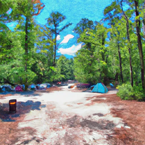
Tugaloo State Park
The park is located near several points of interest, including Victoria Bryant State Park, the Toccoa Falls, and the Chattahoochee National Forest. Visitors can also enjoy various recreational activities such as fishing, swimming, boating, and hiking. The campground is equipped with several amenities, including showers, restrooms, picnic areas, and playgrounds. The camping area has both reservation and first-come-first-serve options, accommodating up to 105 campsites.
An interesting fact about the Tugaloo State Park Camping Area is that it was once a popular 18th-century trading post for Cherokee and Creek Indians. The best time to visit Tugaloo State Park Camping Area is during the fall season, from September to November, with an average temperature of 65°F. The area experiences mild winters and hot summers, with temperatures ranging from 30°F to 90°F. Overall, the Tugaloo State Park Camping Area is a must-visit destination for nature enthusiasts and outdoor adventurers looking for a peaceful and scenic getaway in Georgia.
What's on-site at Tugaloo State Park
Key facilities Snoflo tracks for this campground. Confirm with the operator before booking -- amenities can change seasonally.
Plan your trip down to the hour
Same weather feed Snoflo's iOS app uses -- updated continuously from NOAA / yr.no.
Next 5 days, hour by hour
Temperature line with weather symbols on top, snow + rain accumulation as columns, humidity as a dotted line.
5-day forecast table
Every 3 hours, broken out across temperature, snow, rain, humidity, and wind. Each cell is colour-coded relative to the column min/max so trends jump out at a glance.
| Time | Condition | Temp (°F) | Snow (in) | Rain (in) | Humidity (%) | Wind (mps) | Wind dir |
|---|---|---|---|---|---|---|---|
| Loading detailed forecast… | |||||||
15-day temperature & precipitation
Daily temperatures, snow, and rain projected over the next two weeks. Hover any point for the full breakdown.
Other campgrounds in the area
Snoflo-tracked campsites within driving distance of Tugaloo State Park, with reservations status.
| Campground | Reservations | Toilets | View |
|---|---|---|---|
| Lake Hartwell State Park | ✓ | ✗ | → |
| Coneross - Hartwell Lake | ✓ | ✗ | → |
| Chau Ram County Park | ✗ | ✗ | → |
| Hart State Park | ✗ | ✗ | → |
| Miltown | ✓ | ✗ | → |
Nearby streamflow
USGS streamgauges within reach of Tugaloo State Park -- pulled live from the National Water Information System.
| Streamgauge | Discharge | View |
|---|---|---|
| Tallulah River Ab Powerhouse | 37 cfs | → |
| Chattooga River Near Clayton | 215 cfs | → |
| Beaverdam Creek Ab Elberton Ga | 32 cfs | → |
| Twelvemile Creek Near Liberty | 37 cfs | → |
| Rocky River Nr Starr | 33 cfs | → |
| Broad River Above Carlton | 439 cfs | → |
Nearby snow depths
NRCS SNOTEL stations within reach of Tugaloo State Park -- relevant when planning a shoulder-season or alpine trip.
| SNOTEL station | Snowpack | 24h Snowfall | View |
|---|---|---|---|
| Carnesville 7.3 Sw | 0.0 in | 0.0 in | → |
| Anderson | 0.0 in | 0.0 in | → |
| Antreville | 0.0 in | 0.0 in | → |
| Germany Valley | 0.0 in | 0.0 in | → |
| Dillard 0.7 Nnw | 0.0 in | 0.0 in | → |
| Sautee 3.5 Sw | 0.0 in | 0.0 in | → |
Plan a longer trip
The closest parks, lakes, boat launches, and paddle runs so a camping night can grow into a full weekend.
Parks
- Tugaloo State Park
- Hart State Outdoor Recreation Area
- Blue Ridge Field
- Victoria Bryan State Park
- Sumter National Forest
- Henderson Falls Park
Boat launches
- Tugaloo Point Franklin County
- Tugaloo State Park Road Franklin County
- Poplar Springs
- Harbor Light Marina
- Choestoea Road Oconee County
- Lake Hartwell State Park
Fishing spots
Points of interest
- Franklin County Courthouse
- M60
- Ty Cobb
- Currahee Military Museum
- Riley Moore Falls
- Oconee County Cage
Paddle runs
- Confluence Of Cedar Creek To 1/4 Mile Below The Nf Boundary And Fh 110, Cobbs Bridge Road
- South Of Cedar Creek Rifle Range To Confluence With Chauga River
- 1/4 Mile Below Fs 745 And Cassidy Bridge Hunt Camp To Confluence Of Cedar Creek
- Confluence Of Brasstown Creek And Little Brasstown Creek Just South Of Brasstown Falls Road (Fs 751) To Confluence Of Mill Branch, Brasstown Creek And Boatwright Creek Near Boatwright Road (Fs 753)
- Crpssing Of Land Bridge Road, Sc 196 To 1/4 Mile Below Fs 745 And Cassidy Bridge Hunt Camp
- Headwaters Just East Of Hwy 107 To Crossing Of Norton Field Road (Fs 715a)
Camping essentials & Leave No Trace
- Pack it in, pack it out
- Take all trash, food scraps, and gear back with you to keep campsites clean and protect wildlife.
- Respect wildlife
- Observe animals from a distance, store food securely, and never feed wildlife to maintain natural behavior and safety.
- Know before you go
- Check weather, fire restrictions, trail conditions, and permit requirements to ensure a safe and well-planned trip.
- Minimize campfire impact
- Use established fire rings, keep fires small, fully extinguish them, or opt for a camp stove when fires are restricted.
- Leave what you find
- Preserve natural and cultural features by avoiding removal of plants, rocks, artifacts, or other elements of the environment.
Set push alerts in the Snoflo app
Save Tugaloo State Park as a favorite, set a custom threshold (precipitation, snowpack, freezing temperatures), and the iOS app will push the moment conditions cross.
About Tugaloo State Park
Can I make reservations at Tugaloo State Park?
Yes -- this campground accepts reservations. Snoflo recommends booking early for peak season; check the operator (Recreation.gov / state park system / private operator) for the booking window and cancellation policy.
How fresh is the weather data on this page?
The hourly forecast updates throughout the day from the NOAA / yr.no public feeds. Streamflow data is pulled live from USGS streamgauges and snowpack from the NRCS SNOTEL network.
What's the best time of year to visit?
Use the 15-day temperature & precipitation outlook on this page to plan -- pick a window with comfortable temperatures and low precipitation. For longer trips, the 5-day hourly meteogram shows snow + rain accumulation hour-by-hour.
How do I get to Tugaloo State Park?
Tap Directions in the hero above to open driving directions in Google Maps, or Open in map to center the Snoflo interactive map on the campground.
Can I get alerts when conditions change?
Yes -- alerts are managed through the Snoflo iOS app. Favorite this campground, set a threshold (temperature, snowpack, precipitation), and you'll get a push the moment it crosses.
Other campgrounds near here
Snoflo-tracked campgrounds within driving distance of Tugaloo State Park.