Reservoir Number One Fishing
As of July 18, 2026, the nearest streamgauge to Reservoir Number One — Tallulah River Ab Powerhouse — reports 37 cfs. Source: USGS gauge data, refreshed throughout the day.
Community Reviews
Been here? Share the conditions.
Reviews, ratings & photos are added in the free Snoflo iOS app — rate a spot, tag the conditions, and your visit is verified by location. Add or manage your reviews from the app.
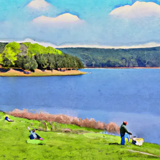
Reservoir Number One
What's biting at Reservoir Number One
Species commonly reported here -- tap any card for techniques, target seasons, and other waters where it's been caught.
Plan your trip down to the hour
Same weather feed Snoflo's iOS app uses -- updated continuously from NOAA / yr.no.
Next 5 days, hour by hour
Temperature line with weather symbols on top, snow + rain accumulation as columns, humidity as a dotted line.
5-day forecast table
Every 3 hours, broken out across temperature, snow, rain, humidity, and wind. Each cell is colour-coded relative to the column min/max so trends jump out at a glance.
| Time | Condition | Temp (°F) | Snow (in) | Rain (in) | Humidity (%) | Wind (mps) | Wind dir |
|---|---|---|---|---|---|---|---|
| Loading detailed forecast… | |||||||
15-day temperature & precipitation
Daily temperatures, snow, and rain projected over the next two weeks. Hover any point for the full breakdown.
Nearby streamflow
USGS streamgauges within reach of Reservoir Number One -- updated continuously from the National Water Information System.
| Streamgauge | Discharge | View |
|---|---|---|
| Tallulah River Ab Powerhouse | 37 cfs | → |
| Chattooga River Near Clayton | 258 cfs | → |
| Chattahoochee River Near Cornelia | 344 cfs | → |
| Chattahoochee River Near Leaf | 175 cfs | → |
| Beaverdam Creek Ab Elberton Ga | 27 cfs | → |
| Broad River Above Carlton | 320 cfs | → |
Plan a longer trip
The closest campgrounds, parks, boat launches, and reservoirs so a fishing run can grow into a weekend.
Campgrounds
- Tugaloo State Park
- Lake Hartwell State Park
- Toccoa Falls College Rv Park
- Victoria Bryant State Park
- Chau Ram County Park
- Lake Yonah County Park
Parks
- Tugaloo State Park
- Henderson Falls Park
- Sumter National Forest
- Victoria Bryan State Park
- Hart State Outdoor Recreation Area
Reservoirs
- North Broad River Ws Str # 1
- North Fork Broad River Ws Str # 14
- North Broad River Ws Str # 32
- North Fork Broad River Ws Str # 15
- North Fork Broad River Ws Str # 13
- North Fork Broad River Ws Str # 11
Boat launches
- Bruce Creek
- Poplar Springs
- Choestoea Road Oconee County
- Mullins Ford Landing Road 205, Westminster
- Jenkins Ferry
- Tugaloo Point Franklin County
Points of interest
- Franklin County Courthouse
- Currahee Military Museum
- Camp Toccoa
- Ty Cobb
- Cromer's Mill Covered Bridge
- Brasstown Falls
Paddle runs
- Confluence Of Brasstown Creek And Little Brasstown Creek Just South Of Brasstown Falls Road (Fs 751) To Confluence Of Mill Branch, Brasstown Creek And Boatwright Creek Near Boatwright Road (Fs 753)
- Confluence Of Cedar Creek To 1/4 Mile Below The Nf Boundary And Fh 110, Cobbs Bridge Road
- 1/4 Mile Below Fs 745 And Cassidy Bridge Hunt Camp To Confluence Of Cedar Creek
- South Of Cedar Creek Rifle Range To Confluence With Chauga River
- Crpssing Of Land Bridge Road, Sc 196 To 1/4 Mile Below Fs 745 And Cassidy Bridge Hunt Camp
- Earl's Ford To Route 76 (Section 3)
Angling safety & ethics
- Know the regulations
- Check local fishing rules, seasons, size limits, and license requirements to ensure legal and sustainable angling.
- Handle fish responsibly
- Use wet hands, minimize air exposure, and release fish gently to improve survival rates when practicing catch-and-release.
- Choose the right gear
- Match your rod, line, and tackle to the species and conditions to increase success and reduce unnecessary harm to fish.
- Respect the waterway
- Avoid disturbing habitat, prevent bank erosion, and keep a safe distance from spawning areas to protect ecosystems.
- Keep it clean
- Pack out all line, hooks, bait containers, and trash. Discarded gear can injure wildlife and degrade waterways.
Set push alerts in the Snoflo app
Save Reservoir Number One as a favorite, set a custom threshold (water temperature, streamflow, snowpack), and the iOS app will push the moment conditions cross.
About Reservoir Number One
What fish species are found at Reservoir Number One?
Snoflo tracks the species commonly reported at Reservoir Number One -- see the Fish Species panel above for the live list with images and links to per-species pages.
How fresh is the weather data on this page?
The hourly forecast updates throughout the day from the NOAA / yr.no public feeds. Streamflow data comes live from USGS streamgauges, also refreshed continuously.
Can I get alerts when conditions change?
Yes -- alerts are managed through the Snoflo iOS app. Favorite this area, set a threshold (water temperature, streamflow, snowpack), and you'll get a push the moment it crosses.
Do I need a fishing license?
Yes. Check your state agency's regulations for license requirements, seasons, size limits, and any waterbody-specific rules before fishing Reservoir Number One.
How do I get to Reservoir Number One?
Tap Open in map in the hero above to center the Snoflo interactive map on this area, or grab the coordinates from the location facts panel.
Other angling spots near here
Snoflo-tracked fishing areas within driving distance of Reservoir Number One.