North Fork Malheur Campground Campground
Community Reviews
Been here? Share the conditions.
Reviews, ratings & photos are added in the free Snoflo iOS app — rate a spot, tag the conditions, and your visit is verified by location. Add or manage your reviews from the app.
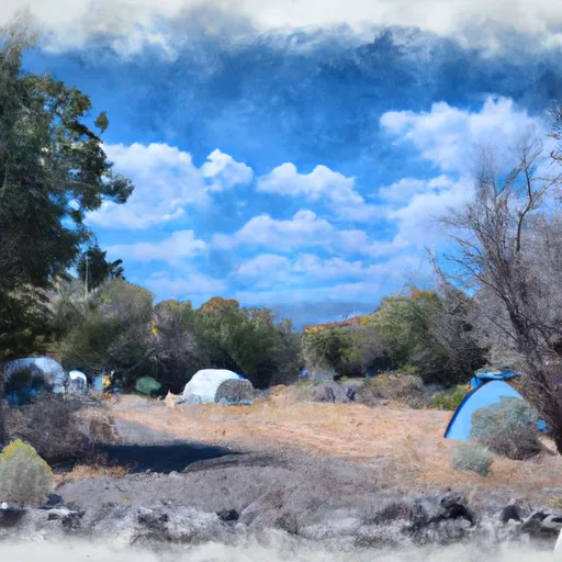
North Fork Malheur Campground
The campground provides basic amenities such as picnic tables, fire rings, and vault toilets. However, there is no potable water available, so campers must bring their own drinking water. The campground does not accept reservations and operates on a first-come, first-served basis. Due to its limited capacity, it is advisable to arrive early to secure a spot, especially during peak seasons.
The best time to visit North Fork Malheur Campground is during the summer months when the weather is pleasant and conducive to outdoor activities. Visitors can enjoy fishing in the nearby North Fork Malheur River or explore the beautiful surrounding forest. It is important to note that the campground is located in bear country, so proper food storage and caution are essential to avoid attracting wildlife.
In conclusion, North Fork Malheur Campground offers a serene and well-equipped camping experience in Oregon. With its diverse amenities, no reservations policy, ideal visitation time, and precautions against wildlife encounters, it provides a great opportunity for campers to enjoy the natural beauty and tranquility of the area.
What's on-site at North Fork Malheur Campground
Key facilities Snoflo tracks for this campground. Confirm with the operator before booking -- amenities can change seasonally.
Plan your trip down to the hour
Same weather feed Snoflo's iOS app uses -- updated continuously from NOAA / yr.no.
Next 5 days, hour by hour
Temperature line with weather symbols on top, snow + rain accumulation as columns, humidity as a dotted line.
5-day forecast table
Every 3 hours, broken out across temperature, snow, rain, humidity, and wind. Each cell is colour-coded relative to the column min/max so trends jump out at a glance.
| Time | Condition | Temp (°F) | Snow (in) | Rain (in) | Humidity (%) | Wind (mps) | Wind dir |
|---|---|---|---|---|---|---|---|
| Loading detailed forecast… | |||||||
15-day temperature & precipitation
Daily temperatures, snow, and rain projected over the next two weeks. Hover any point for the full breakdown.
Other campgrounds in the area
Snoflo-tracked campsites within driving distance of North Fork Malheur Campground, with reservations status.
| Campground | Reservations | Toilets | View |
|---|---|---|---|
| North Fork Malheur | ✗ | ✓ | → |
| Little Crane | ✗ | ✓ | → |
| Crane Creek Campground | ✗ | ✗ | → |
| Crane Crossing | ✗ | ✗ | → |
| Short Creek Guard Station | ✓ | ✗ | → |
Nearby streamflow
USGS streamgauges within reach of North Fork Malheur Campground -- pulled live from the National Water Information System.
| Streamgauge | Discharge | View |
|---|---|---|
| John Day R At Blue Mtn Hot Spgs Nr Prairie City | 22 cfs | → |
| North Fork Malheur River At Beulah Or | 1 cfs | → |
| John Day River Near John Day | 28 cfs | → |
| Malheur R Be Warmsprings Res Nr Riverside Or | 0 cfs | → |
| Malheur River Below Nevada Dam Near Vale Or | 15 cfs | → |
| M Fk John Day R At Ritter | 17 cfs | → |
Nearby snow depths
NRCS SNOTEL stations within reach of North Fork Malheur Campground -- relevant when planning a shoulder-season or alpine trip.
| SNOTEL station | Snowpack | 24h Snowfall | View |
|---|---|---|---|
| Blue Mountain Spring | 0.0 in | 0.0 in | → |
| Blue Mountain Spring | 0.0 in | 0.0 in | → |
| Lake Creek R.S. | 2.0 in | 0.0 in | → |
| Nohrsc Lake Creek R.S. | 3.0 in | 0.0 in | → |
| Rock Springs | 0.0 in | 0.0 in | → |
| Nohrsc Rock Springs | 0.0 in | 0.0 in | → |
Plan a longer trip
The closest parks, lakes, boat launches, and paddle runs so a camping night can grow into a full weekend.
Camping essentials & Leave No Trace
- Pack it in, pack it out
- Take all trash, food scraps, and gear back with you to keep campsites clean and protect wildlife.
- Respect wildlife
- Observe animals from a distance, store food securely, and never feed wildlife to maintain natural behavior and safety.
- Know before you go
- Check weather, fire restrictions, trail conditions, and permit requirements to ensure a safe and well-planned trip.
- Minimize campfire impact
- Use established fire rings, keep fires small, fully extinguish them, or opt for a camp stove when fires are restricted.
- Leave what you find
- Preserve natural and cultural features by avoiding removal of plants, rocks, artifacts, or other elements of the environment.
Set push alerts in the Snoflo app
Save North Fork Malheur Campground as a favorite, set a custom threshold (precipitation, snowpack, freezing temperatures), and the iOS app will push the moment conditions cross.
About North Fork Malheur Campground
Can I make reservations at North Fork Malheur Campground?
This campground does not appear to accept reservations -- it's typically first-come, first-served. Arrive early on summer weekends.
How fresh is the weather data on this page?
The hourly forecast updates throughout the day from the NOAA / yr.no public feeds. Streamflow data is pulled live from USGS streamgauges and snowpack from the NRCS SNOTEL network.
What's the best time of year to visit?
Use the 15-day temperature & precipitation outlook on this page to plan -- pick a window with comfortable temperatures and low precipitation. For longer trips, the 5-day hourly meteogram shows snow + rain accumulation hour-by-hour.
How do I get to North Fork Malheur Campground?
Tap Directions in the hero above to open driving directions in Google Maps, or Open in map to center the Snoflo interactive map on the campground.
Can I get alerts when conditions change?
Yes -- alerts are managed through the Snoflo iOS app. Favorite this campground, set a threshold (temperature, snowpack, precipitation), and you'll get a push the moment it crosses.
Other campgrounds near here
Snoflo-tracked campgrounds within driving distance of North Fork Malheur Campground.