Oxbow Regional Park Campground
Community Reviews
Been here? Share the conditions.
Reviews, ratings & photos are added in the free Snoflo iOS app — rate a spot, tag the conditions, and your visit is verified by location. Add or manage your reviews from the app.
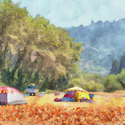
Oxbow Regional Park
Reservations are accepted at Oxbow Regional Park, making it easier for campers to plan their trip ahead of time. However, it is important to note that availability may vary, so it is recommended to make reservations in advance, especially during peak seasons.
The best time to visit Oxbow Regional Park is during the summer months, from June to September, when the weather is pleasant and perfect for outdoor activities. During this time, campers can enjoy hiking along the park's scenic trails, swimming in the refreshing river, or simply relaxing by the beach.
While exploring the camping area, make sure to be cautious of Poison Oak, which is prevalent in the park. It is essential to stay on designated paths and avoid contact with this plant to prevent any allergic reactions. Additionally, campers should be mindful of wildlife, such as raccoons or squirrels, and properly store food to avoid attracting these animals.
Overall, Oxbow Regional Park offers a fantastic camping experience with its amenities, reservation options, and ideal time to visit. Just be careful of Poison Oak and wildlife, and you're set for a memorable camping adventure in this picturesque Oregon campground.
What's on-site at Oxbow Regional Park
Key facilities Snoflo tracks for this campground. Confirm with the operator before booking -- amenities can change seasonally.
Plan your trip down to the hour
Same weather feed Snoflo's iOS app uses -- updated continuously from NOAA / yr.no.
Next 5 days, hour by hour
Temperature line with weather symbols on top, snow + rain accumulation as columns, humidity as a dotted line.
5-day forecast table
Every 3 hours, broken out across temperature, snow, rain, humidity, and wind. Each cell is colour-coded relative to the column min/max so trends jump out at a glance.
| Time | Condition | Temp (°F) | Snow (in) | Rain (in) | Humidity (%) | Wind (mps) | Wind dir |
|---|---|---|---|---|---|---|---|
| Loading detailed forecast… | |||||||
15-day temperature & precipitation
Daily temperatures, snow, and rain projected over the next two weeks. Hover any point for the full breakdown.
Other campgrounds in the area
Snoflo-tracked campsites within driving distance of Oxbow Regional Park, with reservations status.
| Campground | Reservations | Toilets | View |
|---|---|---|---|
| Barton Park Camping | ✗ | ✗ | → |
| Barton Park | ✓ | ✗ | → |
| Hiker/Biker | ✗ | ✗ | → |
| Ainsworth Campground | ✗ | ✗ | → |
| Ainsworth State Park | ✗ | ✗ | → |
Nearby streamflow
USGS streamgauges within reach of Oxbow Regional Park -- pulled live from the National Water Information System.
| Streamgauge | Discharge | View |
|---|---|---|
| Sandy River Blw Bull Run River | 385 cfs | → |
| Beaver Creek At Troutdale | 1 cfs | → |
| Johnson Creek At Regner Road | 1 cfs | → |
| Bull Run River Near Bull Run | 22 cfs | → |
| Fairview Creek At Glisan St Near Gresham | 1 cfs | → |
| Little Sandy River Near Bull Run | 16 cfs | → |
Nearby snow depths
NRCS SNOTEL stations within reach of Oxbow Regional Park -- relevant when planning a shoulder-season or alpine trip.
| SNOTEL station | Snowpack | 24h Snowfall | View |
|---|---|---|---|
| Headworks Portland Water Bureau | 0.0 in | 0.0 in | → |
| Nohrsc South Fork Bull Run | 0.0 in | 0.0 in | → |
| South Fork Bull Run | 0.0 in | 0.0 in | → |
| Nohrsc North Fork | 0.0 in | 0.0 in | → |
| North Fork | 0.0 in | 0.0 in | → |
| Bonneville Dam | 0.0 in | 0.0 in | → |
Plan a longer trip
The closest parks, lakes, boat launches, and paddle runs so a camping night can grow into a full weekend.
Parks
- Oxbow Regional Park
- Portland Women's Forum State Scenic Viewpoint
- Rooster Rock State Park
- George W. Joseph State Natural Area
- Dabney State Recreation Area
- Reed Island State Park
Boat launches
- Dabney State Park
- Interstate 84, Corbett
- Lewis And Clark State Park
- Hathaway Park
- Port Of Camas - Washougal
- Dalton Point, Bridal Veil
Points of interest
- Crown Point Vista House
- North American Bigfoot Center
- Depot Rail Museum
- Cape Horn Overlook
- Camas Potholes
- Philip Foster Farm
Paddle runs
- Clackamas River
- Sandy River
- North Section Line Of Sec 17, T4s, R5e To Slackwater North Fork Reservoir
- Headwaters To North Section Line Of Sec 17, T4s, R5e
- Mt. Hood Wilderness Boundary To Confluence With Sandy River
- Headwaters In Sw 1/4 Of Sec 8, T4n, R6e To Gifford Pinchot Nf Boundary
Camping essentials & Leave No Trace
- Pack it in, pack it out
- Take all trash, food scraps, and gear back with you to keep campsites clean and protect wildlife.
- Respect wildlife
- Observe animals from a distance, store food securely, and never feed wildlife to maintain natural behavior and safety.
- Know before you go
- Check weather, fire restrictions, trail conditions, and permit requirements to ensure a safe and well-planned trip.
- Minimize campfire impact
- Use established fire rings, keep fires small, fully extinguish them, or opt for a camp stove when fires are restricted.
- Leave what you find
- Preserve natural and cultural features by avoiding removal of plants, rocks, artifacts, or other elements of the environment.
Set push alerts in the Snoflo app
Save Oxbow Regional Park as a favorite, set a custom threshold (precipitation, snowpack, freezing temperatures), and the iOS app will push the moment conditions cross.
About Oxbow Regional Park
Can I make reservations at Oxbow Regional Park?
This campground does not appear to accept reservations -- it's typically first-come, first-served. Arrive early on summer weekends.
How fresh is the weather data on this page?
The hourly forecast updates throughout the day from the NOAA / yr.no public feeds. Streamflow data is pulled live from USGS streamgauges and snowpack from the NRCS SNOTEL network.
What's the best time of year to visit?
Use the 15-day temperature & precipitation outlook on this page to plan -- pick a window with comfortable temperatures and low precipitation. For longer trips, the 5-day hourly meteogram shows snow + rain accumulation hour-by-hour.
How do I get to Oxbow Regional Park?
Tap Directions in the hero above to open driving directions in Google Maps, or Open in map to center the Snoflo interactive map on the campground.
Can I get alerts when conditions change?
Yes -- alerts are managed through the Snoflo iOS app. Favorite this campground, set a threshold (temperature, snowpack, precipitation), and you'll get a push the moment it crosses.
Other campgrounds near here
Snoflo-tracked campgrounds within driving distance of Oxbow Regional Park.