Shady Acres campground
Community Reviews
Been here? Share the conditions.
Reviews, ratings & photos are added in the free Snoflo iOS app — rate a spot, tag the conditions, and your visit is verified by location. Add or manage your reviews from the app.
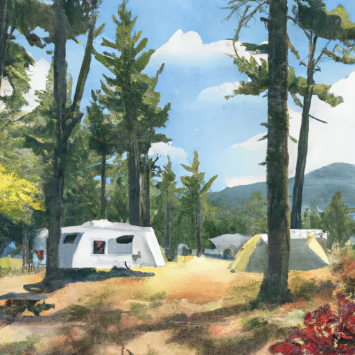
Shady Acres
One of the key factors to note about Shady Acres is that reservations are accepted, allowing campers to secure their spot in advance. This helps avoid any inconvenience or disappointment upon arrival. It is advisable to make a reservation, especially during peak seasons, to ensure availability.
The best time to visit Shady Acres camping area is during the summer and early fall when the weather is pleasant and conducive to outdoor activities. This is also a great time to explore the surrounding natural wonders, such as hiking trails and scenic viewpoints. However, it is recommended to check local weather conditions before planning a trip, as the campground is susceptible to occasional rainfall.
While visiting Shady Acres, campers should be cautious of wildlife encounters, particularly bears. It is crucial to store food properly and follow all safety guidelines to prevent any unwanted incidents. Additionally, respecting the campground rules, such as quiet hours and fire regulations, will contribute to a peaceful and enjoyable experience for all campers.
In conclusion, Shady Acres camping area in Oregon provides a well-equipped and inviting campground for nature enthusiasts. With its range of amenities, availability of reservations, and ideal time to visit, it offers a fantastic opportunity to disconnect from the hustle and bustle of everyday life and immerse oneself in the beauty of nature. By being mindful of wildlife and adhering to campground guidelines, campers can have a memorable and safe camping experience at Shady Acres.
What's on-site at Shady Acres
Key facilities Snoflo tracks for this campground. Confirm with the operator before booking -- amenities can change seasonally.
Plan your trip down to the hour
Same weather feed Snoflo's iOS app uses -- updated continuously from NOAA / yr.no.
Next 5 days, hour by hour
Temperature line with weather symbols on top, snow + rain accumulation as columns, humidity as a dotted line.
5-day forecast table
Every 3 hours, broken out across temperature, snow, rain, humidity, and wind. Each cell is colour-coded relative to the column min/max so trends jump out at a glance.
| Time | Condition | Temp (°F) | Snow (in) | Rain (in) | Humidity (%) | Wind (mps) | Wind dir |
|---|---|---|---|---|---|---|---|
| Loading detailed forecast… | |||||||
15-day temperature & precipitation
Daily temperatures, snow, and rain projected over the next two weeks. Hover any point for the full breakdown.
Other campgrounds in the area
Snoflo-tracked campsites within driving distance of Shady Acres, with reservations status.
| Campground | Reservations | Toilets | View |
|---|---|---|---|
| Little Falls Campground | ✗ | ✗ | → |
| Josephine Creek Camp | ✗ | ✓ | → |
| Josephine Campground | ✓ | ✗ | → |
| Josephine Creek Campground | ✗ | ✗ | → |
| Selmac Lake Park | ✗ | ✗ | → |
Nearby streamflow
USGS streamgauges within reach of Shady Acres -- pulled live from the National Water Information System.
| Streamgauge | Discharge | View |
|---|---|---|
| Illinois River Near Kerby | 39 cfs | → |
| Sucker Cr Bl Lt Grayback Cr Nr Holland | 24 cfs | → |
| Applegate River Near Wilderville | 99 cfs | → |
| Indian C Nr Happy Camp Ca | 48 cfs | → |
| Rogue River At Grants Pass | 1,220 cfs | → |
| Applegate River Near Applegate | 118 cfs | → |
Nearby snow depths
NRCS SNOTEL stations within reach of Shady Acres -- relevant when planning a shoulder-season or alpine trip.
| SNOTEL station | Snowpack | 24h Snowfall | View |
|---|---|---|---|
| Nohrsc Bigelow Camp | 0.0 in | 0.0 in | → |
| Bigelow Camp | 0.0 in | 0.0 in | → |
| Nohrsc Big Red Mountain | 0.0 in | 0.0 in | → |
| Big Red Mountain | 0.0 in | 0.0 in | → |
| Nohrsc King Mountain | 0.0 in | 0.0 in | → |
| King Mountain | 0.0 in | 0.0 in | → |
Plan a longer trip
The closest parks, lakes, boat launches, and paddle runs so a camping night can grow into a full weekend.
Parks
- Illinois River Forks State Park
- Rough And Ready State Natural Site
- Rough And Ready Creek Botanical Wayside
- Eight Dollar Mountain State Natural Area
- Oregon Caves National Monument
- Siskiyou National Forest
Boat launches
Fishing spots
Points of interest
- Butterfly Pavilion
- Great Cats World Park
- Southern Oregon Bigfoot Experience
- Kerbyville Museum
- Rough And Ready Flat
- Jeffery Loop Trailhead
Paddle runs
- Middle Of Sec 15, T40s, R4e To Siskyou Nf Boundary (East Section Line Of Sec 13, T40s, R4e)
- Confluence With Lightening Gulch To Confluence With Josephine Creek
- Middle Of Sec 15, T39s, R4e To Confluence With Canyon Creek
- Headwaters To Middle Of Sec 15, T39s, R4e
- Confluence Of North And South Forks Rough And Ready To Middle Of Sec 15, T40s, R9w
- Headwaters Including Both Unnamed Forks And Rr Lakes To Confluence With Rough And Ready Creek
Camping essentials & Leave No Trace
- Pack it in, pack it out
- Take all trash, food scraps, and gear back with you to keep campsites clean and protect wildlife.
- Respect wildlife
- Observe animals from a distance, store food securely, and never feed wildlife to maintain natural behavior and safety.
- Know before you go
- Check weather, fire restrictions, trail conditions, and permit requirements to ensure a safe and well-planned trip.
- Minimize campfire impact
- Use established fire rings, keep fires small, fully extinguish them, or opt for a camp stove when fires are restricted.
- Leave what you find
- Preserve natural and cultural features by avoiding removal of plants, rocks, artifacts, or other elements of the environment.
Set push alerts in the Snoflo app
Save Shady Acres as a favorite, set a custom threshold (precipitation, snowpack, freezing temperatures), and the iOS app will push the moment conditions cross.
About Shady Acres
Can I make reservations at Shady Acres?
This campground does not appear to accept reservations -- it's typically first-come, first-served. Arrive early on summer weekends.
How fresh is the weather data on this page?
The hourly forecast updates throughout the day from the NOAA / yr.no public feeds. Streamflow data is pulled live from USGS streamgauges and snowpack from the NRCS SNOTEL network.
What's the best time of year to visit?
Use the 15-day temperature & precipitation outlook on this page to plan -- pick a window with comfortable temperatures and low precipitation. For longer trips, the 5-day hourly meteogram shows snow + rain accumulation hour-by-hour.
How do I get to Shady Acres?
Tap Directions in the hero above to open driving directions in Google Maps, or Open in map to center the Snoflo interactive map on the campground.
Can I get alerts when conditions change?
Yes -- alerts are managed through the Snoflo iOS app. Favorite this campground, set a threshold (temperature, snowpack, precipitation), and you'll get a push the moment it crosses.
Other campgrounds near here
Snoflo-tracked campgrounds within driving distance of Shady Acres.