Miltown Campground
Community Reviews
Been here? Share the conditions.
Reviews, ratings & photos are added in the free Snoflo iOS app — rate a spot, tag the conditions, and your visit is verified by location. Add or manage your reviews from the app.
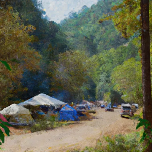
Miltown
Reservations are accepted at Miltown camping area, allowing campers to secure their spot in advance. This is particularly useful during peak seasons when the campground tends to be busy. However, availability may vary, so it is recommended to check with the campground or relevant authorities for the most up-to-date information on reservation policies.
The best time to visit Miltown camping area is typically during spring and fall when the weather is milder, offering pleasant conditions for outdoor activities. It is important to note that Georgia's summers can be hot and humid, while winters may experience colder temperatures. As for items of interest, multiple sources suggest that Miltown camping area is situated near hiking trails, providing opportunities for nature exploration and scenic walks. However, it is advisable to be cautious of potential wildlife encounters and ensure proper safety measures are taken, such as securely storing food away from campsites.
What's on-site at Miltown
Key facilities Snoflo tracks for this campground. Confirm with the operator before booking -- amenities can change seasonally.
Plan your trip down to the hour
Same weather feed Snoflo's iOS app uses -- updated continuously from NOAA / yr.no.
Next 5 days, hour by hour
Temperature line with weather symbols on top, snow + rain accumulation as columns, humidity as a dotted line.
5-day forecast table
Every 3 hours, broken out across temperature, snow, rain, humidity, and wind. Each cell is colour-coded relative to the column min/max so trends jump out at a glance.
| Time | Condition | Temp (°F) | Snow (in) | Rain (in) | Humidity (%) | Wind (mps) | Wind dir |
|---|---|---|---|---|---|---|---|
| Loading detailed forecast… | |||||||
15-day temperature & precipitation
Daily temperatures, snow, and rain projected over the next two weeks. Hover any point for the full breakdown.
Other campgrounds in the area
Snoflo-tracked campsites within driving distance of Miltown, with reservations status.
| Campground | Reservations | Toilets | View |
|---|---|---|---|
| Sadlers Creek State Park | ✓ | ✗ | → |
| Springfield | ✗ | ✗ | → |
| Big Water Campground | ✗ | ✗ | → |
| Springfield - Hartwell Lake | ✓ | ✗ | → |
| Hart State Park | ✗ | ✗ | → |
Nearby streamflow
USGS streamgauges within reach of Miltown -- pulled live from the National Water Information System.
| Streamgauge | Discharge | View |
|---|---|---|
| Rocky River Nr Starr | 13 cfs | → |
| Beaverdam Creek Ab Elberton Ga | 17 cfs | → |
| Broad River Above Carlton | 279 cfs | → |
| Twelvemile Creek Near Liberty | 98 cfs | → |
| Saluda River Near Williamston | 190 cfs | → |
| South Fork Broad River At Carlton | 87 cfs | → |
Nearby snow depths
NRCS SNOTEL stations within reach of Miltown -- relevant when planning a shoulder-season or alpine trip.
| SNOTEL station | Snowpack | 24h Snowfall | View |
|---|---|---|---|
| Anderson | 0.0 in | 0.0 in | → |
| Antreville | 0.0 in | 0.0 in | → |
| Carnesville 7.3 Sw | 0.0 in | 0.0 in | → |
| Fountain Inn 2 Sw | 0.0 in | 0.0 in | → |
| Cleveland 3 S | 0.0 in | 0.0 in | → |
| Germany Valley | 0.0 in | 0.0 in | → |
Plan a longer trip
The closest parks, lakes, boat launches, and paddle runs so a camping night can grow into a full weekend.
Parks
- Sadlers Creek State Park
- Hart State Outdoor Recreation Area
- Tugaloo State Park
- Bea Thompson Park
- Anderson Sports And Entertainment Center
- Linley Park
Boat launches
- Carters Ferry
- Milltown Campground
- Gum Branch
- Long Point Recreation Area
- Sunset Lane Anderson County
- Sadlers Creek State Park
Fishing spots
- Lightwood Log Creek
- Lake Hartwell
- Reservoir Number One
- Richard B Russell Lake
- Presbyterian Lake
- Yonah Lake
Points of interest
Paddle runs
- Confluence Of Cedar Creek To 1/4 Mile Below The Nf Boundary And Fh 110, Cobbs Bridge Road
- South Of Cedar Creek Rifle Range To Confluence With Chauga River
- 1/4 Mile Below Fs 745 And Cassidy Bridge Hunt Camp To Confluence Of Cedar Creek
- Crpssing Of Land Bridge Road, Sc 196 To 1/4 Mile Below Fs 745 And Cassidy Bridge Hunt Camp
- Confluence Of Brasstown Creek And Little Brasstown Creek Just South Of Brasstown Falls Road (Fs 751) To Confluence Of Mill Branch, Brasstown Creek And Boatwright Creek Near Boatwright Road (Fs 753)
- Headwaters Just East Of Hwy 107 To Crossing Of Norton Field Road (Fs 715a)
Camping essentials & Leave No Trace
- Pack it in, pack it out
- Take all trash, food scraps, and gear back with you to keep campsites clean and protect wildlife.
- Respect wildlife
- Observe animals from a distance, store food securely, and never feed wildlife to maintain natural behavior and safety.
- Know before you go
- Check weather, fire restrictions, trail conditions, and permit requirements to ensure a safe and well-planned trip.
- Minimize campfire impact
- Use established fire rings, keep fires small, fully extinguish them, or opt for a camp stove when fires are restricted.
- Leave what you find
- Preserve natural and cultural features by avoiding removal of plants, rocks, artifacts, or other elements of the environment.
Set push alerts in the Snoflo app
Save Miltown as a favorite, set a custom threshold (precipitation, snowpack, freezing temperatures), and the iOS app will push the moment conditions cross.
About Miltown
Can I make reservations at Miltown?
Yes -- this campground accepts reservations. Snoflo recommends booking early for peak season; check the operator (Recreation.gov / state park system / private operator) for the booking window and cancellation policy.
How fresh is the weather data on this page?
The hourly forecast updates throughout the day from the NOAA / yr.no public feeds. Streamflow data is pulled live from USGS streamgauges and snowpack from the NRCS SNOTEL network.
What's the best time of year to visit?
Use the 15-day temperature & precipitation outlook on this page to plan -- pick a window with comfortable temperatures and low precipitation. For longer trips, the 5-day hourly meteogram shows snow + rain accumulation hour-by-hour.
How do I get to Miltown?
Tap Directions in the hero above to open driving directions in Google Maps, or Open in map to center the Snoflo interactive map on the campground.
Can I get alerts when conditions change?
Yes -- alerts are managed through the Snoflo iOS app. Favorite this campground, set a threshold (temperature, snowpack, precipitation), and you'll get a push the moment it crosses.
Other campgrounds near here
Snoflo-tracked campgrounds within driving distance of Miltown.