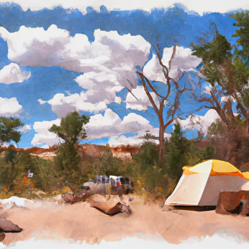
Anthony Flat Trailhead Campground
Community Reviews
Been here? Share the conditions.
Reviews, ratings & photos are added in the free Snoflo iOS app — rate a spot, tag the conditions, and your visit is verified by location. Add or manage your reviews from the app.
Anthony Flat Trailhead
Reservations are not accepted at the Anthony Flat Trailhead camping area, as campsites are available on a first-come, first-served basis. It is recommended to arrive early to secure a spot, especially during peak seasons. The best time to visit this camping area is during the summer and early fall months when the weather is pleasant, allowing for enjoyable outdoor activities such as hiking and fishing.
While camping at Anthony Flat Trailhead, there are a few things to be careful for. It is advised to be cautious of wildlife in the area, such as bears and snakes, and to properly store food to avoid attracting them. Additionally, it's important to respect the natural environment by following Leave No Trace principles and properly disposing of waste. By taking these precautions, campers can have a safe and memorable experience at the Anthony Flat Trailhead camping area in Utah.
What's on-site at Anthony Flat Trailhead
Key facilities Snoflo tracks for this campground. Confirm with the operator before booking -- amenities can change seasonally.
Plan your trip down to the hour
Same weather feed Snoflo's iOS app uses -- updated continuously from NOAA / yr.no.
Next 5 days, hour by hour
Temperature line with weather symbols on top, snow + rain accumulation as columns, humidity as a dotted line.
5-day forecast table
Every 3 hours, broken out across temperature, snow, rain, humidity, and wind. Each cell is colour-coded relative to the column min/max so trends jump out at a glance.
| Time | Condition | Temp (°F) | Snow (in) | Rain (in) | Humidity (%) | Wind (mps) | Wind dir |
|---|---|---|---|---|---|---|---|
| Loading detailed forecast… | |||||||
15-day temperature & precipitation
Daily temperatures, snow, and rain projected over the next two weeks. Hover any point for the full breakdown.
Other campgrounds in the area
Snoflo-tracked campsites within driving distance of Anthony Flat Trailhead, with reservations status.
| Campground | Reservations | Toilets | View |
|---|---|---|---|
| Gooseberry I-70 Trailhead | ✗ | ✗ | → |
| Twin Lake Campground | ✗ | ✗ | → |
| Oak Ridge Trailhead | ✗ | ✗ | → |
| Twelve Mile Flat | ✓ | ✓ | → |
| Twelve Mile Flat Campground | ✗ | ✗ | → |
Nearby streamflow
USGS streamgauges within reach of Anthony Flat Trailhead -- pulled live from the National Water Information System.
| Streamgauge | Discharge | View |
|---|---|---|
| Salina Creek Near Emery | 3 cfs | → |
| Sevier River Blw San Pitch River | 13 cfs | → |
| Manti Creek Below Dugway Creek | 6 cfs | → |
| Muddy Creek Near Emery | 11 cfs | → |
| Ferron Creek (Upper Station) Near Ferron | 14 cfs | → |
| Seven Mile Creek Near Fish Lake | 6 cfs | → |
Nearby snow depths
NRCS SNOTEL stations within reach of Anthony Flat Trailhead -- relevant when planning a shoulder-season or alpine trip.
| SNOTEL station | Snowpack | 24h Snowfall | View |
|---|---|---|---|
| Nohrsc Pickle Keg | 0.0 in | 0.0 in | → |
| Pickle Keg | 1.0 in | 0.0 in | → |
| Dill's Camp | 0.0 in | 0.0 in | → |
| Dill's Camp | 0.0 in | 0.0 in | → |
| Beaver Dams | 0.0 in | 0.0 in | → |
| Beaver Dams | 0.0 in | 0.0 in | → |
Plan a longer trip
The closest parks, lakes, boat launches, and paddle runs so a camping night can grow into a full weekend.
Parks
- State Wildlife Area Mayfield
- 9-Mile State Wildlife Area
- Palisade State Park
- State Wildlife Area 6-Mile
- Gunnison City Park
- Manit Meadows State Wildlife Area
Fishing spots
- Blue Lake - Ferron
- Skutumpah Reservoir
- Twin Lake
- Emerald Lake
- Shingle Mill Reservoir
- Town Reservoir Fishing & Camping Site
Camping essentials & Leave No Trace
- Pack it in, pack it out
- Take all trash, food scraps, and gear back with you to keep campsites clean and protect wildlife.
- Respect wildlife
- Observe animals from a distance, store food securely, and never feed wildlife to maintain natural behavior and safety.
- Know before you go
- Check weather, fire restrictions, trail conditions, and permit requirements to ensure a safe and well-planned trip.
- Minimize campfire impact
- Use established fire rings, keep fires small, fully extinguish them, or opt for a camp stove when fires are restricted.
- Leave what you find
- Preserve natural and cultural features by avoiding removal of plants, rocks, artifacts, or other elements of the environment.
Set push alerts in the Snoflo app
Save Anthony Flat Trailhead as a favorite, set a custom threshold (precipitation, snowpack, freezing temperatures), and the iOS app will push the moment conditions cross.
About Anthony Flat Trailhead
Can I make reservations at Anthony Flat Trailhead?
This campground does not appear to accept reservations -- it's typically first-come, first-served. Arrive early on summer weekends.
How fresh is the weather data on this page?
The hourly forecast updates throughout the day from the NOAA / yr.no public feeds. Streamflow data is pulled live from USGS streamgauges and snowpack from the NRCS SNOTEL network.
What's the best time of year to visit?
Use the 15-day temperature & precipitation outlook on this page to plan -- pick a window with comfortable temperatures and low precipitation. For longer trips, the 5-day hourly meteogram shows snow + rain accumulation hour-by-hour.
How do I get to Anthony Flat Trailhead?
Tap Directions in the hero above to open driving directions in Google Maps, or Open in map to center the Snoflo interactive map on the campground.
Can I get alerts when conditions change?
Yes -- alerts are managed through the Snoflo iOS app. Favorite this campground, set a threshold (temperature, snowpack, precipitation), and you'll get a push the moment it crosses.
Other campgrounds near here
Snoflo-tracked campgrounds within driving distance of Anthony Flat Trailhead.