Tinney Flat Campground
Community Reviews
Been here? Share the conditions.
Reviews, ratings & photos are added in the free Snoflo iOS app — rate a spot, tag the conditions, and your visit is verified by location. Add or manage your reviews from the app.
Tinney Flat
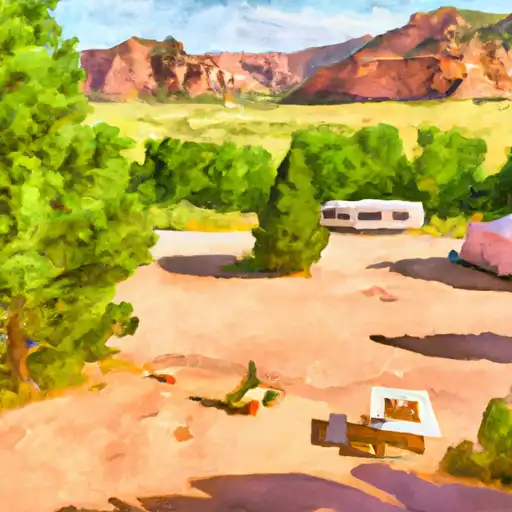
The campground offers basic amenities, including toilets and picnic tables, but does not have potable water or electrical hookups. The campground operates on a first-come, first-served basis and has a total of 10 campsites.
An interesting fact about the area is that it is home to the endangered Mojave Desert Tortoise. Visitors are encouraged to respect their habitat and avoid disturbing them.
The best time to visit Tinney Flat Camping Area is in the spring or fall when temperatures are mild. Average temperatures in the spring range from 50-70°F, and in the fall, temperatures range from 60-80°F. Summer temperatures can reach up to 100°F, making it less ideal for camping.
What's on-site at Tinney Flat
Key facilities Snoflo tracks for this campground. Confirm with the operator before booking -- amenities can change seasonally.
Plan your trip down to the hour
Same weather feed Snoflo's iOS app uses -- updated continuously from NOAA / yr.no.
Next 5 days, hour by hour
Temperature line with weather symbols on top, snow + rain accumulation as columns, humidity as a dotted line.
5-day forecast table
Every 3 hours, broken out across temperature, snow, rain, humidity, and wind. Each cell is colour-coded relative to the column min/max so trends jump out at a glance.
| Time | Condition | Temp (°F) | Snow (in) | Rain (in) | Humidity (%) | Wind (mps) | Wind dir |
|---|---|---|---|---|---|---|---|
| Loading detailed forecast… | |||||||
15-day temperature & precipitation
Daily temperatures, snow, and rain projected over the next two weeks. Hover any point for the full breakdown.
Other campgrounds in the area
Snoflo-tracked campsites within driving distance of Tinney Flat, with reservations status.
| Campground | Reservations | Toilets | View |
|---|---|---|---|
| Tinney Flat Campground | ✓ | ✗ | → |
| Ccc Campsite | ✗ | ✗ | → |
| Maple Lake Campground | ✓ | ✗ | → |
| Maple Lake | ✗ | ✓ | → |
| Maple Bench Campground | ✓ | ✗ | → |
Nearby streamflow
USGS streamgauges within reach of Tinney Flat -- pulled live from the National Water Information System.
| Streamgauge | Discharge | View |
|---|---|---|
| Summit Creek Abv Summit Cr Canal Nr Santaquin Ut | 3 cfs | → |
| Currant Creek Near Mona | 1 cfs | → |
| Salt Crk Blw Nephi Powerplant Div | 4 cfs | → |
| Salt Creek At Nephi | 4 cfs | → |
| Spanish Fork At Castilla | 287 cfs | → |
| Hobble Creek At 1650 West At Springville | 17 cfs | → |
Nearby snow depths
NRCS SNOTEL stations within reach of Tinney Flat -- relevant when planning a shoulder-season or alpine trip.
| SNOTEL station | Snowpack | 24h Snowfall | View |
|---|---|---|---|
| Nohrsc Payson R.S. | 0.0 in | 0.0 in | → |
| Payson R.S. | 0.0 in | 0.0 in | → |
| Us-89 At Mp 290 Hilltop | 0.1 in | 0.0 in | → |
| Nohrsc Clear Creek #1 | 0.0 in | 0.0 in | → |
| Clear Creek #1 | 0.0 in | 0.0 in | → |
| Clear Creek #2 | 0.0 in | 0.0 in | → |
Plan a longer trip
The closest parks, lakes, boat launches, and paddle runs so a camping night can grow into a full weekend.
Parks
- Loafer Mountain State Wildlife Area
- Mona Bench State Wildlife Area
- Birdseye State Wildlife Area
- Wilderness Mount Nebo
- Uinta National Forest
- Spencer Fork State Wildlife Area
Boat launches
Fishing spots
- Bald
- Gooseberry Reservoir
- Lower Gooseberry Reservoir
- Beaver Dam Reservoir Fishing Site
- Fairview Lakes Observation Site
- Fairview Lakes
Camping essentials & Leave No Trace
- Pack it in, pack it out
- Take all trash, food scraps, and gear back with you to keep campsites clean and protect wildlife.
- Respect wildlife
- Observe animals from a distance, store food securely, and never feed wildlife to maintain natural behavior and safety.
- Know before you go
- Check weather, fire restrictions, trail conditions, and permit requirements to ensure a safe and well-planned trip.
- Minimize campfire impact
- Use established fire rings, keep fires small, fully extinguish them, or opt for a camp stove when fires are restricted.
- Leave what you find
- Preserve natural and cultural features by avoiding removal of plants, rocks, artifacts, or other elements of the environment.
Set push alerts in the Snoflo app
Save Tinney Flat as a favorite, set a custom threshold (precipitation, snowpack, freezing temperatures), and the iOS app will push the moment conditions cross.
About Tinney Flat
Can I make reservations at Tinney Flat?
Yes -- this campground accepts reservations. Snoflo recommends booking early for peak season; check the operator (Recreation.gov / state park system / private operator) for the booking window and cancellation policy.
How fresh is the weather data on this page?
The hourly forecast updates throughout the day from the NOAA / yr.no public feeds. Streamflow data is pulled live from USGS streamgauges and snowpack from the NRCS SNOTEL network.
What's the best time of year to visit?
Use the 15-day temperature & precipitation outlook on this page to plan -- pick a window with comfortable temperatures and low precipitation. For longer trips, the 5-day hourly meteogram shows snow + rain accumulation hour-by-hour.
How do I get to Tinney Flat?
Tap Directions in the hero above to open driving directions in Google Maps, or Open in map to center the Snoflo interactive map on the campground.
Can I get alerts when conditions change?
Yes -- alerts are managed through the Snoflo iOS app. Favorite this campground, set a threshold (temperature, snowpack, precipitation), and you'll get a push the moment it crosses.
Other campgrounds near here
Snoflo-tracked campgrounds within driving distance of Tinney Flat.