Squire Creek Park & Campground Campground
Community Reviews
Been here? Share the conditions.
Reviews, ratings & photos are added in the free Snoflo iOS app — rate a spot, tag the conditions, and your visit is verified by location. Add or manage your reviews from the app.
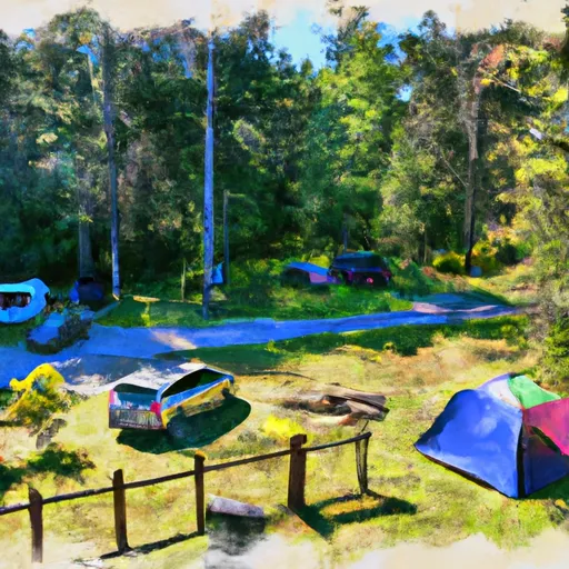
Squire Creek Park & Campground
Reservations are accepted at Squire Creek Park & Campground, ensuring that campers can secure their preferred site beforehand. This is particularly beneficial during peak seasons when the campground tends to get busy. It is advisable to make reservations in advance to guarantee availability.
The best time of year to visit Squire Creek Park & Campground is during the summer months when the weather is mild and suitable for outdoor activities. Campers can explore the surrounding nature trails, go fishing in nearby rivers, or simply relax and enjoy the serene ambiance. However, it is important to note that mosquitoes can be prevalent during certain times of the year, so bringing insect repellent is recommended.
In summary, Squire Creek Park & Campground in Washington State offers a delightful camping experience with its well-equipped campsites and essential amenities. With the option of making reservations and the ideal time to visit, campers can enjoy a peaceful retreat amidst beautiful natural surroundings. Just remember to pack insect repellent to ward off any unwanted guests during your stay.
What's on-site at Squire Creek Park & Campground
Key facilities Snoflo tracks for this campground. Confirm with the operator before booking -- amenities can change seasonally.
Plan your trip down to the hour
Same weather feed Snoflo's iOS app uses -- updated continuously from NOAA / yr.no.
Next 5 days, hour by hour
Temperature line with weather symbols on top, snow + rain accumulation as columns, humidity as a dotted line.
5-day forecast table
Every 3 hours, broken out across temperature, snow, rain, humidity, and wind. Each cell is colour-coded relative to the column min/max so trends jump out at a glance.
| Time | Condition | Temp (°F) | Snow (in) | Rain (in) | Humidity (%) | Wind (mps) | Wind dir |
|---|---|---|---|---|---|---|---|
| Loading detailed forecast… | |||||||
15-day temperature & precipitation
Daily temperatures, snow, and rain projected over the next two weeks. Hover any point for the full breakdown.
Other campgrounds in the area
Snoflo-tracked campsites within driving distance of Squire Creek Park & Campground, with reservations status.
| Campground | Reservations | Toilets | View |
|---|---|---|---|
| Squire Creek County Park | ✗ | ✗ | → |
| Cascade Kamloops Trout Farm & Rv Park | ✗ | ✗ | → |
| Clear Creek Campground | ✗ | ✗ | → |
| William C. Dearinger- State Forest | ✗ | ✓ | → |
| Sauk Park | ✗ | ✗ | → |
Nearby streamflow
USGS streamgauges within reach of Squire Creek Park & Campground -- pulled live from the National Water Information System.
| Streamgauge | Discharge | View |
|---|---|---|
| Smith River Near Ft Logan Mt | 74 cfs | → |
| Smith River Bl Eagle Cr Nr Fort Logan Mt | 113 cfs | → |
| South Fork Musselshell R Ab Martinsdale Mt | 43 cfs | → |
| Belt Creek Near Monarch Mt | 128 cfs | → |
| Musselshell River Nr Martinsdale | 34 cfs | → |
| Smith River Near Eden Mt | 154 cfs | → |
Nearby snow depths
NRCS SNOTEL stations within reach of Squire Creek Park & Campground -- relevant when planning a shoulder-season or alpine trip.
| SNOTEL station | Snowpack | 24h Snowfall | View |
|---|---|---|---|
| Decline Creek Snotel | 0.0 in | 0.0 in | → |
| White Chuck Mountain | 1.3 in | 0.0 in | → |
| Elbow Lake | 0.0 in | 0.0 in | → |
| Elbow Lake | 0.0 in | 0.0 in | → |
| Alpine Meadows | 1.0 in | 0.0 in | → |
| Nohrsc Marten Ridge | 0.0 in | 0.0 in | → |
Plan a longer trip
The closest parks, lakes, boat launches, and paddle runs so a camping night can grow into a full weekend.
Parks
- Squire Creek Park
- Nels Bruseth Memorial Park
- Wilderness Boulder River
- Rockport State Park
- Mount Pilchuck State Park
- Upper Skagit Garden Club Park
Boat launches
- Lower Sauk Boat Launch
- White Chuck Boat Launch
- West Lake Riley Road Snohomish County
- Lake Cavanaugh
- Howard Miller Steelhead County Park
- Faber Ferry South
Fishing spots
- Jumping Creek
- Newlan Creek
- North Fork Smith River
- Newlan Reservoir
- Sheep Creek (Smith Drainage)
- Jefferson Creek
Points of interest
- Three Fingers Lookout
- Oso Slide Memorial
- Cut Log
- Granite Falls And Fish Ladder
- Skagit Aero Education Museum
- Monte Cristo
Paddle runs
- Boulder River Wilderness Boundary To Confluence With Stillaguamish River
- Headwaters In Sw1/4 Of Sec 7, T31n, R9e To Boulder River Wilderness Boundary
- Glacier Peak Wilderness Boundary To Confluence With Sauk River
- Glacier Peak Wilderness Boundary To Confluence With Suiattle River
- Headwaters In Ne1/4 Of Sec 4, T33n, R12e To Glacier Peak Wilderness Boundary
- Glacier Peak Wilderness Boundary To Confluence With Skagit River
Camping essentials & Leave No Trace
- Pack it in, pack it out
- Take all trash, food scraps, and gear back with you to keep campsites clean and protect wildlife.
- Respect wildlife
- Observe animals from a distance, store food securely, and never feed wildlife to maintain natural behavior and safety.
- Know before you go
- Check weather, fire restrictions, trail conditions, and permit requirements to ensure a safe and well-planned trip.
- Minimize campfire impact
- Use established fire rings, keep fires small, fully extinguish them, or opt for a camp stove when fires are restricted.
- Leave what you find
- Preserve natural and cultural features by avoiding removal of plants, rocks, artifacts, or other elements of the environment.
Set push alerts in the Snoflo app
Save Squire Creek Park & Campground as a favorite, set a custom threshold (precipitation, snowpack, freezing temperatures), and the iOS app will push the moment conditions cross.
About Squire Creek Park & Campground
Can I make reservations at Squire Creek Park & Campground?
This campground does not appear to accept reservations -- it's typically first-come, first-served. Arrive early on summer weekends.
How fresh is the weather data on this page?
The hourly forecast updates throughout the day from the NOAA / yr.no public feeds. Streamflow data is pulled live from USGS streamgauges and snowpack from the NRCS SNOTEL network.
What's the best time of year to visit?
Use the 15-day temperature & precipitation outlook on this page to plan -- pick a window with comfortable temperatures and low precipitation. For longer trips, the 5-day hourly meteogram shows snow + rain accumulation hour-by-hour.
How do I get to Squire Creek Park & Campground?
Tap Directions in the hero above to open driving directions in Google Maps, or Open in map to center the Snoflo interactive map on the campground.
Can I get alerts when conditions change?
Yes -- alerts are managed through the Snoflo iOS app. Favorite this campground, set a threshold (temperature, snowpack, precipitation), and you'll get a push the moment it crosses.
Other campgrounds near here
Snoflo-tracked campgrounds within driving distance of Squire Creek Park & Campground.