Thunder Basin Hiker Campground
Community Reviews
Been here? Share the conditions.
Reviews, ratings & photos are added in the free Snoflo iOS app — rate a spot, tag the conditions, and your visit is verified by location. Add or manage your reviews from the app.
Thunder Basin Hiker
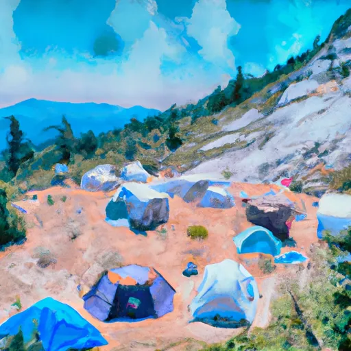
The campground has 12 first-come-first-served campsites, each with a picnic table and fire ring. Vault toilets and potable water are available on-site. Due to its remote location, there is no cell phone service at the campground.
An interesting fact about the Thunder Basin Hiker Camping Area is that it is located on the Pacific Crest Trail, a 2,650-mile hiking trail that runs from Mexico to Canada. Hikers on the trail often stop at the campground to rest and replenish their supplies.
The best time of year to visit Thunder Basin Hiker Camping Area is from June to September when the average high temperatures range from the mid-60s to mid-70s. However, it's important to note that the weather can be unpredictable and visitors should come prepared for changing conditions, including snow in the early and late seasons.
What's on-site at Thunder Basin Hiker
Key facilities Snoflo tracks for this campground. Confirm with the operator before booking -- amenities can change seasonally.
Plan your trip down to the hour
Same weather feed Snoflo's iOS app uses -- updated continuously from NOAA / yr.no.
Next 5 days, hour by hour
Temperature line with weather symbols on top, snow + rain accumulation as columns, humidity as a dotted line.
5-day forecast table
Every 3 hours, broken out across temperature, snow, rain, humidity, and wind. Each cell is colour-coded relative to the column min/max so trends jump out at a glance.
| Time | Condition | Temp (°F) | Snow (in) | Rain (in) | Humidity (%) | Wind (mps) | Wind dir |
|---|---|---|---|---|---|---|---|
| Loading detailed forecast… | |||||||
15-day temperature & precipitation
Daily temperatures, snow, and rain projected over the next two weeks. Hover any point for the full breakdown.
Other campgrounds in the area
Snoflo-tracked campsites within driving distance of Thunder Basin Hiker, with reservations status.
| Campground | Reservations | Toilets | View |
|---|---|---|---|
| Thunder Basin Stock | ✗ | ✗ | → |
| Buckner | ✗ | ✗ | → |
| Five Mile Camp | ✗ | ✗ | → |
| Skagit Queen | ✗ | ✗ | → |
| Sahale Glacier Camp | ✗ | ✗ | → |
Nearby streamflow
USGS streamgauges within reach of Thunder Basin Hiker -- pulled live from the National Water Information System.
| Streamgauge | Discharge | View |
|---|---|---|
| Salix Creek At S Cascade Gl Near Marblemount | 0 cfs | → |
| Thunder Creek Near Newhalem | 677 cfs | → |
| Newhalem Creek Near Newhalem | 32 cfs | → |
| Skagit River At Newhalem | 3,290 cfs | → |
| Stehekin River At Stehekin | 665 cfs | → |
| Cascade River At Marblemount | 431 cfs | → |
Nearby snow depths
NRCS SNOTEL stations within reach of Thunder Basin Hiker -- relevant when planning a shoulder-season or alpine trip.
| SNOTEL station | Snowpack | 24h Snowfall | View |
|---|---|---|---|
| Nohrsc Thunder Basin | 0.0 in | 0.0 in | → |
| Thunder Basin | 0.0 in | 0.0 in | → |
| Nohrsc Park Creek Ridge | 1.0 in | 0.0 in | → |
| Park Creek Ridge | 1.0 in | 0.0 in | → |
| Nohrsc Swamp Creek | 0.0 in | 0.0 in | → |
| Swamp Creek | 0.0 in | 0.0 in | → |
Plan a longer trip
The closest parks, lakes, boat launches, and paddle runs so a camping night can grow into a full weekend.
Parks
- North Cascades National Park
- Ross Lake National Recreation Area
- Lake Chelan National Recreation Area
- Wilderness Stephen Mather
- Wilderness Pasayten
- Wilderness Noisy-Diobsud
Points of interest
- Rock Cabin
- Sulphide–Frisco Cabin
- Washington Pass Observation Site
- Gorge Powerhouse Visitor Gallery
- "Old Number 6" Seattle City Light Locomotive
- Sourdough Mountain Lookout
Paddle runs
- Headwaters To Mouth At Diablo Lake
- Headwaters And Includes All Tributaries To Confluence With Stehekin River
- Headwaters And Includes Four Remaining Unnamed Tributaries To Cottonwood Campground
- Headwaters And Includes Tributaries To Confluence With Stehekin River
- Headwaters And Includes All Tributaries To Confluence With Grizzly Creek
Camping essentials & Leave No Trace
- Pack it in, pack it out
- Take all trash, food scraps, and gear back with you to keep campsites clean and protect wildlife.
- Respect wildlife
- Observe animals from a distance, store food securely, and never feed wildlife to maintain natural behavior and safety.
- Know before you go
- Check weather, fire restrictions, trail conditions, and permit requirements to ensure a safe and well-planned trip.
- Minimize campfire impact
- Use established fire rings, keep fires small, fully extinguish them, or opt for a camp stove when fires are restricted.
- Leave what you find
- Preserve natural and cultural features by avoiding removal of plants, rocks, artifacts, or other elements of the environment.
Set push alerts in the Snoflo app
Save Thunder Basin Hiker as a favorite, set a custom threshold (precipitation, snowpack, freezing temperatures), and the iOS app will push the moment conditions cross.
About Thunder Basin Hiker
Can I make reservations at Thunder Basin Hiker?
This campground does not appear to accept reservations -- it's typically first-come, first-served. Arrive early on summer weekends.
How fresh is the weather data on this page?
The hourly forecast updates throughout the day from the NOAA / yr.no public feeds. Streamflow data is pulled live from USGS streamgauges and snowpack from the NRCS SNOTEL network.
What's the best time of year to visit?
Use the 15-day temperature & precipitation outlook on this page to plan -- pick a window with comfortable temperatures and low precipitation. For longer trips, the 5-day hourly meteogram shows snow + rain accumulation hour-by-hour.
How do I get to Thunder Basin Hiker?
Tap Directions in the hero above to open driving directions in Google Maps, or Open in map to center the Snoflo interactive map on the campground.
Can I get alerts when conditions change?
Yes -- alerts are managed through the Snoflo iOS app. Favorite this campground, set a threshold (temperature, snowpack, precipitation), and you'll get a push the moment it crosses.
Other campgrounds near here
Snoflo-tracked campgrounds within driving distance of Thunder Basin Hiker.