Anvil Lake Recreation Area Campground
Community Reviews
Been here? Share the conditions.
Reviews, ratings & photos are added in the free Snoflo iOS app — rate a spot, tag the conditions, and your visit is verified by location. Add or manage your reviews from the app.
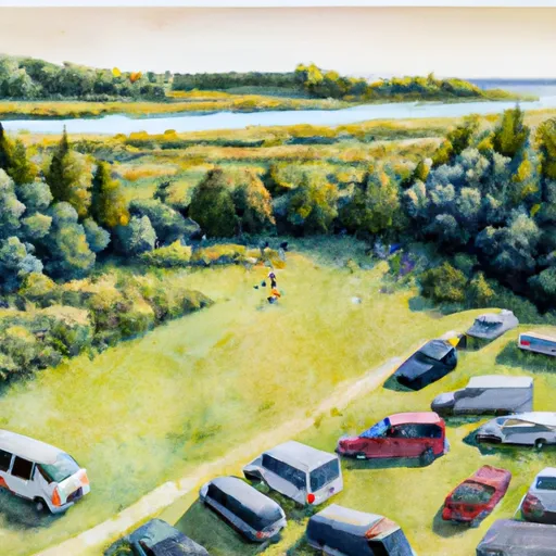
Anvil Lake Recreation Area
Reservations are accepted at Anvil Lake Recreation Area, ensuring campers can secure their desired site in advance. This is particularly beneficial during peak seasons, as the campground tends to be popular among visitors. It is recommended to make reservations early, especially for weekends and holidays.
The best time to visit Anvil Lake Recreation Area is during the summer months when the weather is warm and favorable for outdoor activities. It is important to note that the campground is open from May through October, so plan accordingly. While exploring the camping area, be cautious of wildlife encounters, as the region is home to various species, including bears. Campers should properly store their food and dispose of trash in designated containers to minimize the risk of attracting animals to their campsite. Overall, Anvil Lake Recreation Area offers a picturesque and well-equipped camping experience, making it a great destination for nature enthusiasts and outdoor lovers.
What's on-site at Anvil Lake Recreation Area
Key facilities Snoflo tracks for this campground. Confirm with the operator before booking -- amenities can change seasonally.
Plan your trip down to the hour
Same weather feed Snoflo's iOS app uses -- updated continuously from NOAA / yr.no.
Next 5 days, hour by hour
Temperature line with weather symbols on top, snow + rain accumulation as columns, humidity as a dotted line.
5-day forecast table
Every 3 hours, broken out across temperature, snow, rain, humidity, and wind. Each cell is colour-coded relative to the column min/max so trends jump out at a glance.
| Time | Condition | Temp (°F) | Snow (in) | Rain (in) | Humidity (%) | Wind (mps) | Wind dir |
|---|---|---|---|---|---|---|---|
| Loading detailed forecast… | |||||||
15-day temperature & precipitation
Daily temperatures, snow, and rain projected over the next two weeks. Hover any point for the full breakdown.
Other campgrounds in the area
Snoflo-tracked campsites within driving distance of Anvil Lake Recreation Area, with reservations status.
| Campground | Reservations | Toilets | View |
|---|---|---|---|
| Franklin Lake Recreation Area | ✓ | ✓ | → |
| Seven Mile Lake Campground | ✗ | ✓ | → |
| Luna White Deer Campground | ✓ | ✓ | → |
| Luna - White Deer Lake Recreation Area | ✓ | ✗ | → |
| Kentuck Lake Recreation Area | ✗ | ✓ | → |
Nearby streamflow
USGS streamgauges within reach of Anvil Lake Recreation Area -- pulled live from the National Water Information System.
| Streamgauge | Discharge | View |
|---|---|---|
| Muskellunge Ck-Muskellunge L Otl-Nr Eagle River | 2 cfs | → |
| Muskellunge Creek Near St. Germain | 9 cfs | → |
| Iron River At County Hwy-424 At Caspian | 69 cfs | → |
| Wisconsin River @ Rainbow Lake Nr Lake Tomahawk | 443 cfs | → |
| Allequash Creek Site 3 Near Boulder Junction | 4 cfs | → |
| Cisco Branch Ontonagon R At Cisco Lake Outlet | 0 cfs | → |
Nearby snow depths
NRCS SNOTEL stations within reach of Anvil Lake Recreation Area -- relevant when planning a shoulder-season or alpine trip.
| SNOTEL station | Snowpack | 24h Snowfall | View |
|---|---|---|---|
| Eagle River-4 E | 0.0 in | 0.0 in | → |
| Eagle River-South | 0.0 in | 0.0 in | → |
| Lac Vieux Desert | 0.0 in | 0.0 in | → |
| Argonne-1.5 Nw | 8.0 in | 0.0 in | → |
| St Germain | 0.0 in | 0.0 in | → |
| Stambaugh 2sse | 0.0 in | 0.0 in | → |
Plan a longer trip
The closest parks, lakes, boat launches, and paddle runs so a camping night can grow into a full weekend.
Parks
- Wilderness Blackjack Springs
- Wilderness Headwaters
- Thunder Lake Wildlife Area
- State Forest Northern Highland
- Ottawa National Forest
- National Wild And Scenic River Paint, Michigan
Boat launches
- Anvil Lake -- Access
- Anvil Lake
- Ninemile Road Town Of Washington
- Franklin Lake - Access Adjacent To Us Forest Svc Campground
- Kentuck Boat Landing Road 2998, Town Of Phelps
- Sevenmile Lake
Fishing spots
Points of interest
- Burnt Rollways Boat Hoist
- Wisconsin Hockey Hall Of Fame
- Phelps Historical Museum
- Kartway
- Three Lakes Historical Society
- Northern Waters Museum
Paddle runs
- North Branch--Butternut Lake To Confluence With Main Branch
- Main Branch--Headwaters To Forest Road 2174
- Forest Road 2174 To Private Bridge
- Private Bridge To Highway 55
- North Branch--Origin In Sec 10, T38n, R13e To 1/4 Mile West Of Highway 55
- 1/4 Mile West Of Highway 55 To Confluence With Main Branch
Camping essentials & Leave No Trace
- Pack it in, pack it out
- Take all trash, food scraps, and gear back with you to keep campsites clean and protect wildlife.
- Respect wildlife
- Observe animals from a distance, store food securely, and never feed wildlife to maintain natural behavior and safety.
- Know before you go
- Check weather, fire restrictions, trail conditions, and permit requirements to ensure a safe and well-planned trip.
- Minimize campfire impact
- Use established fire rings, keep fires small, fully extinguish them, or opt for a camp stove when fires are restricted.
- Leave what you find
- Preserve natural and cultural features by avoiding removal of plants, rocks, artifacts, or other elements of the environment.
Set push alerts in the Snoflo app
Save Anvil Lake Recreation Area as a favorite, set a custom threshold (precipitation, snowpack, freezing temperatures), and the iOS app will push the moment conditions cross.
About Anvil Lake Recreation Area
Can I make reservations at Anvil Lake Recreation Area?
This campground does not appear to accept reservations -- it's typically first-come, first-served. Arrive early on summer weekends.
How fresh is the weather data on this page?
The hourly forecast updates throughout the day from the NOAA / yr.no public feeds. Streamflow data is pulled live from USGS streamgauges and snowpack from the NRCS SNOTEL network.
What's the best time of year to visit?
Use the 15-day temperature & precipitation outlook on this page to plan -- pick a window with comfortable temperatures and low precipitation. For longer trips, the 5-day hourly meteogram shows snow + rain accumulation hour-by-hour.
How do I get to Anvil Lake Recreation Area?
Tap Directions in the hero above to open driving directions in Google Maps, or Open in map to center the Snoflo interactive map on the campground.
Can I get alerts when conditions change?
Yes -- alerts are managed through the Snoflo iOS app. Favorite this campground, set a threshold (temperature, snowpack, precipitation), and you'll get a push the moment it crosses.
Other campgrounds near here
Snoflo-tracked campgrounds within driving distance of Anvil Lake Recreation Area.