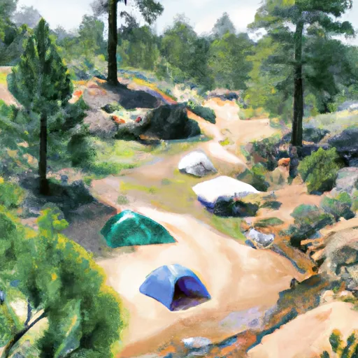
South Yuba Campground
Community Reviews
Been here? Share the conditions.
Reviews, ratings & photos are added in the free Snoflo iOS app — rate a spot, tag the conditions, and your visit is verified by location. Add or manage your reviews from the app.
South Yuba
Reservations are accepted at South Yuba Camping Area, making it easy for campers to secure a spot in advance. It is recommended to make a reservation, especially during peak seasons, to guarantee a place at this popular campground.
The best time of year to visit South Yuba Camping Area is during the summer and early fall. The weather is typically pleasant during this time, allowing for various outdoor activities such as hiking, fishing, and swimming in the nearby South Yuba River. However, it is important to note that the campground can get crowded during weekends and holidays, so planning a midweek visit may be preferable for those seeking a quieter experience.
While camping at South Yuba, it is advised to be cautious of potential wildlife encounters, such as bears and rattlesnakes. It is essential to store food properly and keep a safe distance from any wildlife that may be present in the area. Additionally, staying hydrated and wearing appropriate clothing and sunscreen are important due to the warm temperatures in the region. With its beautiful surroundings and convenient amenities, South Yuba Camping Area is an ideal destination for nature lovers and outdoor enthusiasts.
What's on-site at South Yuba
Key facilities Snoflo tracks for this campground. Confirm with the operator before booking -- amenities can change seasonally.
Plan your trip down to the hour
Same weather feed Snoflo's iOS app uses -- updated continuously from NOAA / yr.no.
Next 5 days, hour by hour
Temperature line with weather symbols on top, snow + rain accumulation as columns, humidity as a dotted line.
5-day forecast table
Every 3 hours, broken out across temperature, snow, rain, humidity, and wind. Each cell is colour-coded relative to the column min/max so trends jump out at a glance.
| Time | Condition | Temp (°F) | Snow (in) | Rain (in) | Humidity (%) | Wind (mps) | Wind dir |
|---|---|---|---|---|---|---|---|
| Loading detailed forecast… | |||||||
15-day temperature & precipitation
Daily temperatures, snow, and rain projected over the next two weeks. Hover any point for the full breakdown.
Other campgrounds in the area
Snoflo-tracked campsites within driving distance of South Yuba, with reservations status.
| Campground | Reservations | Toilets | View |
|---|---|---|---|
| South Yuba Primitive Camp | ✗ | ✗ | → |
| Environmental Camp | ✗ | ✗ | → |
| Rock Creek Mill Site | ✗ | ✗ | → |
| Malakoff Diggins State Park | ✓ | ✓ | → |
| Chute Hill Campground | ✗ | ✗ | → |
Nearby streamflow
USGS streamgauges within reach of South Yuba -- pulled live from the National Water Information System.
| Streamgauge | Discharge | View |
|---|---|---|
| N Yuba R Bl Goodyears Bar Ca | 148 cfs | → |
| Deer C Nr Smartville Ca | 7 cfs | → |
| Nf American R A North Fork Dam Ca | 71 cfs | → |
| Yuba R Nr Marysville Ca | 539 cfs | → |
| Bear R Nr Wheatland Ca | 26 cfs | → |
| Pilot C Bl Mutton Canyon Nr Georgetown Ca | 2 cfs | → |
Nearby snow depths
NRCS SNOTEL stations within reach of South Yuba -- relevant when planning a shoulder-season or alpine trip.
| SNOTEL station | Snowpack | 24h Snowfall | View |
|---|---|---|---|
| Grass Valley No. 2 | 0.0 in | 0.0 in | → |
| Blue Canyon | 21.0 in | 3.0 in | → |
| Blue Canyon Alert | 0.0 in | 0.0 in | → |
| Nohrsc Meadow Lk Snow Course | 21.2 in | 0.2 in | → |
| Soda Springs 1.5 Ssw | 0.0 in | 0.0 in | → |
| Nohrsc Css Lab | 0.0 in | 0.0 in | → |
Plan a longer trip
The closest parks, lakes, boat launches, and paddle runs so a camping night can grow into a full weekend.
Parks
- Malakoff Diggins State Historic Park
- Kalithea Park
- Devere Mautino Community Park
- Condon Park
- Empire Mine State Historic Park
- South Yuba River State Park
Boat launches
- Scotts Flat Marina
- Cascade Shores
- Bullards Bar Reservoir (Dark Day )
- Bullards Bar Reservoir (Cottage Creek )
- Greenhorn Campground
- Peninsula Camping And Boating Resort
Fishing spots
- Scotts Flat Lake
- Bullards Bar Reservoir
- Lake Rollins
- Englebright Lake
- Carr Lake
- Merle Collins Reservoir
Points of interest
Paddle runs
- One-Half Mile West Of Confluence With Fall Creek To Confluence With Jefferson Creek
- Headwaters Of North Yuba River (Sec 10, T20n, R13 E) To One-Eighth Mile Downstream Of Confluence With Cherokee Creek
- Confluence With Jefferson Creek To Confluence With Kentucky Creek
- Langs Crossing Bridge To One-Half Mile West Of Confluence With Fall Creek (Boundary Of Nf And Private Land)
- One-Eighth Mile Downstream From Confluence With Cherokee Creek To One-Quarter Mile Upstream From Confluence With Slate Creek
- One-Quarter Mile Upstream From Confluence With Slate Creek To Bullards Bar Reservoir Spillway (Elevation 1902 Feet)
Camping essentials & Leave No Trace
- Pack it in, pack it out
- Take all trash, food scraps, and gear back with you to keep campsites clean and protect wildlife.
- Respect wildlife
- Observe animals from a distance, store food securely, and never feed wildlife to maintain natural behavior and safety.
- Know before you go
- Check weather, fire restrictions, trail conditions, and permit requirements to ensure a safe and well-planned trip.
- Minimize campfire impact
- Use established fire rings, keep fires small, fully extinguish them, or opt for a camp stove when fires are restricted.
- Leave what you find
- Preserve natural and cultural features by avoiding removal of plants, rocks, artifacts, or other elements of the environment.
Set push alerts in the Snoflo app
Save South Yuba as a favorite, set a custom threshold (precipitation, snowpack, freezing temperatures), and the iOS app will push the moment conditions cross.
About South Yuba
Can I make reservations at South Yuba?
This campground does not appear to accept reservations -- it's typically first-come, first-served. Arrive early on summer weekends.
How fresh is the weather data on this page?
The hourly forecast updates throughout the day from the NOAA / yr.no public feeds. Streamflow data is pulled live from USGS streamgauges and snowpack from the NRCS SNOTEL network.
What's the best time of year to visit?
Use the 15-day temperature & precipitation outlook on this page to plan -- pick a window with comfortable temperatures and low precipitation. For longer trips, the 5-day hourly meteogram shows snow + rain accumulation hour-by-hour.
How do I get to South Yuba?
Tap Directions in the hero above to open driving directions in Google Maps, or Open in map to center the Snoflo interactive map on the campground.
Can I get alerts when conditions change?
Yes -- alerts are managed through the Snoflo iOS app. Favorite this campground, set a threshold (temperature, snowpack, precipitation), and you'll get a push the moment it crosses.
Other campgrounds near here
Snoflo-tracked campgrounds within driving distance of South Yuba.