South Yuba River State Park
Community Reviews
Been here? Share the conditions.
Reviews, ratings & photos are added in the free Snoflo iOS app — rate a spot, tag the conditions, and your visit is verified by location. Add or manage your reviews from the app.
South Yuba River State Park
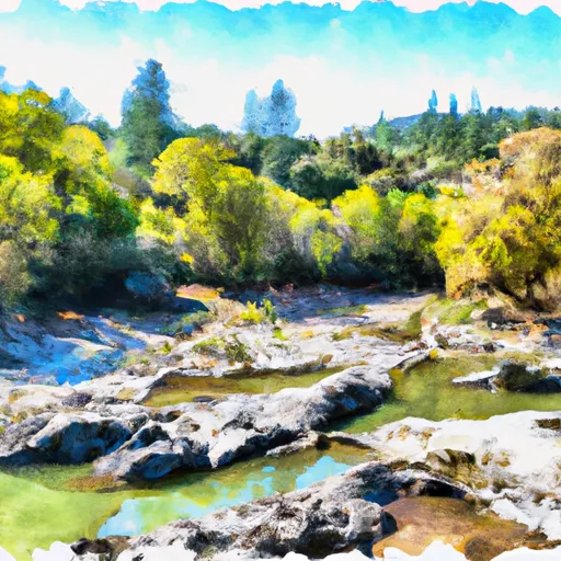
One of the primary attractions of South Yuba River State Park is its picturesque swimming holes and natural pools. The crystal-clear waters of the South Yuba River create an inviting environment for swimming, tubing, and fishing. Bridgeport, located within the park, is a popular spot for swimming and sunbathing during the summer months.
The park is also home to numerous hiking trails, providing opportunities for scenic walks and challenging treks. The South Yuba Trail, with its breathtaking views of the river and lush vegetation, is a must-visit for nature enthusiasts. Another notable trail is the Independence Trail, which is fully accessible and winds through a beautiful woodland along the river.
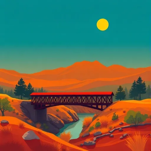
For history buffs, South Yuba River State Park offers a glimpse into the region's gold rush era. Visitors can explore remnants of the 19th-century gold mining operations, such as the historic covered bridge and the restored 1862 Bridgeport Powerhouse. Interpretive displays and guided tours educate visitors about the area's rich history and the impact of gold mining on the landscape.
Interesting facts about the park include its designation as a National Wild and Scenic River, highlighting the importance of preserving its natural beauty and ecological integrity. The park also provides habitat for a diverse array of plant and animal species, including black bears, mountain lions, and various bird species.
The best time to visit South Yuba River State Park is during the spring and fall seasons when the weather is pleasant, and the river flow is ideal for water activities. During summer, the park can get crowded, making it a good option to visit on weekdays or early mornings to avoid crowds. Winter visits can offer a unique experience, with fewer visitors and the possibility of seeing the park covered in snow.
In summary, South Yuba River State Park in California offers visitors breathtaking scenery, recreational activities, historical sites, and diverse wildlife. Whether you're interested in swimming, hiking, or immersing yourself in the region's gold rush history, this park has something to offer for everyone.
Trails in South Yuba River State Park
Named trails whose route falls inside the park.
Points of interest in South Yuba River State Park
Landmarks and points of interest inside the park boundary.

Plan your visit down to the hour
Same weather feed Snoflo's iOS app uses -- updated continuously from NOAA / yr.no.
Next 5 days, hour by hour
Temperature line with weather symbols on top, snow + rain accumulation as columns, humidity as a dotted line.
5-day forecast table
Every 3 hours, broken out across temperature, snow, rain, humidity, and wind.
| Time | Condition | Temp (°F) | Snow (in) | Rain (in) | Humidity (%) | Wind (mps) | Wind dir |
|---|---|---|---|---|---|---|---|
| Loading detailed forecast… | |||||||
15-day temperature & precipitation
Daily temperatures, snow, and rain projected over the next two weeks.
Responsible recreation & Leave No Trace
- Know before you go
- Check the operator's site for hours, permit requirements, seasonal closures, and fire restrictions before heading out.
- Stay on trail
- Stick to marked paths to protect vegetation, prevent erosion, and avoid disturbing wildlife habitat.
- Respect wildlife
- Observe from a distance, never feed wildlife, and store food securely if camping is permitted on-site.
- Pack it in, pack it out
- Carry out all trash, food scraps, and gear. Many parks have limited or no trash service.
- Leave what you find
- Don't take rocks, plants, or artifacts. They make the park what it is for the next visitor.
Set push alerts in the Snoflo app
Save South Yuba River State Park as a favorite, set a custom threshold (precipitation, freezing temperatures, fire-restriction days), and the iOS app will push the moment conditions cross.
About South Yuba River State Park
What can I do at South Yuba River State Park?
Most Snoflo-tracked parks support hiking, picnicking, and wildlife viewing. Check the operator's site for activity-specific rules (camping, fishing, paddling, hunting).
How fresh is the weather data?
The hourly forecast updates throughout the day from NOAA / yr.no. Streamflow comes live from USGS streamgauges.
When is the best time to visit?
Use the 15-day temperature & precipitation outlook on this page to plan -- pick a window with comfortable temperatures and low precipitation.
How do I get to South Yuba River State Park?
Tap Directions in the hero above to open driving directions in Google Maps, or Open in map to center the Snoflo interactive map on the park.
Can I get alerts when conditions change?
Yes -- alerts are managed in the Snoflo iOS app. Favorite this park, set a threshold (temperature, precipitation), and you'll get a push the moment it crosses.
Park & land designation reference
A quick legend for the federal and state land categories Snoflo tracks. Each designation comes with different rules around access, recreation, and resource extraction.
- National Park
- Large protected natural areas managed by the federal government to preserve significant landscapes, ecosystems, and cultural resources; recreation is allowed but conservation is the priority.
- State Park
- Public natural or recreational areas managed by a state government, typically smaller than national parks and focused on regional natural features, recreation, and education.
- Local Park
- Community-level parks managed by cities or counties, emphasizing recreation, playgrounds, sports, and green space close to populated areas.
- Wilderness Area
- The highest level of land protection in the U.S.; designated areas where nature is left essentially untouched, with no roads, structures, or motorized motorized access permitted.
- National Recreation Area
- Areas set aside primarily for outdoor recreation (boating, hiking, fishing, often around reservoirs, rivers, or scenic landscapes); may allow more development.
- National Conservation Area (BLM)
- BLM-managed areas with special ecological, cultural, or scientific value; more protection than typical BLM land but less strict than Wilderness Areas.
- State Forest
- State-managed forests focused on habitat, watershed, recreation, and sustainable timber harvest.
- Bureau of Land Management (BLM) Land
- Vast federal lands managed for mixed use -- recreation, grazing, mining, conservation -- with fewer restrictions than national parks or forests.