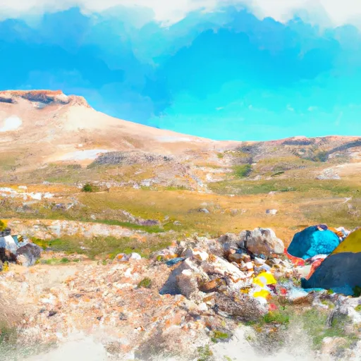
Big Horn Pass Trail Campground
Community Reviews
Been here? Share the conditions.
Reviews, ratings & photos are added in the free Snoflo iOS app — rate a spot, tag the conditions, and your visit is verified by location. Add or manage your reviews from the app.
Big Horn Pass Trail
The best time of year to visit Big Horn Pass Trail camping area is during the summer months, from June to September. This is when the weather is more favorable, with warmer temperatures and less precipitation. It is advisable to check the weather forecast beforehand and be prepared for sudden changes in weather, as Wyoming can experience rapid weather fluctuations.
While camping at Big Horn Pass Trail, visitors can explore the surrounding area, which offers breathtaking views, hiking trails, and wildlife spotting opportunities. However, campers should be cautious of bears in the area and take necessary precautions to store food securely and avoid attracting them. It is recommended to carry bear spray and be aware of proper bear safety practices.
What's on-site at Big Horn Pass Trail
Key facilities Snoflo tracks for this campground. Confirm with the operator before booking -- amenities can change seasonally.
Plan your trip down to the hour
Same weather feed Snoflo's iOS app uses -- updated continuously from NOAA / yr.no.
Next 5 days, hour by hour
Temperature line with weather symbols on top, snow + rain accumulation as columns, humidity as a dotted line.
5-day forecast table
Every 3 hours, broken out across temperature, snow, rain, humidity, and wind. Each cell is colour-coded relative to the column min/max so trends jump out at a glance.
| Time | Condition | Temp (°F) | Snow (in) | Rain (in) | Humidity (%) | Wind (mps) | Wind dir |
|---|---|---|---|---|---|---|---|
| Loading detailed forecast… | |||||||
15-day temperature & precipitation
Daily temperatures, snow, and rain projected over the next two weeks. Hover any point for the full breakdown.
Other campgrounds in the area
Snoflo-tracked campsites within driving distance of Big Horn Pass Trail, with reservations status.
| Campground | Reservations | Toilets | View |
|---|---|---|---|
| Indian Creek | ✗ | ✗ | → |
| Indian Creek - Yellowstone National Park | ✗ | ✓ | → |
| Winter Creek North | ✓ | ✗ | → |
| Straight Creek South | ✓ | ✗ | → |
| Soldier’S Corral | ✓ | ✗ | → |
Nearby streamflow
USGS streamgauges within reach of Big Horn Pass Trail -- pulled live from the National Water Information System.
| Streamgauge | Discharge | View |
|---|---|---|
| Boiling River At Mammoth | 22 cfs | → |
| Gardner River Near Mammoth Ynp | 177 cfs | → |
| Tantalus Creek At Norris Junction | 3 cfs | → |
| Yellowstone River At Corwin Springs Mt | 3,760 cfs | → |
| Lamar River Nr Tower Falls Ranger Station Ynp | 505 cfs | → |
| Gibbon River At Madison Jct | 90 cfs | → |
Nearby snow depths
NRCS SNOTEL stations within reach of Big Horn Pass Trail -- relevant when planning a shoulder-season or alpine trip.
| SNOTEL station | Snowpack | 24h Snowfall | View |
|---|---|---|---|
| Tower Falls Rs - Coop | 0.0 in | 0.0 in | → |
| Canyon | 0.0 in | 0.0 in | → |
| Nohrsc Canyon Snotel | 0.0 in | 0.0 in | → |
| West Yellowstone | 0.0 in | 0.0 in | → |
| Nohrsc West Yellowstone | 0.0 in | 0.0 in | → |
| Carrot Basin | 0.0 in | 0.0 in | → |
Plan a longer trip
The closest parks, lakes, boat launches, and paddle runs so a camping night can grow into a full weekend.
Boat launches
- Brogan's Landing
- Yellowstone
- Carbella Boat Ramp
- Old Yellowstone Trail Park County
- Madison Arm Resort
Fishing spots
Points of interest
- Apollinaris Spring
- Osprey Falls
- Mammoth Hot Springs Terraces
- Fort Yellowstone
- Albright Visitor Center
- Travertine Terraces & Parade Ground Webcam
Paddle runs
- Begins Downstream Of Osprey Falls To Confluence With Yellowstone River, At The Northern Park Boundary
- The Headwaters In The Gallatin Range To Ends Where The River Parallels A Two-Lane Highway
- The Headwaters, In The Gallatin Range To Ends Downstream Of Osprey Falls
- Gardiner Town Run
- Begins Above Blanding Hill And The Road Access To Virginia Cascades To The Confluence With Firehole River
- The Headwaters, In The Washburn Range To Ends Above Blanding Hill And The Road Access To Virginia Cascades
Camping essentials & Leave No Trace
- Pack it in, pack it out
- Take all trash, food scraps, and gear back with you to keep campsites clean and protect wildlife.
- Respect wildlife
- Observe animals from a distance, store food securely, and never feed wildlife to maintain natural behavior and safety.
- Know before you go
- Check weather, fire restrictions, trail conditions, and permit requirements to ensure a safe and well-planned trip.
- Minimize campfire impact
- Use established fire rings, keep fires small, fully extinguish them, or opt for a camp stove when fires are restricted.
- Leave what you find
- Preserve natural and cultural features by avoiding removal of plants, rocks, artifacts, or other elements of the environment.
Set push alerts in the Snoflo app
Save Big Horn Pass Trail as a favorite, set a custom threshold (precipitation, snowpack, freezing temperatures), and the iOS app will push the moment conditions cross.
About Big Horn Pass Trail
Can I make reservations at Big Horn Pass Trail?
Yes -- this campground accepts reservations. Snoflo recommends booking early for peak season; check the operator (Recreation.gov / state park system / private operator) for the booking window and cancellation policy.
How fresh is the weather data on this page?
The hourly forecast updates throughout the day from the NOAA / yr.no public feeds. Streamflow data is pulled live from USGS streamgauges and snowpack from the NRCS SNOTEL network.
What's the best time of year to visit?
Use the 15-day temperature & precipitation outlook on this page to plan -- pick a window with comfortable temperatures and low precipitation. For longer trips, the 5-day hourly meteogram shows snow + rain accumulation hour-by-hour.
How do I get to Big Horn Pass Trail?
Tap Directions in the hero above to open driving directions in Google Maps, or Open in map to center the Snoflo interactive map on the campground.
Can I get alerts when conditions change?
Yes -- alerts are managed through the Snoflo iOS app. Favorite this campground, set a threshold (temperature, snowpack, precipitation), and you'll get a push the moment it crosses.
Other campgrounds near here
Snoflo-tracked campgrounds within driving distance of Big Horn Pass Trail.