Grouse Creek Campground
Community Reviews
Been here? Share the conditions.
Reviews, ratings & photos are added in the free Snoflo iOS app — rate a spot, tag the conditions, and your visit is verified by location. Add or manage your reviews from the app.
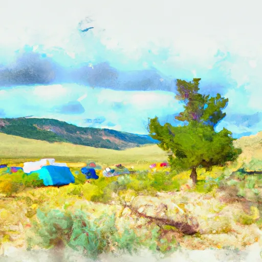
Grouse Creek
Reservations are not accepted at Grouse Creek camping area, making it a first-come, first-served campground. This means that securing a spot depends on availability, so it is advisable to arrive early, especially during peak season. Speaking of seasons, the best time to visit Grouse Creek is during the summer months, from June to September. The weather during this period is generally warm and pleasant, allowing for various outdoor activities such as hiking, fishing, and wildlife spotting.
While exploring the camping area, be cautious of the local wildlife, such as bears and moose, and remember to properly store food to avoid attracting them. Additionally, it is essential to bring bug repellent as mosquitoes can be plentiful in this area. Grouse Creek camping area offers a peaceful retreat amidst nature, but it is always recommended to check with official sources for any updates or changes before planning your trip.
What's on-site at Grouse Creek
Key facilities Snoflo tracks for this campground. Confirm with the operator before booking -- amenities can change seasonally.
Plan your trip down to the hour
Same weather feed Snoflo's iOS app uses -- updated continuously from NOAA / yr.no.
Next 5 days, hour by hour
Temperature line with weather symbols on top, snow + rain accumulation as columns, humidity as a dotted line.
5-day forecast table
Every 3 hours, broken out across temperature, snow, rain, humidity, and wind. Each cell is colour-coded relative to the column min/max so trends jump out at a glance.
| Time | Condition | Temp (°F) | Snow (in) | Rain (in) | Humidity (%) | Wind (mps) | Wind dir |
|---|---|---|---|---|---|---|---|
| Loading detailed forecast… | |||||||
15-day temperature & precipitation
Daily temperatures, snow, and rain projected over the next two weeks. Hover any point for the full breakdown.
Other campgrounds in the area
Snoflo-tracked campsites within driving distance of Grouse Creek, with reservations status.
| Campground | Reservations | Toilets | View |
|---|---|---|---|
| Lower Grouse Creek | ✓ | ✗ | → |
| Southwest Bay | ✓ | ✗ | → |
| 7n4 | ✗ | ✗ | → |
| Gowdy Camp | ✓ | ✗ | → |
| Monument Camp | ✓ | ✗ | → |
Nearby streamflow
USGS streamgauges within reach of Grouse Creek -- pulled live from the National Water Information System.
| Streamgauge | Discharge | View |
|---|---|---|
| Snake River Ab Jackson Lake At Flagg Ranch Wy | 409 cfs | → |
| Yellowstone River At Yellowstone Lk Outlet Ynp | 2,470 cfs | → |
| Pacific Creek At Moran Wy | 81 cfs | → |
| Buffalo Fork Ab Lava Creek Nr Moran Wy | 619 cfs | → |
| Snake River Nr Moran Wy | 4,910 cfs | → |
| Firehole River Near West Yellowstone Mt | 208 cfs | → |
Nearby snow depths
NRCS SNOTEL stations within reach of Grouse Creek -- relevant when planning a shoulder-season or alpine trip.
| SNOTEL station | Snowpack | 24h Snowfall | View |
|---|---|---|---|
| Nohrsc Two Ocean Plateau Snotel | 0.0 in | 0.0 in | → |
| Two Ocean Plateau | 0.0 in | 0.0 in | → |
| Nohrsc Thumb Divide Snotel | 0.0 in | 0.0 in | → |
| Thumb Divide | 0.0 in | 0.0 in | → |
| Lewis Lake Divide | 0.0 in | 0.0 in | → |
| Nohrsc Lewis Lake Divide Snotel | 0.0 in | 0.0 in | → |
Plan a longer trip
The closest parks, lakes, boat launches, and paddle runs so a camping night can grow into a full weekend.
Points of interest
- Grant Village Visitor Center
- Lewis Falls
- Thumb Paintpots
- West Thumb Geyser Basin
- Eagle Pass
- Parting Of The Waters National Natural Landmark
Paddle runs
- Southeastern Boundary Of The Park To Yellowstone Lake Inlet
- Confluence Of North/South Forks To Yellowstone Np Boundary
- Thorofare Creek Source To Yellowstone Np Boundary
- Outlet Of Yellowstone Lake At Fishing Bridge To Lower Falls
- The Headwaters To The Southern Yellowstone National Park Boundary
- Open Creek Source To Confluence With Thorofare
Camping essentials & Leave No Trace
- Pack it in, pack it out
- Take all trash, food scraps, and gear back with you to keep campsites clean and protect wildlife.
- Respect wildlife
- Observe animals from a distance, store food securely, and never feed wildlife to maintain natural behavior and safety.
- Know before you go
- Check weather, fire restrictions, trail conditions, and permit requirements to ensure a safe and well-planned trip.
- Minimize campfire impact
- Use established fire rings, keep fires small, fully extinguish them, or opt for a camp stove when fires are restricted.
- Leave what you find
- Preserve natural and cultural features by avoiding removal of plants, rocks, artifacts, or other elements of the environment.
Set push alerts in the Snoflo app
Save Grouse Creek as a favorite, set a custom threshold (precipitation, snowpack, freezing temperatures), and the iOS app will push the moment conditions cross.
About Grouse Creek
Can I make reservations at Grouse Creek?
Yes -- this campground accepts reservations. Snoflo recommends booking early for peak season; check the operator (Recreation.gov / state park system / private operator) for the booking window and cancellation policy.
How fresh is the weather data on this page?
The hourly forecast updates throughout the day from the NOAA / yr.no public feeds. Streamflow data is pulled live from USGS streamgauges and snowpack from the NRCS SNOTEL network.
What's the best time of year to visit?
Use the 15-day temperature & precipitation outlook on this page to plan -- pick a window with comfortable temperatures and low precipitation. For longer trips, the 5-day hourly meteogram shows snow + rain accumulation hour-by-hour.
How do I get to Grouse Creek?
Tap Directions in the hero above to open driving directions in Google Maps, or Open in map to center the Snoflo interactive map on the campground.
Can I get alerts when conditions change?
Yes -- alerts are managed through the Snoflo iOS app. Favorite this campground, set a threshold (temperature, snowpack, precipitation), and you'll get a push the moment it crosses.
Other campgrounds near here
Snoflo-tracked campgrounds within driving distance of Grouse Creek.