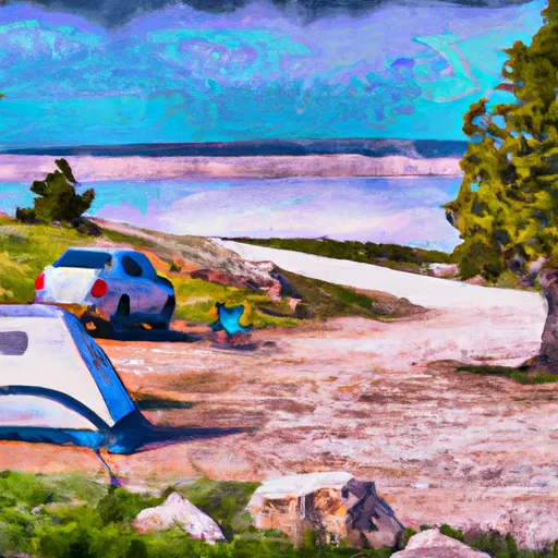
South Arm Campground
Community Reviews
Been here? Share the conditions.
Reviews, ratings & photos are added in the free Snoflo iOS app — rate a spot, tag the conditions, and your visit is verified by location. Add or manage your reviews from the app.
South Arm
Reservations are not accepted at South Arm camping area, and sites are available on a first-come, first-served basis. It is advisable to arrive early during peak seasons to secure a spot. The best time to visit this camping area is during the summer months, from June to September when the weather is pleasant and ideal for outdoor activities.
Campers at South Arm can enjoy various activities such as fishing, hiking, and wildlife spotting. The campground is situated near beautiful lakes and rivers, providing opportunities for fishing enthusiasts. Visitors should be cautious of wildlife in the area, including bears and other potentially dangerous animals. It is important to follow safe camping practices, such as proper food storage and avoiding confrontation with wildlife. By exercising caution and respecting the natural surroundings, campers can have a memorable and enjoyable experience at South Arm camping area in Wyoming.
What's on-site at South Arm
Key facilities Snoflo tracks for this campground. Confirm with the operator before booking -- amenities can change seasonally.
Plan your trip down to the hour
Same weather feed Snoflo's iOS app uses -- updated continuously from NOAA / yr.no.
Next 5 days, hour by hour
Temperature line with weather symbols on top, snow + rain accumulation as columns, humidity as a dotted line.
5-day forecast table
Every 3 hours, broken out across temperature, snow, rain, humidity, and wind. Each cell is colour-coded relative to the column min/max so trends jump out at a glance.
| Time | Condition | Temp (°F) | Snow (in) | Rain (in) | Humidity (%) | Wind (mps) | Wind dir |
|---|---|---|---|---|---|---|---|
| Loading detailed forecast… | |||||||
15-day temperature & precipitation
Daily temperatures, snow, and rain projected over the next two weeks. Hover any point for the full breakdown.
Other campgrounds in the area
Snoflo-tracked campsites within driving distance of South Arm, with reservations status.
| Campground | Reservations | Toilets | View |
|---|---|---|---|
| South Arm Bay | ✓ | ✗ | → |
| Promontory Point | ✓ | ✗ | → |
| 5l5 | ✗ | ✗ | → |
| South Arm Meadow | ✓ | ✗ | → |
| Plover Bay | ✓ | ✗ | → |
Nearby streamflow
USGS streamgauges within reach of South Arm -- pulled live from the National Water Information System.
| Streamgauge | Discharge | View |
|---|---|---|
| Yellowstone River At Yellowstone Lk Outlet Ynp | 2,550 cfs | → |
| Snake River Ab Jackson Lake At Flagg Ranch Wy | 443 cfs | → |
| Firehole River Near West Yellowstone Mt | 230 cfs | → |
| Gibbon River At Madison Jct | 105 cfs | → |
| Pacific Creek At Moran Wy | 91 cfs | → |
| Tantalus Creek At Norris Junction | 3 cfs | → |
Nearby snow depths
NRCS SNOTEL stations within reach of South Arm -- relevant when planning a shoulder-season or alpine trip.
| SNOTEL station | Snowpack | 24h Snowfall | View |
|---|---|---|---|
| Thumb Divide | 0.0 in | 0.0 in | → |
| Nohrsc Thumb Divide Snotel | 0.0 in | 0.0 in | → |
| Nohrsc Sylvan Lake Snotel | 0.0 in | 0.0 in | → |
| Sylvan Road | 0.0 in | 0.0 in | → |
| Sylvan Lake | 0.0 in | 0.0 in | → |
| Two Ocean Plateau | 0.0 in | 0.0 in | → |
Plan a longer trip
The closest parks, lakes, boat launches, and paddle runs so a camping night can grow into a full weekend.
Points of interest
- Grant Village Visitor Center
- Thumb Paintpots
- West Thumb Geyser Basin
- Natural Bridge
- Lewis Falls
- Fishing Bridge
Paddle runs
- Outlet Of Yellowstone Lake At Fishing Bridge To Lower Falls
- Southeastern Boundary Of The Park To Yellowstone Lake Inlet
- Confluence Of North/South Forks To Yellowstone Np Boundary
- The Headwaters To The Southern Yellowstone National Park Boundary
- Thorofare Creek Source To Yellowstone Np Boundary
- Open Creek Source To Confluence With Thorofare
Camping essentials & Leave No Trace
- Pack it in, pack it out
- Take all trash, food scraps, and gear back with you to keep campsites clean and protect wildlife.
- Respect wildlife
- Observe animals from a distance, store food securely, and never feed wildlife to maintain natural behavior and safety.
- Know before you go
- Check weather, fire restrictions, trail conditions, and permit requirements to ensure a safe and well-planned trip.
- Minimize campfire impact
- Use established fire rings, keep fires small, fully extinguish them, or opt for a camp stove when fires are restricted.
- Leave what you find
- Preserve natural and cultural features by avoiding removal of plants, rocks, artifacts, or other elements of the environment.
Set push alerts in the Snoflo app
Save South Arm as a favorite, set a custom threshold (precipitation, snowpack, freezing temperatures), and the iOS app will push the moment conditions cross.
About South Arm
Can I make reservations at South Arm?
Yes -- this campground accepts reservations. Snoflo recommends booking early for peak season; check the operator (Recreation.gov / state park system / private operator) for the booking window and cancellation policy.
How fresh is the weather data on this page?
The hourly forecast updates throughout the day from the NOAA / yr.no public feeds. Streamflow data is pulled live from USGS streamgauges and snowpack from the NRCS SNOTEL network.
What's the best time of year to visit?
Use the 15-day temperature & precipitation outlook on this page to plan -- pick a window with comfortable temperatures and low precipitation. For longer trips, the 5-day hourly meteogram shows snow + rain accumulation hour-by-hour.
How do I get to South Arm?
Tap Directions in the hero above to open driving directions in Google Maps, or Open in map to center the Snoflo interactive map on the campground.
Can I get alerts when conditions change?
Yes -- alerts are managed through the Snoflo iOS app. Favorite this campground, set a threshold (temperature, snowpack, precipitation), and you'll get a push the moment it crosses.
Other campgrounds near here
Snoflo-tracked campgrounds within driving distance of South Arm.