

-
 Snoflo Premium
Get unlimited access to all our content
With no Ad interruptions! - Start Your Free Trial Login with existing account
Frazier-Park
Eden Index
Climate
7.4
•
Recreation
6.1
•
Community
0.9
•
Safeguard
5.3/10
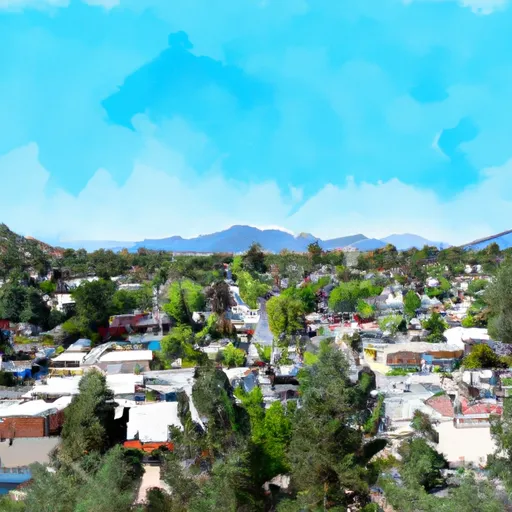
Frazier Park is a small unincorporated community located in Kern County, California, situated in the San Emigdio Mountains. The climate in Frazier Park is Mediterranean with mild winters and hot summers. The area is fed by the Kern River, which provides water for hydroelectric power generation and irrigation. The local flora and fauna include oak and pine trees, black bears, mountain lions, and deer. Frazier Park offers numerous outdoor recreation opportunities such as hiking, mountain biking, camping, and fishing in nearby Lake Piru. The Los Padres National Forest, Hungry Valley State Park, and Tejon Ranch are all within a 30-minute drive from Frazier Park, providing visitors with many options to explore the great outdoors.
What is the Eden Index?
The Snoflo Eden Index serves as a comprehensive rating system for regions, evaluating their desirability through a holistic assessment of climate health, outdoor recreation opportunities, and natural disaster risk, acknowledging the profound impact of these factors on livability and well-being.
Climate Health Indicator (CHI): 7.4
Frazier-Park receives approximately
350mm of rain per year,
with humidity levels near 87%
and air temperatures averaging around
12°C.
Frazier-Park has a plant hardyness factor of
8, meaning
plants and agriculture in this region tend to thrive here all year round.
By considering the ideal temperature range, reliable water supplies, clean air, and stable seasonal rain or snowpacks, the Climate Health Indicator (CHI) underscores the significance of a healthy climate as the foundation for quality living.
A healthy climate is paramount for ensuring a high quality of life and livability in a region, fostering both physical well-being and environmental harmony. This can be characterized by ideal temperatures, reliable access to water supplies, clean air, and consistent seasonal rain or snowpacks.
Weather Forecast
Streamflow Conditions
Tulare-Buena Vista Lakes
Area Rivers
Tulare-Buena Vista Lakes
Snowpack Depths
Tulare-Buena Vista Lakes
Reservoir Storage Capacity
Tulare-Buena Vista Lakes
Groundwater Levels
Recreational Opportunity Index (ROI): 6.1
The Recreational Opportunity Index (ROI) recognizes the value of outdoor recreational options, such as parks, hiking trails, camping sites, and fishing spots, while acknowledging that climate plays a pivotal role in ensuring the comfort and consistency of these experiences.
Access to outdoor recreational opportunities, encompassing activities such as parks, hiking, camping, and fishing, is crucial for overall well-being, and the climate plays a pivotal role in enabling and enhancing these experiences, ensuring that individuals can engage in nature-based activities comfortably and consistently.
Camping Areas
| Campground | Campsites | Reservations | Toilets | Showers | Elevation |
|---|---|---|---|---|---|
| Lake Casitas | 400 | 597 ft | |||
| Thorn Meadows | 5 | 5,054 ft | |||
| Camp Comfort | 15 | 578 ft | |||
| Reyes Peak | 6 | 7,086 ft | |||
| Middle Lion | 8 | 3,151 ft | |||
| Dennison Park | None | 1,270 ft | |||
| Steckel Co Park | None | 775 ft | |||
| Wheeler Gorge | 70 | 1,814 ft | |||
| Rose Valley | 9 | 3,418 ft | |||
| Pine Mountain | 6 | 6,619 ft |
Nearby Fishing
Catastrophe Safeguard Index (CSI):
The Catastrophe Safeguard Index (CSI) recognizes that natural disaster risk, encompassing floods, fires, hurricanes, and tornadoes, can drastically affect safety and the overall appeal of an area.
The level of natural disaster risk in a region significantly affects safety and the overall livability, with climate change amplifying these risks by potentially increasing the frequency and intensity of events like floods, fires, hurricanes, and tornadoes, thereby posing substantial challenges to community resilience and well-being.
Community Resilience Indicator (CRI): 0.9
The Community Resilience Indicator (CRI) recognizes that education, healthcare, and socioeconomics are crucial to the well-being of a region. The CRI acknowledges the profound impact of these elements on residents' overall quality of life. By evaluating educational resources, healthcare accessibility, and economic inclusivity, the index captures the essential aspects that contribute to a thriving community, fostering resident satisfaction, equity, and social cohesion.