

-
 Snoflo Premium
Get unlimited access to all our content
With no Ad interruptions! - Start Your Free Trial Login with existing account
Marland
Eden Index
Climate
8.3
•
Recreation
2.0
•
Community
•
Safeguard
4.0/10
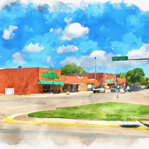
Marland, Oklahoma is a small town located in the northern part of the state. The climate in Marland is classified as humid subtropical, with hot summers and mild winters. Summers are typically hot and humid, with temperatures often reaching the mid to high 90s Fahrenheit. Winters are relatively mild, with average temperatures in the mid-40s to mid-50s Fahrenheit.
Marland is situated near the Salt Fork Arkansas River, which provides a significant hydrological presence in the area. The river is a tributary of the Arkansas River and offers opportunities for fishing, boating, and other water-related activities. The hydrology of the region also supports the growth of lush vegetation and various wildlife species.
Outdoor recreation enthusiasts will find several opportunities in Marland and its surrounding areas. The nearby Kaw Lake is a popular destination for fishing, camping, and boating. Outdoor enthusiasts can also explore the Great Salt Plains State Park, which is known for its unique salt flats and offers activities such as hiking, bird watching, and fossil digging.
In summary, Marland, Oklahoma boasts a humid subtropical climate, with hot summers and mild winters. Its hydrology is marked by the presence of the Salt Fork Arkansas River, providing opportunities for water-based activities. The town and its surrounding areas offer outdoor recreation opportunities like fishing, boating, camping, hiking, bird watching, and fossil digging.
What is the Eden Index?
The Snoflo Eden Index serves as a comprehensive rating system for regions, evaluating their desirability through a holistic assessment of climate health, outdoor recreation opportunities, and natural disaster risk, acknowledging the profound impact of these factors on livability and well-being.
Climate Health Indicator (CHI): 8.3
Marland receives approximately
909mm of rain per year,
with humidity levels near 85%
and air temperatures averaging around
16°C.
Marland has a plant hardyness factor of
7, meaning
plants and agriculture in this region tend to thrive during the non-winter months.
By considering the ideal temperature range, reliable water supplies, clean air, and stable seasonal rain or snowpacks, the Climate Health Indicator (CHI) underscores the significance of a healthy climate as the foundation for quality living.
A healthy climate is paramount for ensuring a high quality of life and livability in a region, fostering both physical well-being and environmental harmony. This can be characterized by ideal temperatures, reliable access to water supplies, clean air, and consistent seasonal rain or snowpacks.
Weather Forecast
Streamflow Conditions
Arkansas - Keystone
Area Rivers
Arkansas - Keystone
Snowpack Depths
Arkansas - Keystone
Reservoir Storage Capacity
Arkansas - Keystone
Groundwater Levels
Recreational Opportunity Index (ROI): 2.0
The Recreational Opportunity Index (ROI) recognizes the value of outdoor recreational options, such as parks, hiking trails, camping sites, and fishing spots, while acknowledging that climate plays a pivotal role in ensuring the comfort and consistency of these experiences.
Access to outdoor recreational opportunities, encompassing activities such as parks, hiking, camping, and fishing, is crucial for overall well-being, and the climate plays a pivotal role in enabling and enhancing these experiences, ensuring that individuals can engage in nature-based activities comfortably and consistently.
Camping Areas
| Campground | Campsites | Reservations | Toilets | Showers | Elevation |
|---|---|---|---|---|---|
| Lake Thunderbird State Park - South | None | 1,146 ft | |||
| Heart of Oklahoma Exposition Center | 300 | 1,083 ft | |||
| Lake Thunderbird State Park - North | None | 1,081 ft | |||
| Lake Carl Blackwell | 200 | 988 ft | |||
| Lake McMurtry West | None | 993 ft | |||
| Wes Watkins Reservoir | 62 | 1,113 ft | |||
| Shawnee Twin Lakes | None | 1,101 ft | |||
| Meeker Lake | None | 923 ft | |||
| Bell Cow Lake and Equestrian | 60 | 928 ft | |||
| Lake McMurtry East | None | 985 ft |
Catastrophe Safeguard Index (CSI):
The Catastrophe Safeguard Index (CSI) recognizes that natural disaster risk, encompassing floods, fires, hurricanes, and tornadoes, can drastically affect safety and the overall appeal of an area.
The level of natural disaster risk in a region significantly affects safety and the overall livability, with climate change amplifying these risks by potentially increasing the frequency and intensity of events like floods, fires, hurricanes, and tornadoes, thereby posing substantial challenges to community resilience and well-being.
Community Resilience Indicator (CRI):
The Community Resilience Indicator (CRI) recognizes that education, healthcare, and socioeconomics are crucial to the well-being of a region. The CRI acknowledges the profound impact of these elements on residents' overall quality of life. By evaluating educational resources, healthcare accessibility, and economic inclusivity, the index captures the essential aspects that contribute to a thriving community, fostering resident satisfaction, equity, and social cohesion.