

-
 Snoflo Premium
Get unlimited access to all our content
With no Ad interruptions! - Start Your Free Trial Login with existing account
Trout-Lake
Eden Index
Climate
7.3
•
Recreation
5.7
•
Community
1.5
•
Safeguard
5.3/10
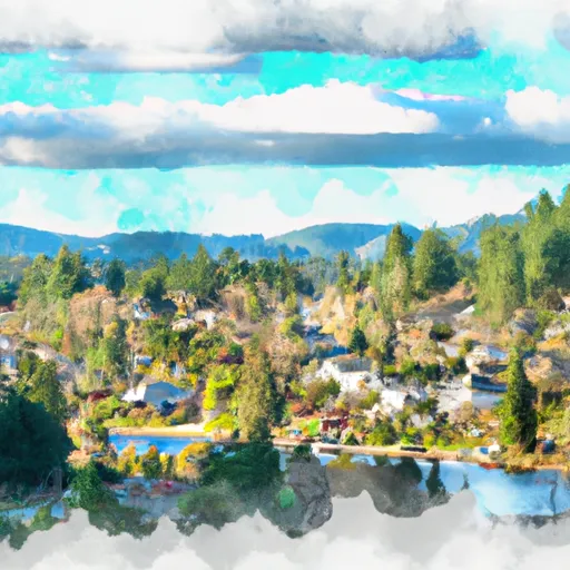
Located in the southern part of Washington State, Trout Lake is a small community nestled in the heart of the Cascade Mountains. The region experiences a cool, temperate climate, with mild summers and cold winters. The area receives significant precipitation, particularly during the winter months, making it an ideal location for outdoor enthusiasts.
Trout Lake is surrounded by pristine natural beauty, with the namesake lake being a prominent feature. The lake is fed by glacial runoff, resulting in crystal-clear waters that are popular for fishing and boating. Numerous rivers and streams flow through the area, including the White Salmon River, offering excellent opportunities for kayaking, rafting, and swimming.
The region is also known for its abundant wildlife, including various bird species and the occasional sighting of elk and deer. Hiking trails wind through the picturesque landscape, providing breathtaking views of the surrounding mountains and valleys. Mount Adams, a prominent volcano, is a popular destination for climbers and hikers.
Whether it is fishing in the lake, exploring the rivers, or hiking the trails, Trout Lake offers a multitude of outdoor recreation opportunities for visitors to immerse themselves in the natural wonders of the area.
What is the Eden Index?
The Snoflo Eden Index serves as a comprehensive rating system for regions, evaluating their desirability through a holistic assessment of climate health, outdoor recreation opportunities, and natural disaster risk, acknowledging the profound impact of these factors on livability and well-being.
Climate Health Indicator (CHI): 7.3
Trout-Lake receives approximately
1095mm of rain per year,
with humidity levels near 82%
and air temperatures averaging around
9°C.
Trout-Lake has a plant hardyness factor of
7, meaning
plants and agriculture in this region tend to thrive during the non-winter months.
By considering the ideal temperature range, reliable water supplies, clean air, and stable seasonal rain or snowpacks, the Climate Health Indicator (CHI) underscores the significance of a healthy climate as the foundation for quality living.
A healthy climate is paramount for ensuring a high quality of life and livability in a region, fostering both physical well-being and environmental harmony. This can be characterized by ideal temperatures, reliable access to water supplies, clean air, and consistent seasonal rain or snowpacks.
Weather Forecast
Streamflow Conditions
Middle Columbia
Area Rivers
Middle Columbia
Snowpack Depths
Middle Columbia
Reservoir Storage Capacity
Middle Columbia
Groundwater Levels
Recreational Opportunity Index (ROI): 5.7
The Recreational Opportunity Index (ROI) recognizes the value of outdoor recreational options, such as parks, hiking trails, camping sites, and fishing spots, while acknowledging that climate plays a pivotal role in ensuring the comfort and consistency of these experiences.
Access to outdoor recreational opportunities, encompassing activities such as parks, hiking, camping, and fishing, is crucial for overall well-being, and the climate plays a pivotal role in enabling and enhancing these experiences, ensuring that individuals can engage in nature-based activities comfortably and consistently.
Camping Areas
| Campground | Campsites | Reservations | Toilets | Showers | Elevation |
|---|---|---|---|---|---|
| Horseshoe Lake | 11 | 4,177 ft | |||
| Cat Creek | 5 | 2,728 ft | |||
| Adams Fork | 31 | 2,615 ft | |||
| Council Lake | 9 | 4,371 ft | |||
| Chain - Of - Lakes | 7 | 4,400 ft | |||
| Takhlakh Lake | 54 | 4,459 ft | |||
| Twin Falls | 6 | 2,768 ft | |||
| Cat Creek Chimney | 10 | 2,849 ft | |||
| Killen Creek | 9 | 4,461 ft | |||
| Olallie Lake | 5 | 4,254 ft |
Nearby Fishing
Nearby Ski Areas
Catastrophe Safeguard Index (CSI):
The Catastrophe Safeguard Index (CSI) recognizes that natural disaster risk, encompassing floods, fires, hurricanes, and tornadoes, can drastically affect safety and the overall appeal of an area.
The level of natural disaster risk in a region significantly affects safety and the overall livability, with climate change amplifying these risks by potentially increasing the frequency and intensity of events like floods, fires, hurricanes, and tornadoes, thereby posing substantial challenges to community resilience and well-being.
Community Resilience Indicator (CRI): 1.5
The Community Resilience Indicator (CRI) recognizes that education, healthcare, and socioeconomics are crucial to the well-being of a region. The CRI acknowledges the profound impact of these elements on residents' overall quality of life. By evaluating educational resources, healthcare accessibility, and economic inclusivity, the index captures the essential aspects that contribute to a thriving community, fostering resident satisfaction, equity, and social cohesion.