Headwaters To Diversion For Cluff Ranch River Run
Community Reviews
Been here? Share the conditions.
Reviews, ratings & photos are added in the free Snoflo iOS app — rate a spot, tag the conditions, and your visit is verified by location. Add or manage your reviews from the app.
Headwaters To Diversion For Cluff Ranch
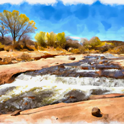
The class rating of this section of the Whitewater River is generally considered to be Class III, although some rapids may reach up to Class IV in difficulty. The segment mileage for this run is approximately 8 miles, with a total of 14 named rapids and several other challenging sections.
Some of the specific rapids and obstacles on this stretch of the Whitewater River include House Rock, Cluff's Revenge, Humpback, and Slick Horn. Boaters should be prepared for steep drops, tight turns, and complex rock formations.
There are several specific regulations that apply to this section of the Whitewater River, including a requirement for all boaters to wear personal flotation devices and to carry appropriate safety equipment such as throw bags and rescue ropes. Boaters should also be aware of private land boundaries and respect the rights of landowners in the area.
Overall, the Headwaters to Diversion for Cluff Ranch section of the Whitewater River offers a challenging and exciting run for experienced boaters who are prepared for the rapids and obstacles that await them.
Plan your run down to the hour
Same weather feed Snoflo's iOS app uses -- updated continuously from NOAA / yr.no. Watch the precipitation column on the meteogram; rain ahead of a run typically lifts flows 12-48 hours later depending on the basin.
Next 5 days, hour by hour
Temperature line with weather symbols on top, snow + rain accumulation as columns, humidity as a dotted line.
5-day forecast table
Every 3 hours, broken out across temperature, snow, rain, humidity, and wind. Each cell is colour-coded relative to the column min/max.
| Time | Condition | Temp (°F) | Snow (in) | Rain (in) | Humidity (%) | Wind (mps) | Wind dir |
|---|---|---|---|---|---|---|---|
| Loading detailed forecast… | |||||||
15-day temperature & precipitation
Daily temperatures, snow, and rain projected over the next two weeks -- the upstream story that drives next week's flows.
Regional streamflow levels
USGS streamgauges around Headwaters To Diversion For Cluff Ranch -- useful for spotting upstream pulses and gauging which tributary is contributing what.
| Streamgauge | Discharge | View |
|---|---|---|
| Frye Creek Near Thatcher | 1 cfs | → |
| Gila River At Head Of Safford Valley | 186 cfs | → |
| Bonita Creek Near Morenci | 2 cfs | → |
| Eagle Creek Above Pumping Plant | 32 cfs | → |
| Gila River At Calva | 8 cfs | → |
| Gila River Near Clifton | 23 cfs | → |
Plan a longer trip
The closest boat launches, other paddle runs, and campgrounds so a day on the water can grow into a full weekend.
Boat launches
Other river runs
- Headwaters To Confluence With Grant Creek
- Headwaters To Diversion Approximately 0.75 Mile From Coronado National Forest Boundary
- Bonita Creek
- Gila River (Gila Box)
- Headwaters To Coronado National Forest Boundary
Whitewater safety
- Check the flow before you run
- Use the linked-gauge card and Regional Flow panel above. Class ratings change with flow -- a Class III at low water can become Class IV+ at high water.
- Know your skill ceiling
- Pick runs comfortably below your ceiling. Cold-water and big-water runs raise the consequences of any mistake.
- Wear the right gear
- Helmet, PFD, drysuit / wetsuit when water is below 60°F. Throw bag, knife, and whistle on your person, not in the boat.
- Scout, set safety, and run with a team
- Scout new rapids on foot, set safety with throw bags above the consequence pool, and run with at least one other competent paddler.
- Respect the river
- Strainers, undercuts, low-head dams, and wood can kill at any class rating. When in doubt, portage.
Set push alerts in the Snoflo app
Save Headwaters To Diversion For Cluff Ranch as a favorite, set a discharge threshold (e.g. "alert me when flow hits 600 cfs"), and the iOS app pushes the moment the linked gauge crosses.
About Headwaters To Diversion For Cluff Ranch
What's the optimal flow for Headwaters To Diversion For Cluff Ranch?
The optimal flow depends on the section and the craft. Check the Run Details panel for the linked gauge and current status.
How fresh is the cfs reading on this page?
The linked USGS streamgauge reports continuously (every 15 minutes); Snoflo refreshes throughout the day. Hover the streamflow sparkline to read individual datapoints.
What's the whitewater class?
See the Run Details panel for the class rating Snoflo tracks for this run. Class ratings change with flow -- a Class III at low water can become Class IV in high water.
Where do I put in / take out?
Tap Directions in the hero above to open driving directions to the put-in. For shuttle planning, check the Nearby Boat Launches panel and the river run operator's site.
Can I get alerts when flows hit the optimal range?
Yes -- alerts are managed in the Snoflo iOS app. Favorite this run, set a discharge threshold, and you'll get a push the moment the gauge crosses.
Other runs near here
Snoflo-tracked paddle runs within driving distance of Headwaters To Diversion For Cluff Ranch.