Headwaters In The Santa Monica Mountains To Mouth At Pacific Ocean River Run
Community Reviews
Been here? Share the conditions.
Reviews, ratings & photos are added in the free Snoflo iOS app — rate a spot, tag the conditions, and your visit is verified by location. Add or manage your reviews from the app.
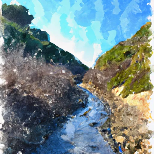
Headwaters In The Santa Monica Mountains To Mouth At Pacific Ocean
Some notable rapids and obstacles along the Whitewater River run include "S-Turn," "Stovepipe," "Devil's Elbow," and "Pinball." These rapids require technical paddling skills and proper equipment to navigate safely. The river also contains several large boulders and fallen trees that create additional challenges for paddlers.
Regulations for the Whitewater River run include the requirement for all paddlers to wear Personal Flotation Devices (PFDs) at all times. Additionally, the river is subject to seasonal closures and restrictions based on water levels and weather conditions. Paddlers are also encouraged to practice Leave No Trace principles and avoid disturbing the natural environment.
Overall, the Whitewater River run is a challenging and exciting paddle for experienced whitewater enthusiasts. It is important to check current river conditions and regulations before embarking on a trip and to always prioritize safety while on the water.
Plan your run down to the hour
Same weather feed Snoflo's iOS app uses -- updated continuously from NOAA / yr.no. Watch the precipitation column on the meteogram; rain ahead of a run typically lifts flows 12-48 hours later depending on the basin.
Next 5 days, hour by hour
Temperature line with weather symbols on top, snow + rain accumulation as columns, humidity as a dotted line.
5-day forecast table
Every 3 hours, broken out across temperature, snow, rain, humidity, and wind. Each cell is colour-coded relative to the column min/max.
| Time | Condition | Temp (°F) | Snow (in) | Rain (in) | Humidity (%) | Wind (mps) | Wind dir |
|---|---|---|---|---|---|---|---|
| Loading detailed forecast… | |||||||
15-day temperature & precipitation
Daily temperatures, snow, and rain projected over the next two weeks -- the upstream story that drives next week's flows.
Regional streamflow levels
USGS streamgauges around Headwaters In The Santa Monica Mountains To Mouth At Pacific Ocean -- useful for spotting upstream pulses and gauging which tributary is contributing what.
| Streamgauge | Discharge | View |
|---|---|---|
| Calleguas C Nr Camarillo Ca | 6 cfs | → |
| Santa Paula C Nr Santa Paula | 6 cfs | → |
| Santa Clara R Nr Piru Ca | 36 cfs | → |
| Sespe C Nr Fillmore | 12 cfs | → |
| Piru Creek Below Santa Felicia Dam Ca | 21 cfs | → |
| Ventura R Nr Ventura | 14 cfs | → |
Plan a longer trip
The closest boat launches, other paddle runs, and campgrounds so a day on the water can grow into a full weekend.
Other river runs
- Lower Piru Creek (Oulet At Pyramid Reservoir) To Piru Reservoir
- Section Line To Confluence With Rock Creek
- Chorro Grande Canyon To Section Line Dividing Sec 1, T5n, R23w And Sec 6, T5n, T22w
- Site Of St Francis Dam Disaster To Seco Canyon At The Nf Boundary
- Castaic To Pyramid Reservoir
Campgrounds
- Circle X Ranch Campground
- Group Campground
- Circle X Group
- Sycamore Group Multi-Use Area
- Danielson Group Multi-Use Area
- Camp Bloomfield
Fishing spots
Parks
Whitewater safety
- Check the flow before you run
- Use the linked-gauge card and Regional Flow panel above. Class ratings change with flow -- a Class III at low water can become Class IV+ at high water.
- Know your skill ceiling
- Pick runs comfortably below your ceiling. Cold-water and big-water runs raise the consequences of any mistake.
- Wear the right gear
- Helmet, PFD, drysuit / wetsuit when water is below 60°F. Throw bag, knife, and whistle on your person, not in the boat.
- Scout, set safety, and run with a team
- Scout new rapids on foot, set safety with throw bags above the consequence pool, and run with at least one other competent paddler.
- Respect the river
- Strainers, undercuts, low-head dams, and wood can kill at any class rating. When in doubt, portage.
Set push alerts in the Snoflo app
Save Headwaters In The Santa Monica Mountains To Mouth At Pacific Ocean as a favorite, set a discharge threshold (e.g. "alert me when flow hits 600 cfs"), and the iOS app pushes the moment the linked gauge crosses.
About Headwaters In The Santa Monica Mountains To Mouth At Pacific Ocean
What's the optimal flow for Headwaters In The Santa Monica Mountains To Mouth At Pacific Ocean?
The optimal flow depends on the section and the craft. Check the Run Details panel for the linked gauge and current status.
How fresh is the cfs reading on this page?
The linked USGS streamgauge reports continuously (every 15 minutes); Snoflo refreshes throughout the day. Hover the streamflow sparkline to read individual datapoints.
What's the whitewater class?
See the Run Details panel for the class rating Snoflo tracks for this run. Class ratings change with flow -- a Class III at low water can become Class IV in high water.
Where do I put in / take out?
Tap Directions in the hero above to open driving directions to the put-in. For shuttle planning, check the Nearby Boat Launches panel and the river run operator's site.
Can I get alerts when flows hit the optimal range?
Yes -- alerts are managed in the Snoflo iOS app. Favorite this run, set a discharge threshold, and you'll get a push the moment the gauge crosses.
Other runs near here
Snoflo-tracked paddle runs within driving distance of Headwaters In The Santa Monica Mountains To Mouth At Pacific Ocean.