Sycamore Group Multi-Use Area Campground
Community Reviews
Been here? Share the conditions.
Reviews, ratings & photos are added in the free Snoflo iOS app — rate a spot, tag the conditions, and your visit is verified by location. Add or manage your reviews from the app.
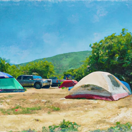
Sycamore Group Multi-Use Area
One of the most notable points of interest in the area is the nearby Blue Jay Campground. This campground is located just a short distance from the Sycamore Group Multi-Use Area and offers additional camping opportunities and amenities. Visitors can also explore the nearby Wildomar Off-Highway Vehicle Area and the Santa Rosa Plateau Ecological Reserve.
The Sycamore Group Multi-Use Area is open year-round, although the best time to visit is during the spring and fall when temperatures are more moderate. Average temperatures during the spring months range from 60-80 degrees Fahrenheit, while temperatures in the fall range from 70-90 degrees Fahrenheit.
Interesting facts about the area include its history as a former mining site and the presence of various endangered species, such as the mountain yellow-legged frog and the southwestern willow flycatcher.
Overall, the Sycamore Group Multi-Use Area offers a beautiful camping experience with stunning views, nearby points of interest, and a range of amenities for visitors to enjoy.
What's on-site at Sycamore Group Multi-Use Area
Key facilities Snoflo tracks for this campground. Confirm with the operator before booking -- amenities can change seasonally.
Plan your trip down to the hour
Same weather feed Snoflo's iOS app uses -- updated continuously from NOAA / yr.no.
Next 5 days, hour by hour
Temperature line with weather symbols on top, snow + rain accumulation as columns, humidity as a dotted line.
5-day forecast table
Every 3 hours, broken out across temperature, snow, rain, humidity, and wind. Each cell is colour-coded relative to the column min/max so trends jump out at a glance.
| Time | Condition | Temp (°F) | Snow (in) | Rain (in) | Humidity (%) | Wind (mps) | Wind dir |
|---|---|---|---|---|---|---|---|
| Loading detailed forecast… | |||||||
15-day temperature & precipitation
Daily temperatures, snow, and rain projected over the next two weeks. Hover any point for the full breakdown.
Other campgrounds in the area
Snoflo-tracked campsites within driving distance of Sycamore Group Multi-Use Area, with reservations status.
| Campground | Reservations | Toilets | View |
|---|---|---|---|
| Danielson Group Multi-Use Area | ✗ | ✗ | → |
| La Jolla Valley Trail Camps | ✗ | ✗ | → |
| Group Campground | ✗ | ✗ | → |
| Circle X Group | ✗ | ✗ | → |
| Circle X Ranch Campground | ✗ | ✗ | → |
Nearby streamflow
USGS streamgauges within reach of Sycamore Group Multi-Use Area -- pulled live from the National Water Information System.
| Streamgauge | Discharge | View |
|---|---|---|
| Calleguas C Nr Camarillo Ca | 6 cfs | → |
| Santa Paula C Nr Santa Paula | 6 cfs | → |
| Sespe C Nr Fillmore | 12 cfs | → |
| Santa Clara R Nr Piru Ca | 36 cfs | → |
| Ventura R Nr Ventura | 14 cfs | → |
| Piru Creek Below Santa Felicia Dam Ca | 21 cfs | → |
Plan a longer trip
The closest parks, lakes, boat launches, and paddle runs so a camping night can grow into a full weekend.
Parks
- Dos Vientos Neighborhood Park
- Hickory Park
- Banyan Park
- Dos Vientos Playfield
- Dos Vientos Community Park
- Cypress Park
Boat launches
Fishing spots
Points of interest
- Chumash Demonstration Village
- Sandstone Peak
- Stagecoach Inn Museum
- Western Foundation Of Vertebrate Zoology Museum
- Camarillo House County Landmark
- Santa Monica College Astronomical Observing Site
Paddle runs
- Headwaters In The Santa Monica Mountains To Mouth At Pacific Ocean
- Lower Piru Creek (Oulet At Pyramid Reservoir) To Piru Reservoir
- Section Line To Confluence With Rock Creek
- Chorro Grande Canyon To Section Line Dividing Sec 1, T5n, R23w And Sec 6, T5n, T22w
- Headwaters, Upper Piru Creek To Wildernes Boundary
- Castaic To Pyramid Reservoir
Camping essentials & Leave No Trace
- Pack it in, pack it out
- Take all trash, food scraps, and gear back with you to keep campsites clean and protect wildlife.
- Respect wildlife
- Observe animals from a distance, store food securely, and never feed wildlife to maintain natural behavior and safety.
- Know before you go
- Check weather, fire restrictions, trail conditions, and permit requirements to ensure a safe and well-planned trip.
- Minimize campfire impact
- Use established fire rings, keep fires small, fully extinguish them, or opt for a camp stove when fires are restricted.
- Leave what you find
- Preserve natural and cultural features by avoiding removal of plants, rocks, artifacts, or other elements of the environment.
Set push alerts in the Snoflo app
Save Sycamore Group Multi-Use Area as a favorite, set a custom threshold (precipitation, snowpack, freezing temperatures), and the iOS app will push the moment conditions cross.
About Sycamore Group Multi-Use Area
Can I make reservations at Sycamore Group Multi-Use Area?
This campground does not appear to accept reservations -- it's typically first-come, first-served. Arrive early on summer weekends.
How fresh is the weather data on this page?
The hourly forecast updates throughout the day from the NOAA / yr.no public feeds. Streamflow data is pulled live from USGS streamgauges and snowpack from the NRCS SNOTEL network.
What's the best time of year to visit?
Use the 15-day temperature & precipitation outlook on this page to plan -- pick a window with comfortable temperatures and low precipitation. For longer trips, the 5-day hourly meteogram shows snow + rain accumulation hour-by-hour.
How do I get to Sycamore Group Multi-Use Area?
Tap Directions in the hero above to open driving directions in Google Maps, or Open in map to center the Snoflo interactive map on the campground.
Can I get alerts when conditions change?
Yes -- alerts are managed through the Snoflo iOS app. Favorite this campground, set a threshold (temperature, snowpack, precipitation), and you'll get a push the moment it crosses.
Other campgrounds near here
Snoflo-tracked campgrounds within driving distance of Sycamore Group Multi-Use Area.