Burney Valley Creek Headwaters To Confluence With Granite Creek River Run
Community Reviews
Been here? Share the conditions.
Reviews, ratings & photos are added in the free Snoflo iOS app — rate a spot, tag the conditions, and your visit is verified by location. Add or manage your reviews from the app.
Burney Valley Creek Headwaters To Confluence With Granite Creek
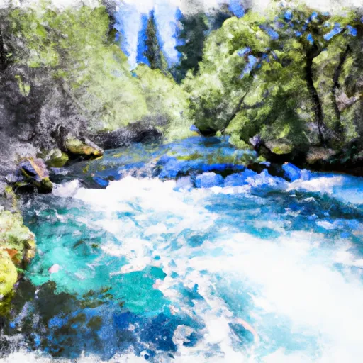
This section of river is rated as a Class IV-V, making it suitable only for experienced paddlers who are comfortable navigating technical rapids and obstacles such as steep drops, boulder gardens, and tight chutes. The total segment mileage is approximately 5.8 miles, with the river flowing through a scenic canyon with steep cliffs and lush vegetation.
Some of the notable rapids and obstacles on this river include the Burney Falls Drop, a steep and technical Class V rapid that requires precise navigation and expert maneuvering. Other challenging sections include the Chute, Cathedral Falls, and the S-Turns, which all require careful attention and advanced paddling skills.
It is important to note that there are specific regulations and guidelines for paddling this section of river, including a requirement for helmets and personal flotation devices (PFDs), as well as restrictions on the use of motorized watercraft and alcohol. Additionally, paddlers should be mindful of their impact on the natural environment and take steps to protect the river and its surrounding ecosystem.
Overall, the Burney Valley Creek Headwaters to Confluence with Granite Creek is a thrilling and challenging whitewater run that requires skill, experience, and respect for the natural environment. Paddlers should be sure to consult multiple sources and follow all regulations and guidelines to ensure a safe and enjoyable experience on this beautiful river.
Plan your run down to the hour
Same weather feed Snoflo's iOS app uses -- updated continuously from NOAA / yr.no. Watch the precipitation column on the meteogram; rain ahead of a run typically lifts flows 12-48 hours later depending on the basin.
Next 5 days, hour by hour
Temperature line with weather symbols on top, snow + rain accumulation as columns, humidity as a dotted line.
5-day forecast table
Every 3 hours, broken out across temperature, snow, rain, humidity, and wind. Each cell is colour-coded relative to the column min/max.
| Time | Condition | Temp (°F) | Snow (in) | Rain (in) | Humidity (%) | Wind (mps) | Wind dir |
|---|---|---|---|---|---|---|---|
| Loading detailed forecast… | |||||||
15-day temperature & precipitation
Daily temperatures, snow, and rain projected over the next two weeks -- the upstream story that drives next week's flows.
Regional streamflow levels
USGS streamgauges around Burney Valley Creek Headwaters To Confluence With Granite Creek -- useful for spotting upstream pulses and gauging which tributary is contributing what.
| Streamgauge | Discharge | View |
|---|---|---|
| Scott R Nr Fort Jones Ca | 27 cfs | → |
| Indian C Nr Happy Camp Ca | 46 cfs | → |
| Klamath R Nr Seiad Valley Ca | 1,090 cfs | → |
| Salmon R A Somes Bar Ca | 265 cfs | → |
| Klamath R A Orleans | 1,000 cfs | → |
| Applegate River Near Copper | 124 cfs | → |
Plan a longer trip
The closest boat launches, other paddle runs, and campgrounds so a day on the water can grow into a full weekend.
Boat launches
- Q. Ferry Point River Access
- R. Independence Rest Area /River Access
- Bridge Flat River Access
- Canyon Creek River Access
- S. Coon Creek River Access
- Wingate Bar
Other river runs
- Granite Creek Headwaters To Confluence With Elk Creek
- Tom's Valley Creek Headwaters To Confluence With Elk Creek
- Elk Creek Headwaters In Marble Mtn. Wilderness To Confluence With Bear Creek
- Rainey Valley Creek Headwaters To Confluence With Elk Creek
- Confluence With Bear Creek To Bridge In Sec 19, T15n, R8e
Campgrounds
Fishing spots
Whitewater safety
- Check the flow before you run
- Use the linked-gauge card and Regional Flow panel above. Class ratings change with flow -- a Class III at low water can become Class IV+ at high water.
- Know your skill ceiling
- Pick runs comfortably below your ceiling. Cold-water and big-water runs raise the consequences of any mistake.
- Wear the right gear
- Helmet, PFD, drysuit / wetsuit when water is below 60°F. Throw bag, knife, and whistle on your person, not in the boat.
- Scout, set safety, and run with a team
- Scout new rapids on foot, set safety with throw bags above the consequence pool, and run with at least one other competent paddler.
- Respect the river
- Strainers, undercuts, low-head dams, and wood can kill at any class rating. When in doubt, portage.
Set push alerts in the Snoflo app
Save Burney Valley Creek Headwaters To Confluence With Granite Creek as a favorite, set a discharge threshold (e.g. "alert me when flow hits 600 cfs"), and the iOS app pushes the moment the linked gauge crosses.
About Burney Valley Creek Headwaters To Confluence With Granite Creek
What's the optimal flow for Burney Valley Creek Headwaters To Confluence With Granite Creek?
The optimal flow depends on the section and the craft. Check the Run Details panel for the linked gauge and current status.
How fresh is the cfs reading on this page?
The linked USGS streamgauge reports continuously (every 15 minutes); Snoflo refreshes throughout the day. Hover the streamflow sparkline to read individual datapoints.
What's the whitewater class?
See the Run Details panel for the class rating Snoflo tracks for this run. Class ratings change with flow -- a Class III at low water can become Class IV in high water.
Where do I put in / take out?
Tap Directions in the hero above to open driving directions to the put-in. For shuttle planning, check the Nearby Boat Launches panel and the river run operator's site.
Can I get alerts when flows hit the optimal range?
Yes -- alerts are managed in the Snoflo iOS app. Favorite this run, set a discharge threshold, and you'll get a push the moment the gauge crosses.
Other runs near here
Snoflo-tracked paddle runs within driving distance of Burney Valley Creek Headwaters To Confluence With Granite Creek.