Headwaters In Marble Mtn. Wilderness To Confluence With Fish Creek River Run
Community Reviews
Been here? Share the conditions.
Reviews, ratings & photos are added in the free Snoflo iOS app — rate a spot, tag the conditions, and your visit is verified by location. Add or manage your reviews from the app.
Headwaters In Marble Mtn. Wilderness To Confluence With Fish Creek
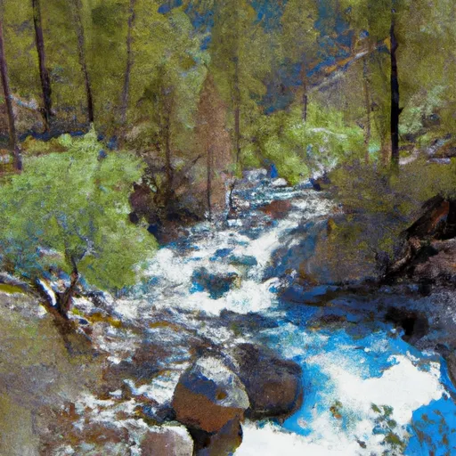
The Whitewater River run from Headwaters in Marble Mtn. Wilderness to Confluence with Fish Creek in California is a popular destination for whitewater enthusiasts. The ideal streamflow range for this run is between 500-1500 cfs, which provides Class III-IV rapids. The segment mileage is approximately 9 miles and it takes around 4-5 hours to complete.
One of the most challenging rapids in this section is the Mule Creek Falls, which is a Class V rapid with a steep drop and a dangerous undercut rock. Other notable rapids include the Marble Canyon, a Class IV rapid that involves maneuvering through a narrow gorge, and the Limestone Slide, a Class III rapid that has a long and steep descent.
There are specific regulations that must be followed when navigating this river. For instance, all boaters must carry a California Boater Card and wear a US Coast Guard approved personal flotation device (PFD). Additionally, camping is not permitted along the riverbank, and all fires must be contained in a fire pan.
In conclusion, the Whitewater River run from Headwaters in Marble Mtn. Wilderness to Confluence with Fish Creek in California is a thrilling and challenging experience for whitewater enthusiasts. With proper planning and adherence to regulations, it can be a safe and enjoyable adventure.
Plan your run down to the hour
Same weather feed Snoflo's iOS app uses -- updated continuously from NOAA / yr.no. Watch the precipitation column on the meteogram; rain ahead of a run typically lifts flows 12-48 hours later depending on the basin.
Next 5 days, hour by hour
Temperature line with weather symbols on top, snow + rain accumulation as columns, humidity as a dotted line.
5-day forecast table
Every 3 hours, broken out across temperature, snow, rain, humidity, and wind. Each cell is colour-coded relative to the column min/max.
| Time | Condition | Temp (°F) | Snow (in) | Rain (in) | Humidity (%) | Wind (mps) | Wind dir |
|---|---|---|---|---|---|---|---|
| Loading detailed forecast… | |||||||
15-day temperature & precipitation
Daily temperatures, snow, and rain projected over the next two weeks -- the upstream story that drives next week's flows.
Regional streamflow levels
USGS streamgauges around Headwaters In Marble Mtn. Wilderness To Confluence With Fish Creek -- useful for spotting upstream pulses and gauging which tributary is contributing what.
| Streamgauge | Discharge | View |
|---|---|---|
| Scott R Nr Fort Jones Ca | 24 cfs | → |
| Klamath R Nr Seiad Valley Ca | 1,070 cfs | → |
| Indian C Nr Happy Camp Ca | 41 cfs | → |
| Applegate River Near Copper | 123 cfs | → |
| Salmon R A Somes Bar Ca | 252 cfs | → |
| Klamath R A Orleans | 1,010 cfs | → |
Plan a longer trip
The closest boat launches, other paddle runs, and campgrounds so a day on the water can grow into a full weekend.
Boat launches
- Thompkins Creek River Access
- Bridge Flat River Access
- Gold Flat River Access
- Townsend Gulch River Access
- Canyon Creek River Access
- Sugar Pine Gulch River Access
Other river runs
- Confluence With Fish Creek To Confluence With Rancheria Creek
- Headwaters In Marble Mtn. Wilderness To Wilderness Boundary
- Elk Creek Headwaters In Marble Mtn. Wilderness To Confluence With Bear Creek
- Granite Creek Headwaters To Confluence With Elk Creek
- Rainey Valley Creek Headwaters To Confluence With Elk Creek
Campgrounds
- Bridge Flat
- Sulphur Springs
- Norcross Campground
- Norcross - Horse
- Sulphur Springs Campground
- Big Rock Camp
Fishing spots
Whitewater safety
- Check the flow before you run
- Use the linked-gauge card and Regional Flow panel above. Class ratings change with flow -- a Class III at low water can become Class IV+ at high water.
- Know your skill ceiling
- Pick runs comfortably below your ceiling. Cold-water and big-water runs raise the consequences of any mistake.
- Wear the right gear
- Helmet, PFD, drysuit / wetsuit when water is below 60°F. Throw bag, knife, and whistle on your person, not in the boat.
- Scout, set safety, and run with a team
- Scout new rapids on foot, set safety with throw bags above the consequence pool, and run with at least one other competent paddler.
- Respect the river
- Strainers, undercuts, low-head dams, and wood can kill at any class rating. When in doubt, portage.
Set push alerts in the Snoflo app
Save Headwaters In Marble Mtn. Wilderness To Confluence With Fish Creek as a favorite, set a discharge threshold (e.g. "alert me when flow hits 600 cfs"), and the iOS app pushes the moment the linked gauge crosses.
About Headwaters In Marble Mtn. Wilderness To Confluence With Fish Creek
What's the optimal flow for Headwaters In Marble Mtn. Wilderness To Confluence With Fish Creek?
The optimal flow depends on the section and the craft. Check the Run Details panel for the linked gauge and current status.
How fresh is the cfs reading on this page?
The linked USGS streamgauge reports continuously (every 15 minutes); Snoflo refreshes throughout the day. Hover the streamflow sparkline to read individual datapoints.
What's the whitewater class?
See the Run Details panel for the class rating Snoflo tracks for this run. Class ratings change with flow -- a Class III at low water can become Class IV in high water.
Where do I put in / take out?
Tap Directions in the hero above to open driving directions to the put-in. For shuttle planning, check the Nearby Boat Launches panel and the river run operator's site.
Can I get alerts when flows hit the optimal range?
Yes -- alerts are managed in the Snoflo iOS app. Favorite this run, set a discharge threshold, and you'll get a push the moment the gauge crosses.
Other runs near here
Snoflo-tracked paddle runs within driving distance of Headwaters In Marble Mtn. Wilderness To Confluence With Fish Creek.