Site Of St Francis Dam Disaster To Seco Canyon At The Nf Boundary River Run
Community Reviews
Been here? Share the conditions.
Reviews, ratings & photos are added in the free Snoflo iOS app — rate a spot, tag the conditions, and your visit is verified by location. Add or manage your reviews from the app.
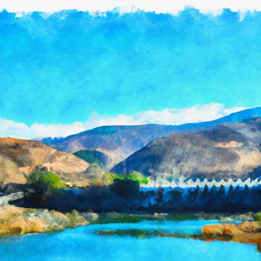
Site Of St Francis Dam Disaster To Seco Canyon At The Nf Boundary
This segment of the river has a class rating of III-V, meaning it is appropriate only for expert paddlers who are comfortable with significant rapids and obstacles. The total segment mileage is approximately 7.5 miles, and it includes some challenging rapids such as The Chute, The Maze, and The Toilet Bowl.
One of the most significant obstacles on this run is the St. Francis Dam Disaster site, which occurred in 1928. The dam was the second-largest in California at the time and failed catastrophically, killing over 400 people. Paddlers must navigate this section carefully, as there may be debris from the dam in the water.
There are specific regulations in place for the Whitewater River Run, including a requirement for personal flotation devices, helmets, and appropriate skill level for the class rating. Additionally, paddlers should be aware of the limited access points and the potential for flash floods in the area.
Plan your run down to the hour
Same weather feed Snoflo's iOS app uses -- updated continuously from NOAA / yr.no. Watch the precipitation column on the meteogram; rain ahead of a run typically lifts flows 12-48 hours later depending on the basin.
Next 5 days, hour by hour
Temperature line with weather symbols on top, snow + rain accumulation as columns, humidity as a dotted line.
5-day forecast table
Every 3 hours, broken out across temperature, snow, rain, humidity, and wind. Each cell is colour-coded relative to the column min/max.
| Time | Condition | Temp (°F) | Snow (in) | Rain (in) | Humidity (%) | Wind (mps) | Wind dir |
|---|---|---|---|---|---|---|---|
| Loading detailed forecast… | |||||||
15-day temperature & precipitation
Daily temperatures, snow, and rain projected over the next two weeks -- the upstream story that drives next week's flows.
Regional streamflow levels
USGS streamgauges around Site Of St Francis Dam Disaster To Seco Canyon At The Nf Boundary -- useful for spotting upstream pulses and gauging which tributary is contributing what.
| Streamgauge | Discharge | View |
|---|---|---|
| Piru Creek Above Lake Piru Ca | 18 cfs | → |
| Piru C Ab Frenchmans Flat Ca | 16 cfs | → |
| Piru Creek Below Santa Felicia Dam Ca | 21 cfs | → |
| Santa Clara R Nr Piru Ca | 30 cfs | → |
| Big Tujunga C Bl Hansen Dam Ca | 3 cfs | → |
| Sespe C Nr Fillmore | 12 cfs | → |
Plan a longer trip
The closest boat launches, other paddle runs, and campgrounds so a day on the water can grow into a full weekend.
Boat launches
- Castaic Lake State Recreation Area (East)
- Castaic Lake State Recreation Area (West)
- Csu Northridge Aquatic Center
- Lake Hughes Road Castaic
- Elizabeth Lake
- Piru Canyon Road 4780, Castaic
Other river runs
- Green Valley At The Nf Boundary To Site Of St Francis Dam Disaster
- Lower Piru Creek (Oulet At Pyramid Reservoir) To Piru Reservoir
- Castaic To Pyramid Reservoir
- Confluence With Gold Hill Creek To Castaic
- Wilderness Boundary To Confluence With Gold Hill Creek
Campgrounds
Fishing spots
Whitewater safety
- Check the flow before you run
- Use the linked-gauge card and Regional Flow panel above. Class ratings change with flow -- a Class III at low water can become Class IV+ at high water.
- Know your skill ceiling
- Pick runs comfortably below your ceiling. Cold-water and big-water runs raise the consequences of any mistake.
- Wear the right gear
- Helmet, PFD, drysuit / wetsuit when water is below 60°F. Throw bag, knife, and whistle on your person, not in the boat.
- Scout, set safety, and run with a team
- Scout new rapids on foot, set safety with throw bags above the consequence pool, and run with at least one other competent paddler.
- Respect the river
- Strainers, undercuts, low-head dams, and wood can kill at any class rating. When in doubt, portage.
Set push alerts in the Snoflo app
Save Site Of St Francis Dam Disaster To Seco Canyon At The Nf Boundary as a favorite, set a discharge threshold (e.g. "alert me when flow hits 600 cfs"), and the iOS app pushes the moment the linked gauge crosses.
About Site Of St Francis Dam Disaster To Seco Canyon At The Nf Boundary
What's the optimal flow for Site Of St Francis Dam Disaster To Seco Canyon At The Nf Boundary?
The optimal flow depends on the section and the craft. Check the Run Details panel for the linked gauge and current status.
How fresh is the cfs reading on this page?
The linked USGS streamgauge reports continuously (every 15 minutes); Snoflo refreshes throughout the day. Hover the streamflow sparkline to read individual datapoints.
What's the whitewater class?
See the Run Details panel for the class rating Snoflo tracks for this run. Class ratings change with flow -- a Class III at low water can become Class IV in high water.
Where do I put in / take out?
Tap Directions in the hero above to open driving directions to the put-in. For shuttle planning, check the Nearby Boat Launches panel and the river run operator's site.
Can I get alerts when flows hit the optimal range?
Yes -- alerts are managed in the Snoflo iOS app. Favorite this run, set a discharge threshold, and you'll get a push the moment the gauge crosses.
Other runs near here
Snoflo-tracked paddle runs within driving distance of Site Of St Francis Dam Disaster To Seco Canyon At The Nf Boundary.