Summary
Francis Dam Disaster segment, is a popular whitewater run in California. The ideal streamflow range for this segment is between 200-600 cubic feet per second (cfs), with the best times to run being in the spring and early summer. The class rating for this segment ranges from Class III to Class IV, with challenging rapids such as Cement Mixer and Pinball.
The segment is approximately 8.5 miles long and is known for its technical and narrow sections, as well as its scenic beauty. However, it is important to note that this run is not suitable for beginners and requires advanced skills and experience.
There are specific regulations to the area, including a permit requirement for commercial and non-commercial use, as well as limitations on group size and camping. Additionally, it is important to practice Leave No Trace principles and respect the natural environment.
Overall, the Green Valley at the NF Boundary to Site of St. Francis Dam Disaster segment of the Whitewater River offers a challenging and rewarding experience for experienced kayakers and rafters, with stunning scenery and technical rapids. However, it is important to approach this run with caution and respect for the natural environment.
°F
°F
mph
Wind
%
Humidity
15-Day Weather Outlook
River Run Details
| Last Updated | 2023-06-21 |
| River Levels | 22 cfs (4.65 ft) |
| Percent of Normal | 85% |
| Status | |
| Class Level | iii-iv |
| Elevation | ft |
| Streamflow Discharge | cfs |
| Gauge Height | ft |
| Reporting Streamgage | USGS 11109550 |
5-Day Hourly Forecast Detail
Nearby Streamflow Levels
 Piru C Ab Frenchmans Flat Ca
|
16cfs |
 Piru Creek Above Lake Piru Ca
|
356cfs |
 Piru Creek Below Santa Felicia Dam Ca
|
204cfs |
 Santa Clara R Nr Piru Ca
|
509cfs |
 Big Tujunga C Bl Hansen Dam Ca
|
133cfs |
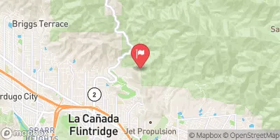 Arroyo Seco Nr Pasadena Ca
|
42cfs |
Area Campgrounds
| Location | Reservations | Toilets |
|---|---|---|
 Spunky
|
||
 Streamside
|
||
 Upper Shake Campground
|
||
 Upper Shake
|
||
 Cienaga Campground
|


 Green Valley At The Nf Boundary To Site Of St Francis Dam Disaster
 Site Of St Francis Dam Disaster To Seco Canyon At The Nf Boundary
 Saint Francis Dam Disaster National Monument
 Arthur B. Ripley Desert Woodland State Park
 George Lane Park
 Warrack Park
 Hillside Park