Make an Announcement

Communicate warnings, disperse advice, and share.


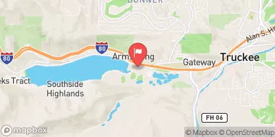
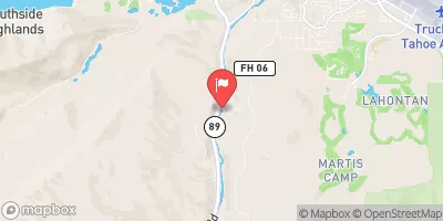
ROYAL GORGE (SODA SPRINGS TO TADPOLE CREEK)

Whitewater River Run


California American River, North Fork

Royal Gorge (Soda Springs To Tadpole Creek)

Class V TO V+

STREAMFLOW: 2,980 CFS

Too High
68°, Heavy Rain

The Truckee River's Royal Gorge Soda Springs to Tadpole Creek river run in California is a thrilling adventure for experienced paddlers. The river features Class III-IV rapids, including the notorious Toilet Bowl, which requires precise maneuvering skills. The best time to float this section is during the spring runoff season, from May to June, with recommended flows of 800-1,200 cfs. Other obstacles to watch out for include S-Bends and the infamous Jaws, a series of class IV-V drops that require expert kayaking skills. This river run is not recommended for beginners or inexperienced paddlers.

Weather today, A chance of showers and thunderstorms, then showers and possibly a thunderstorm after 2pm. Some of the storms could produce heavy rain. High near 68. Calm wind becoming west around 5 mph in the afternoon. Chance of precipitation is 80%.

Status Too High
Class Level V to V+
Elevation 5,493 ft
Run Length 25.0 Mi
Streamflow Discharge 2980 cfs
Gauge Height 9.3 ft
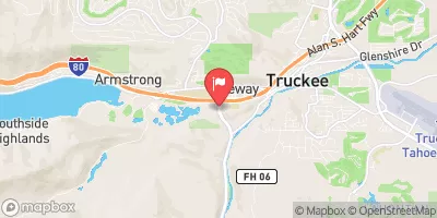
Reporting Streamgage Truckee R A Boca Bridge Nr Truckee Ca
USGS 10344505

Nearby Snowpack and Streamflow Levels

Gauge Streamflow Stage
E F Carson R Bl Markleeville C Nr Markleevilleca
USGS 10308200
3,420 cfs 6.9 ft
Cosumnes R A Michigan Bar Ca
USGS 11335000
827 cfs 4.9 ft
West Fork Carson River At Woodfords
USGS 10310000
1,020 cfs 13.4 ft
Logan House Ck Nr Glenbrook
USGS 10336740
0 cfs 4.1 ft
Carson River Near Carson City
USGS 10311000
4,150 cfs 7.4 ft
Blackwood C Nr Tahoe City Ca
USGS 10336660
302 cfs 10.4 ft
Aspen C Overburden Seep Nr Markleeville Ca
USGS 103087892
0 cfs 0.1 ft
Bryant C Bl Mountaineer C Nr Markleeville Ca
USGS 10308794
74 cfs 5.6 ft
Glenbrook Ck At Glenbrook
USGS 10336730
22 cfs 2.4 ft
Leviathan C Ab Aspen C Nr Markleeville Ca
USGS 10308789
32 cfs 5.8 ft
Snotel Site Snowpack 24hr Change
Heavenly Valley
SNOTEL 518
45" -2"
Echo Peak
SNOTEL 463
64" -2"
Rubicon #2
SNOTEL 724
54" -2"
Mt Rose Ski Area
SNOTEL 652
103" -1"
Css Lab
SNOTEL 428
53" 0"
Blue Lakes
SNOTEL 356
76" 0"
bloods creek
SNOTEL BLCC1
44.9" -1.56"
Tahoe City Cross
SNOTEL 809
2" 1"
Squaw Valley G.C.
SNOTEL 784
54" 0"
Carson Pass
SNOTEL 1067
56" -1"
Big Meadow
SNOTEL 340
31" -2"
Forestdale Creek
SNOTEL 1049
88" -2"
Marlette Lake
SNOTEL 615
29" 0"
Ward Creek #3
SNOTEL 848
41" -2"
alpine meadows-base
SNOTEL AMBC1
135" -36"
Horse Meadow
SNOTEL 1050
60" -3"
Ebbetts Pass
SNOTEL 462
86" -4"
black springs
SNOTEL BLSC1
30.58" -2.5"
Independence Lake
SNOTEL 541
115" -2"
Burnside Lake
SNOTEL 1051
50" -3"
Independence Camp
SNOTEL 539
5" -3"

Popular Destinations

Campground Campsites Reservations Toilets Showers Elevation
William Kent 95 6,337 ft
Fashoda 30 4,869 ft
Woodcamp 20 6,140 ft
Findley 15 6,178 ft
Fir Top 12 6,078 ft
Cold Creek 11 5,702 ft
Pleasant Dispersed 10 6,413 ft
East Meadow 46 6,130 ft
Northwind 9 5,477 ft
French Meadows 75 5,330 ft
Wench Creek 2 4,947 ft
Upper Little Truckee 26 6,187 ft
Independence Lake 20 6,957 ft
Hampshire Rocks 30 5,921 ft
Sugar Pine Point State Park 175 6,465 ft
Donner Memorial State Park 54 5,951 ft
Airport Flat 16 5,383 ft
Camino Cove 32 4,898 ft
Strawberry Point 10 5,440 ft
Woodchuck 8 6,256 ft
Chapman Creek 27 5,893 ft
Northshore 15 6,411 ft
Kaspian 9 6,276 ft
Lower Little Truckee 15 6,141 ft
Sterling Lake 8 7,023 ft
Gerle Creek 50 5,272 ft
Hell Hole 10 5,167 ft
Wentworth Springs 8 6,153 ft
Lewis 40 5,280 ft
Sterling lake- dispersed None 7,036 ft
Pass Creek 30 6,137 ft
Ice House 83 5,493 ft
Little Lasier Meadow 12 6,484 ft
Ahart 12 5,341 ft
Yuba Pass 20 6,715 ft
Silver Creek-Truckee 27 6,041 ft
Sierra 16 5,710 ft
Sunset 139 4,970 ft
Goose Meadow 24 5,970 ft
Robinson Flat 14 6,696 ft
Prosser 29 5,805 ft
Jones Fork 10 5,052 ft
West Point 8 4,999 ft
Wrights Lake 70 6,949 ft
Ski Area Snowpack Air Temperature 5 Day Forecast
Mt. Rose Ski Tahoe 103" 57° 0"
Tahoe Donner 53" 59° 0"
Bear Valley Mountain Resort 76" 55° 0"
Squaw Valley 54" 57° 0"
Donner Ski Ranch 53" 59° 0"
Homewood Mountain Resort 41" 57° 0"
Northstar 0" 64° 0"
Kirkwood 56" 54° 0"
Granlibakken Ski Resort 41" 57° 0"
Boreal Mountain Resort 53" 59° 0"
Diamond Peak -1" 66° 0"
Sierra at Tahoe 64" 55° 0"
Heavenly Ski Resort 45" 54° 0"
Alpine Meadows Ski Area 41" 57° 0"
Soda Springs 53" 59° 0"
Sugar Bowl Resort 0" 64° 0"
River Run Streamflow Length Class
Tahoe City to River Ranch 835.0cfs None Mi I
Chili Bar 2630.0cfs 8.0 Mi III to IV
Generation and Giant Gaps (Tadpole to Colfax-Iowa Hill Road) 2630.0cfs 26.8 Mi IV to IV+
Tunnel Run (Ralston Powerhouse to Greenwood) 2630.0cfs 16.5 Mi IV- to IV
Royal Gorge (Soda Springs to Tadpole Creek) 2980.0cfs 25.0 Mi V to V+

Log Your Visit

When was your last visit to Royal Gorge (Soda Springs to Tadpole Creek)?

Add a Photo

How was it? How were conditions?

Rate the paddle


Submit

Leave A Review

Royal Gorge (Soda Springs To Tadpole Creek)

Submit

Upload an Image

Royal Gorge (Soda Springs To Tadpole Creek)
Login

Need an Account?

Forgot Your Password?

Delete User Account

Welcome to Snoflo


Continue with a free account

Already Have an Account?


Snoflo Premium

Your first week's free. Cancel anytime

Have a Promo Code?


Already Have an Account?

Signup for Basic Access


Welcome to Snoflo


Continue with a free account

Add Snoflo Premium


Already Have an Account?


Please Verify Your Account

Favorite Limit Reached
Signup for a Free Account

Already Have an Account?