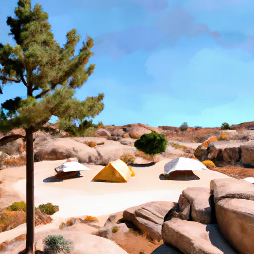
Muninnvagl Campground
Community Reviews
Been here? Share the conditions.
Reviews, ratings & photos are added in the free Snoflo iOS app — rate a spot, tag the conditions, and your visit is verified by location. Add or manage your reviews from the app.
Muninnvagl
Reservations are accepted at Muninnvagl camping area, allowing campers to secure their spot in advance. It is recommended to make reservations, especially during peak seasons, to ensure availability. The campground is a popular destination, so planning ahead is advised.
The best time to visit Muninnvagl camping area is during the summer months when the weather is warm and mild. This allows for outdoor activities such as hiking, fishing, and exploring the surrounding nature. However, it is important to note that the campground can get crowded during these peak months.
While camping at Muninnvagl, campers should be cautious of local wildlife, such as bears and snakes. Proper food storage is essential to prevent any unwanted encounters. Additionally, it is important to follow all fire safety regulations and guidelines to prevent wildfires and protect the natural environment.
Overall, Muninnvagl camping area in California offers a range of amenities, accepts reservations, and is best visited during the summer months. However, campers should be cautious of wildlife and adhere to fire safety regulations to ensure a safe and enjoyable camping experience.
What's on-site at Muninnvagl
Key facilities Snoflo tracks for this campground. Confirm with the operator before booking -- amenities can change seasonally.
Plan your trip down to the hour
Same weather feed Snoflo's iOS app uses -- updated continuously from NOAA / yr.no.
Next 5 days, hour by hour
Temperature line with weather symbols on top, snow + rain accumulation as columns, humidity as a dotted line.
5-day forecast table
Every 3 hours, broken out across temperature, snow, rain, humidity, and wind. Each cell is colour-coded relative to the column min/max so trends jump out at a glance.
| Time | Condition | Temp (°F) | Snow (in) | Rain (in) | Humidity (%) | Wind (mps) | Wind dir |
|---|---|---|---|---|---|---|---|
| Loading detailed forecast… | |||||||
15-day temperature & precipitation
Daily temperatures, snow, and rain projected over the next two weeks. Hover any point for the full breakdown.
Other campgrounds in the area
Snoflo-tracked campsites within driving distance of Muninnvagl, with reservations status.
| Campground | Reservations | Toilets | View |
|---|---|---|---|
| Cold Springs Campground | ✗ | ✗ | → |
| Hampshire Rocks | ✓ | ✓ | → |
| Hampshire Rocks Campground | ✓ | ✗ | → |
| Sterling Lake | ✗ | ✗ | → |
| Sterling Lake- Dispersed | ✗ | ✗ | → |
Nearby streamflow
USGS streamgauges within reach of Muninnvagl -- pulled live from the National Water Information System.
| Streamgauge | Discharge | View |
|---|---|---|
| Donner C A Donner Lk Nr Truckee Ca | 4 cfs | → |
| Donner C At Hwy 89 Nr Truckee Ca | 7 cfs | → |
| Truckee R Nr Truckee Ca | 300 cfs | → |
| Independence C Nr Truckee Ca | 4 cfs | → |
| Sagehen C Nr Truckee Ca | 2 cfs | → |
| Little Truckee R Bl Div Dam Nr Sierraville Ca | 3 cfs | → |
Nearby snow depths
NRCS SNOTEL stations within reach of Muninnvagl -- relevant when planning a shoulder-season or alpine trip.
| SNOTEL station | Snowpack | 24h Snowfall | View |
|---|---|---|---|
| Soda Springs 1.5 Ssw | 0.0 in | 0.0 in | → |
| Nohrsc Css Lab | 0.0 in | 0.0 in | → |
| Css Lab | 0.0 in | 0.0 in | → |
| Tahoe Donner Raws | 0.1 in | 0.0 in | → |
| Nohrsc Meadow Lk Snow Course | 21.2 in | 0.2 in | → |
| Nohrsc Independence Lake | 0.0 in | 0.0 in | → |
Plan a longer trip
The closest parks, lakes, boat launches, and paddle runs so a camping night can grow into a full weekend.
Parks
- Wilderness Snow Mountain
- Donner Memorial State Park
- West End Beach Park
- Bill Rose Park
- Bill Rose Memorial Park
- Truckee Regional Park
Boat launches
- Donner Lake
- Tahoe Donner Beach Club Marina
- Lake Spaulding Road 10260, Nevada City
- Webber Lake
- Meadow Lake Road Nevada County
- Fuller Lake Boating Site
Fishing spots
Points of interest
- Donner Summit Historical Society
- Frog Lake Cabin
- Donner Memorial State Park Museum
- Webber Lake
- Truckee Railroad Museum
- Rodeo Grounds
Paddle runs
- Royal Gorge (Soda Springs To Tadpole Creek)
- Generation And Giant Gaps (Tadpole To Colfax-Iowa Hill Road)
- Headwaters Se 1/4 Of Sec 10, T18, R15e To Stampede Reservoir
- Langs Crossing Bridge To One-Half Mile West Of Confluence With Fall Creek (Boundary Of Nf And Private Land)
- Tahoe City To River Ranch
- Hell Hole Dam To Ellicotts Bridge
Camping essentials & Leave No Trace
- Pack it in, pack it out
- Take all trash, food scraps, and gear back with you to keep campsites clean and protect wildlife.
- Respect wildlife
- Observe animals from a distance, store food securely, and never feed wildlife to maintain natural behavior and safety.
- Know before you go
- Check weather, fire restrictions, trail conditions, and permit requirements to ensure a safe and well-planned trip.
- Minimize campfire impact
- Use established fire rings, keep fires small, fully extinguish them, or opt for a camp stove when fires are restricted.
- Leave what you find
- Preserve natural and cultural features by avoiding removal of plants, rocks, artifacts, or other elements of the environment.
Set push alerts in the Snoflo app
Save Muninnvagl as a favorite, set a custom threshold (precipitation, snowpack, freezing temperatures), and the iOS app will push the moment conditions cross.
About Muninnvagl
Can I make reservations at Muninnvagl?
This campground does not appear to accept reservations -- it's typically first-come, first-served. Arrive early on summer weekends.
How fresh is the weather data on this page?
The hourly forecast updates throughout the day from the NOAA / yr.no public feeds. Streamflow data is pulled live from USGS streamgauges and snowpack from the NRCS SNOTEL network.
What's the best time of year to visit?
Use the 15-day temperature & precipitation outlook on this page to plan -- pick a window with comfortable temperatures and low precipitation. For longer trips, the 5-day hourly meteogram shows snow + rain accumulation hour-by-hour.
How do I get to Muninnvagl?
Tap Directions in the hero above to open driving directions in Google Maps, or Open in map to center the Snoflo interactive map on the campground.
Can I get alerts when conditions change?
Yes -- alerts are managed through the Snoflo iOS app. Favorite this campground, set a threshold (temperature, snowpack, precipitation), and you'll get a push the moment it crosses.
Other campgrounds near here
Snoflo-tracked campgrounds within driving distance of Muninnvagl.