Headwaters To Confluence With Kern River river run
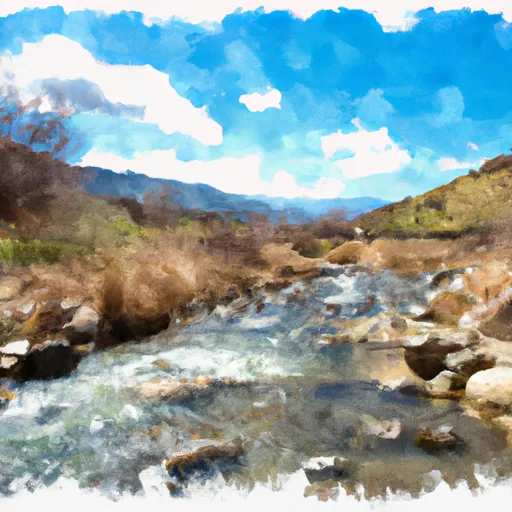
Headwaters To Confluence With Kern River
The segment mileage for this run is 8.5 miles. The river rapids and obstacles include boulder gardens, tight chutes, and drops, making the run exciting and adventurous. The rapids are mostly technical, requiring precise navigation and good boat control.
There are specific regulations to the area that paddlers should abide by. These include obtaining a permit for overnight camping, camping only in designated areas, and carrying out all trash. Additionally, paddlers are required to wear a personal flotation device and a helmet while on the river.
In conclusion, the whitewater river run from Headwaters to Confluence with Kern River in California is a challenging and exhilarating adventure for experienced paddlers. The ideal streamflow range is 100-400 cfs, with class II-IV rapids over 8.5 miles. Paddlers should familiarize themselves with specific regulations to the area, including obtaining a permit for overnight camping and wearing protective gear while on the river.
Plan your run down to the hour
Same weather feed Snoflo's iOS app uses -- updated continuously from NOAA / yr.no. Watch the precipitation column on the meteogram; rain ahead of a run typically lifts flows 12-48 hours later depending on the basin.
Next 5 days, hour by hour
Temperature line with weather symbols on top, snow + rain accumulation as columns, humidity as a dotted line.
5-day forecast table
Every 3 hours, broken out across temperature, snow, rain, humidity, and wind. Each cell is colour-coded relative to the column min/max.
| Time | Condition | Temp (°F) | Snow (in) | Rain (in) | Humidity (%) | Wind (mps) | Wind dir |
|---|---|---|---|---|---|---|---|
| Loading detailed forecast… | |||||||
15-day temperature & precipitation
Daily temperatures, snow, and rain projected over the next two weeks -- the upstream story that drives next week's flows.
Regional streamflow levels
USGS streamgauges around Headwaters To Confluence With Kern River -- useful for spotting upstream pulses and gauging which tributary is contributing what.
| Streamgauge | Discharge | View |
|---|---|---|
| Marble Fork Kaweah R Ab Horse C Nr Lodgepole Ca | 149 cfs | → |
| Sf Tule R Nr Cholollo Campground Nr Porterville Ca | 20 cfs | → |
| Sf Tule R Nr Reservation Bndry Nr Porterville Ca | 34 cfs | → |
| Deer C Nr Fountain Springs Ca | 20 cfs | → |
| Sf Kern R Nr Onyx Ca | 111 cfs | → |
| San Joaquin R Bl Friant Ca | 520 cfs | → |
Plan a longer trip
The closest boat launches, other paddle runs, and campgrounds so a day on the water can grow into a full weekend.
Other river runs
- Nf Boundary To Table Meadows Creek
- 8,000 Ft Contour Line (Boundary Extend 0.25 Mile On Each Side Of River) To The Atwell Mill Trail Bridge At ~ 5,800 Ft
- 9,000 Ft Contour Line (Boundary Extend 0.25 Mile On Each Side Of River) To 8,000 Ft Contour Line
- Outlet Of Green Meadows North Of The Windy Gap And Windy Ridges (Boundary Extend 0.25 Mile On Each Side Of River) To Bridge Above South Fork Campground
- Table Meadow Creek To Kern River
Campgrounds
- Corral Campsite (4 Tents)
- Campsite (3 Tents)
- Waterfall For Two Campsite (1 Tent)
- Middle Of The Road Campsite (1-2 Tents)
- Riverside Campsite (3-4 Tents)
- Mid Peninsula Campsite One (2-3 Tents)
Fishing spots
Whitewater safety
- Check the flow before you run
- Use the linked-gauge card and Regional Flow panel above. Class ratings change with flow -- a Class III at low water can become Class IV+ at high water.
- Know your skill ceiling
- Pick runs comfortably below your ceiling. Cold-water and big-water runs raise the consequences of any mistake.
- Wear the right gear
- Helmet, PFD, drysuit / wetsuit when water is below 60°F. Throw bag, knife, and whistle on your person, not in the boat.
- Scout, set safety, and run with a team
- Scout new rapids on foot, set safety with throw bags above the consequence pool, and run with at least one other competent paddler.
- Respect the river
- Strainers, undercuts, low-head dams, and wood can kill at any class rating. When in doubt, portage.
Set push alerts in the Snoflo app
Save Headwaters To Confluence With Kern River as a favorite, set a discharge threshold (e.g. "alert me when flow hits 600 cfs"), and the iOS app pushes the moment the linked gauge crosses.
About Headwaters To Confluence With Kern River
What's the optimal flow for Headwaters To Confluence With Kern River?
The optimal flow depends on the section and the craft. Check the Run Details panel for the linked gauge and current status.
How fresh is the cfs reading on this page?
The linked USGS streamgauge reports continuously (every 15 minutes); Snoflo refreshes throughout the day. Hover the streamflow sparkline to read individual datapoints.
What's the whitewater class?
See the Run Details panel for the class rating Snoflo tracks for this run. Class ratings change with flow -- a Class III at low water can become Class IV in high water.
Where do I put in / take out?
Tap Directions in the hero above to open driving directions to the put-in. For shuttle planning, check the Nearby Boat Launches panel and the river run operator's site.
Can I get alerts when flows hit the optimal range?
Yes -- alerts are managed in the Snoflo iOS app. Favorite this run, set a discharge threshold, and you'll get a push the moment the gauge crosses.
Other runs near here
Snoflo-tracked paddle runs within driving distance of Headwaters To Confluence With Kern River.