Rio Nutritas To Stewart Meadows River Run
Community Reviews
Been here? Share the conditions.
Reviews, ratings & photos are added in the free Snoflo iOS app — rate a spot, tag the conditions, and your visit is verified by location. Add or manage your reviews from the app.
Rio Nutritas To Stewart Meadows
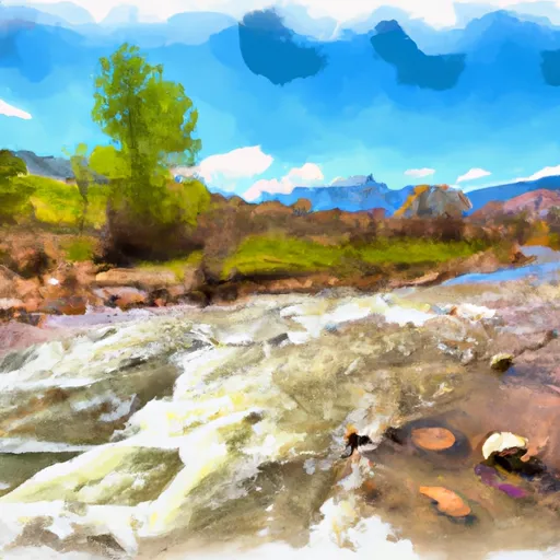
The class rating for this section of the river is class III-IV, with several challenging obstacles and rapids, including Nutritas Rapid, Pinball Rapids, and Sledgehammer Rapid. Some of these rapids require precise navigation and have potential hazards such as undercut rocks, strainers, and hydraulics.
In terms of regulations, the Colorado Parks and Wildlife require a valid Colorado boating registration for all motorboats. Additionally, non-motorized watercraft such as kayaks and rafts must carry a personal flotation device for each occupant and a sound-producing device.
It is also recommended that paddlers have proper safety equipment and experience before attempting this portion of the river. The segment mileage of this run is 11.5 miles, with beautiful scenery and wildlife along the way. Overall, the Rio Nutritas To Stewart Meadows run on the Whitewater River provides a challenging and rewarding adventure for experienced whitewater enthusiasts.
Plan your run down to the hour
Same weather feed Snoflo's iOS app uses -- updated continuously from NOAA / yr.no. Watch the precipitation column on the meteogram; rain ahead of a run typically lifts flows 12-48 hours later depending on the basin.
Next 5 days, hour by hour
Temperature line with weather symbols on top, snow + rain accumulation as columns, humidity as a dotted line.
5-day forecast table
Every 3 hours, broken out across temperature, snow, rain, humidity, and wind. Each cell is colour-coded relative to the column min/max.
| Time | Condition | Temp (°F) | Snow (in) | Rain (in) | Humidity (%) | Wind (mps) | Wind dir |
|---|---|---|---|---|---|---|---|
| Loading detailed forecast… | |||||||
15-day temperature & precipitation
Daily temperatures, snow, and rain projected over the next two weeks -- the upstream story that drives next week's flows.
Regional streamflow levels
USGS streamgauges around Rio Nutritas To Stewart Meadows -- useful for spotting upstream pulses and gauging which tributary is contributing what.
| Streamgauge | Discharge | View |
|---|---|---|
| Conejos River Near Mogote | 49 cfs | → |
| Rio Grande Near Lobatos | 6 cfs | → |
| Rio Grande Near Cerro | 38 cfs | → |
| La Jara Creek At Gallegos Ranch | 3 cfs | → |
| San Antonio River At Mouth | 0 cfs | → |
| Red River Below Fish Hatchery | 27 cfs | → |
Plan a longer trip
The closest boat launches, other paddle runs, and campgrounds so a day on the water can grow into a full weekend.
Other river runs
- Headwaters To Rio San Antonio
- Colorado Stateline To Nf Boundary
- Headwaters To Private Land Boundary
- Headwaters To Los Pinos
Campgrounds
- Laguna Larga
- Rio De Los Pinos Campground
- Los Pinos
- Cruces Basin Campground
- Lagunitas
- Upper Lagunitas / Lower Lagunitas Campgrounds
Whitewater safety
- Check the flow before you run
- Use the linked-gauge card and Regional Flow panel above. Class ratings change with flow -- a Class III at low water can become Class IV+ at high water.
- Know your skill ceiling
- Pick runs comfortably below your ceiling. Cold-water and big-water runs raise the consequences of any mistake.
- Wear the right gear
- Helmet, PFD, drysuit / wetsuit when water is below 60°F. Throw bag, knife, and whistle on your person, not in the boat.
- Scout, set safety, and run with a team
- Scout new rapids on foot, set safety with throw bags above the consequence pool, and run with at least one other competent paddler.
- Respect the river
- Strainers, undercuts, low-head dams, and wood can kill at any class rating. When in doubt, portage.
Set push alerts in the Snoflo app
Save Rio Nutritas To Stewart Meadows as a favorite, set a discharge threshold (e.g. "alert me when flow hits 600 cfs"), and the iOS app pushes the moment the linked gauge crosses.
About Rio Nutritas To Stewart Meadows
What's the optimal flow for Rio Nutritas To Stewart Meadows?
The optimal flow depends on the section and the craft. Check the Run Details panel for the linked gauge and current status.
How fresh is the cfs reading on this page?
The linked USGS streamgauge reports continuously (every 15 minutes); Snoflo refreshes throughout the day. Hover the streamflow sparkline to read individual datapoints.
What's the whitewater class?
See the Run Details panel for the class rating Snoflo tracks for this run. Class ratings change with flow -- a Class III at low water can become Class IV in high water.
Where do I put in / take out?
Tap Directions in the hero above to open driving directions to the put-in. For shuttle planning, check the Nearby Boat Launches panel and the river run operator's site.
Can I get alerts when flows hit the optimal range?
Yes -- alerts are managed in the Snoflo iOS app. Favorite this run, set a discharge threshold, and you'll get a push the moment the gauge crosses.
Other runs near here
Snoflo-tracked paddle runs within driving distance of Rio Nutritas To Stewart Meadows.