Tierra Amarilla Grant Boundary To Colorado Stateline River Run
Community Reviews
Been here? Share the conditions.
Reviews, ratings & photos are added in the free Snoflo iOS app — rate a spot, tag the conditions, and your visit is verified by location. Add or manage your reviews from the app.
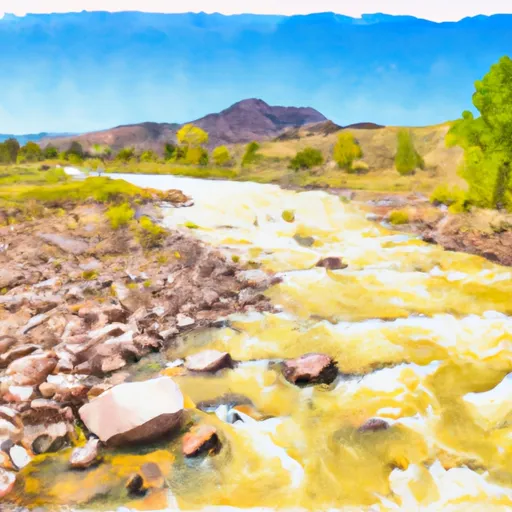
Tierra Amarilla Grant Boundary To Colorado Stateline
Specific regulations for this area include a permit requirement for commercial outfitters and a maximum group size of 25 people. Additionally, boaters are required to practice Leave No Trace principles and avoid disturbing wildlife habitats. The area also has strict regulations on camping and fires to protect the natural environment.
Plan your run down to the hour
Same weather feed Snoflo's iOS app uses -- updated continuously from NOAA / yr.no. Watch the precipitation column on the meteogram; rain ahead of a run typically lifts flows 12-48 hours later depending on the basin.
Next 5 days, hour by hour
Temperature line with weather symbols on top, snow + rain accumulation as columns, humidity as a dotted line.
5-day forecast table
Every 3 hours, broken out across temperature, snow, rain, humidity, and wind. Each cell is colour-coded relative to the column min/max.
| Time | Condition | Temp (°F) | Snow (in) | Rain (in) | Humidity (%) | Wind (mps) | Wind dir |
|---|---|---|---|---|---|---|---|
| Loading detailed forecast… | |||||||
15-day temperature & precipitation
Daily temperatures, snow, and rain projected over the next two weeks -- the upstream story that drives next week's flows.
Regional streamflow levels
USGS streamgauges around Tierra Amarilla Grant Boundary To Colorado Stateline -- useful for spotting upstream pulses and gauging which tributary is contributing what.
| Streamgauge | Discharge | View |
|---|---|---|
| Conejos River Near Mogote | 49 cfs | → |
| La Jara Creek At Gallegos Ranch | 6 cfs | → |
| Navajo R At Banded Peak Ranch | 25 cfs | → |
| Navajo River Bl Oso Diversion Dam Nr Chromo | 28 cfs | → |
| Alamosa River Below Terrace Reservoir | 41 cfs | → |
| Alamosa River Above Terrace Reservoir | 18 cfs | → |
Plan a longer trip
The closest boat launches, other paddle runs, and campgrounds so a day on the water can grow into a full weekend.
Boat launches
Other river runs
- Sec 23, T32n, R5e To Sec 20, T32n, R6e (Co/Nm State Line)
- Sec 9, T32n, R6e To Sec 22, T32n, R6e (Co/Nm State Line)
- Headwaters To Los Pinos
- Colorado Stateline To Nf Boundary
- Lower Branch--Sec 28, T33n, R3e; Upper Branch--Sec 15, T33n, R3e To Sec 7, T32n, R4e
Campgrounds
- Aspen Glade
- Aspen Glade Campground
- Trujillo Meadows Campground
- Trujillo Meadows
- Cruces Basin Campground
- Upper Lagunitas
Fishing spots
- Trujillo Meadows Lake
- Trujillo Meadows Boating Site
- Lagunitas Creek Fishing
- La Manga Creek (Beaver Ponds)
- Spectacle Lake Fishing Site
- Lost Lake
Parks
Whitewater safety
- Check the flow before you run
- Use the linked-gauge card and Regional Flow panel above. Class ratings change with flow -- a Class III at low water can become Class IV+ at high water.
- Know your skill ceiling
- Pick runs comfortably below your ceiling. Cold-water and big-water runs raise the consequences of any mistake.
- Wear the right gear
- Helmet, PFD, drysuit / wetsuit when water is below 60°F. Throw bag, knife, and whistle on your person, not in the boat.
- Scout, set safety, and run with a team
- Scout new rapids on foot, set safety with throw bags above the consequence pool, and run with at least one other competent paddler.
- Respect the river
- Strainers, undercuts, low-head dams, and wood can kill at any class rating. When in doubt, portage.
Set push alerts in the Snoflo app
Save Tierra Amarilla Grant Boundary To Colorado Stateline as a favorite, set a discharge threshold (e.g. "alert me when flow hits 600 cfs"), and the iOS app pushes the moment the linked gauge crosses.
About Tierra Amarilla Grant Boundary To Colorado Stateline
What's the optimal flow for Tierra Amarilla Grant Boundary To Colorado Stateline?
The optimal flow depends on the section and the craft. Check the Run Details panel for the linked gauge and current status.
How fresh is the cfs reading on this page?
The linked USGS streamgauge reports continuously (every 15 minutes); Snoflo refreshes throughout the day. Hover the streamflow sparkline to read individual datapoints.
What's the whitewater class?
See the Run Details panel for the class rating Snoflo tracks for this run. Class ratings change with flow -- a Class III at low water can become Class IV in high water.
Where do I put in / take out?
Tap Directions in the hero above to open driving directions to the put-in. For shuttle planning, check the Nearby Boat Launches panel and the river run operator's site.
Can I get alerts when flows hit the optimal range?
Yes -- alerts are managed in the Snoflo iOS app. Favorite this run, set a discharge threshold, and you'll get a push the moment the gauge crosses.
Other runs near here
Snoflo-tracked paddle runs within driving distance of Tierra Amarilla Grant Boundary To Colorado Stateline.