East Fork Arkansas River River Run
Community Reviews
Been here? Share the conditions.
Reviews, ratings & photos are added in the free Snoflo iOS app — rate a spot, tag the conditions, and your visit is verified by location. Add or manage your reviews from the app.
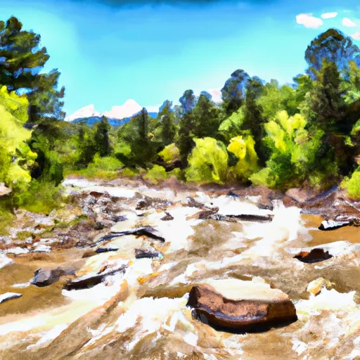
East Fork Arkansas River
The class rating for the Whitewater River Run is Class IV-V, meaning it is a challenging and technical river. The segment mileage varies depending on which section you choose, but the most popular section is the 6.4-mile run from St. Elmo to Nathrop.
There are several specific river rapids and obstacles on this section of the river, including the Elephant Rock Rapid, Twin Falls, and the Miracle Mile. These rapids offer a thrilling adventure for experienced kayakers and rafters.
It's important to note that there are specific regulations in place for this area, including a limit on the number of commercial outfitters allowed to operate on the river. Additionally, all boaters are required to wear a personal flotation device and have a whistle and a throw rope with them at all times.
Overall, the East Fork Arkansas River offers a challenging and exciting adventure for experienced kayakers and rafters. It's important to always check the streamflow and water conditions before heading out and to follow all regulations in place for the safety of yourself and others on the river.
Plan your run down to the hour
Same weather feed Snoflo's iOS app uses -- updated continuously from NOAA / yr.no. Watch the precipitation column on the meteogram; rain ahead of a run typically lifts flows 12-48 hours later depending on the basin.
Next 5 days, hour by hour
Temperature line with weather symbols on top, snow + rain accumulation as columns, humidity as a dotted line.
5-day forecast table
Every 3 hours, broken out across temperature, snow, rain, humidity, and wind. Each cell is colour-coded relative to the column min/max.
| Time | Condition | Temp (°F) | Snow (in) | Rain (in) | Humidity (%) | Wind (mps) | Wind dir |
|---|---|---|---|---|---|---|---|
| Loading detailed forecast… | |||||||
15-day temperature & precipitation
Daily temperatures, snow, and rain projected over the next two weeks -- the upstream story that drives next week's flows.
Regional streamflow levels
USGS streamgauges around East Fork Arkansas River -- useful for spotting upstream pulses and gauging which tributary is contributing what.
| Streamgauge | Discharge | View |
|---|---|---|
| Columbine Ditch Near Fremont Pass | 0 cfs | → |
| East Fork Eagle River Near Climax | 3 cfs | → |
| Ewing Ditch At Tennessee Pass | 0 cfs | → |
| Wurtz Ditch Near Tenneessee Pass | 0 cfs | → |
| Ef Arkansas R At Us Hiway 24 | 9 cfs | → |
| Bemrose-Hoosier Diversion Near Hoosier Pass | · | → |
Plan a longer trip
The closest boat launches, other paddle runs, and campgrounds so a day on the water can grow into a full weekend.
Boat launches
Other river runs
- Upper-Upper Ten Mile
- Arkansas River Segment 1
- Upper Ten Mile
- Breckenridge Whitewater Park (Town Run)
- Middle Ten Mile
Campgrounds
- Kite Lake Campground
- Kite Lake
- Camp Hale East Fork Group Campground
- Camp Hale Memorial
- Camp Hale Memorial Campground
- Father Dyer Campground
Fishing spots
- Montgomery Reservoir
- Camp Hale Pond Fishing Pier
- Abe Lee Fishing Site
- Turquoise Lake
- Curtain Ponds
- Crystal Lakes
Parks
Whitewater safety
- Check the flow before you run
- Use the linked-gauge card and Regional Flow panel above. Class ratings change with flow -- a Class III at low water can become Class IV+ at high water.
- Know your skill ceiling
- Pick runs comfortably below your ceiling. Cold-water and big-water runs raise the consequences of any mistake.
- Wear the right gear
- Helmet, PFD, drysuit / wetsuit when water is below 60°F. Throw bag, knife, and whistle on your person, not in the boat.
- Scout, set safety, and run with a team
- Scout new rapids on foot, set safety with throw bags above the consequence pool, and run with at least one other competent paddler.
- Respect the river
- Strainers, undercuts, low-head dams, and wood can kill at any class rating. When in doubt, portage.
Set push alerts in the Snoflo app
Save East Fork Arkansas River as a favorite, set a discharge threshold (e.g. "alert me when flow hits 600 cfs"), and the iOS app pushes the moment the linked gauge crosses.
About East Fork Arkansas River
What's the optimal flow for East Fork Arkansas River?
The optimal flow depends on the section and the craft. Check the Run Details panel for the linked gauge and current status.
How fresh is the cfs reading on this page?
The linked USGS streamgauge reports continuously (every 15 minutes); Snoflo refreshes throughout the day. Hover the streamflow sparkline to read individual datapoints.
What's the whitewater class?
See the Run Details panel for the class rating Snoflo tracks for this run. Class ratings change with flow -- a Class III at low water can become Class IV in high water.
Where do I put in / take out?
Tap Directions in the hero above to open driving directions to the put-in. For shuttle planning, check the Nearby Boat Launches panel and the river run operator's site.
Can I get alerts when flows hit the optimal range?
Yes -- alerts are managed in the Snoflo iOS app. Favorite this run, set a discharge threshold, and you'll get a push the moment the gauge crosses.
Other runs near here
Snoflo-tracked paddle runs within driving distance of East Fork Arkansas River.