Arkansas River Segment 1 River Run
Community Reviews
Been here? Share the conditions.
Reviews, ratings & photos are added in the free Snoflo iOS app — rate a spot, tag the conditions, and your visit is verified by location. Add or manage your reviews from the app.
Arkansas River Segment 1
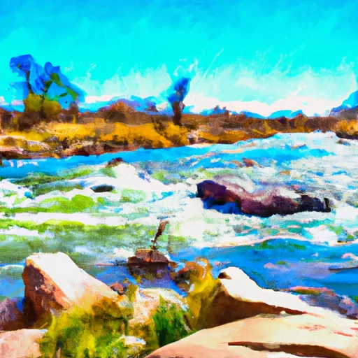
The segment has a total mileage of 9.5 miles, starting from Fisherman's Bridge and ending at Stone Bridge. The stretch includes several notable rapids such as Zoom Flume, Pine Creek, and The Numbers. Each rapid presents its own set of challenges, including large waves, tight chutes, and technical drops.
In terms of regulations, the area is managed by the Bureau of Land Management and has specific rules and guidelines in place to protect the natural resources and provide a safe experience for visitors. All individuals are required to wear a personal flotation device, and commercial rafting companies operating in the area must hold valid permits and follow safety protocols.
Overall, the Whitewater River Run on the Arkansas River Segment 1 provides an exciting and challenging whitewater experience for experienced paddlers, with specific regulations in place to ensure the safety of all individuals and protect the natural environment.
Plan your run down to the hour
Same weather feed Snoflo's iOS app uses -- updated continuously from NOAA / yr.no. Watch the precipitation column on the meteogram; rain ahead of a run typically lifts flows 12-48 hours later depending on the basin.
Next 5 days, hour by hour
Temperature line with weather symbols on top, snow + rain accumulation as columns, humidity as a dotted line.
5-day forecast table
Every 3 hours, broken out across temperature, snow, rain, humidity, and wind. Each cell is colour-coded relative to the column min/max.
| Time | Condition | Temp (°F) | Snow (in) | Rain (in) | Humidity (%) | Wind (mps) | Wind dir |
|---|---|---|---|---|---|---|---|
| Loading detailed forecast… | |||||||
15-day temperature & precipitation
Daily temperatures, snow, and rain projected over the next two weeks -- the upstream story that drives next week's flows.
Regional streamflow levels
USGS streamgauges around Arkansas River Segment 1 -- useful for spotting upstream pulses and gauging which tributary is contributing what.
| Streamgauge | Discharge | View |
|---|---|---|
| Arkansas River Near Leadville | 10 cfs | → |
| Lake Fork Below Sugar Loaf Reservoir | 4 cfs | → |
| Ef Arkansas R At Us Hiway 24 | 9 cfs | → |
| Halfmoon Creek Near Malta | 7 cfs | → |
| Arkansas River Below Empire Gulch Near Malta | 48 cfs | → |
| Wurtz Ditch Near Tenneessee Pass | 0 cfs | → |
Plan a longer trip
The closest boat launches, other paddle runs, and campgrounds so a day on the water can grow into a full weekend.
Boat launches
- Matchless Boating Site
- Turquoise Lake Trail Lake County
- Homestake Reservoir Boat Ramp Day Use Area
- Dexter Point Boating Site
- Red Rooster Boating Site
Other river runs
- East Fork Arkansas River
- Lower (Bottom Four)
- Pine Creek (Granite To Numbers)
- The Upper
- Upper-Upper Ten Mile
Campgrounds
- Silver Dollar
- Silver Dollar Campground
- Molly Brown Campground
- Molly Brown
- Sugar Loafin' Rv Park
- Printerboy Group Campground
Fishing spots
- Abe Lee Fishing Site
- Turquoise Lake
- Crystal Lakes
- Crystal Lake Fishing Site
- Hayden Meadows Reservoir
- Homestake Reservoir
Whitewater safety
- Check the flow before you run
- Use the linked-gauge card and Regional Flow panel above. Class ratings change with flow -- a Class III at low water can become Class IV+ at high water.
- Know your skill ceiling
- Pick runs comfortably below your ceiling. Cold-water and big-water runs raise the consequences of any mistake.
- Wear the right gear
- Helmet, PFD, drysuit / wetsuit when water is below 60°F. Throw bag, knife, and whistle on your person, not in the boat.
- Scout, set safety, and run with a team
- Scout new rapids on foot, set safety with throw bags above the consequence pool, and run with at least one other competent paddler.
- Respect the river
- Strainers, undercuts, low-head dams, and wood can kill at any class rating. When in doubt, portage.
Set push alerts in the Snoflo app
Save Arkansas River Segment 1 as a favorite, set a discharge threshold (e.g. "alert me when flow hits 600 cfs"), and the iOS app pushes the moment the linked gauge crosses.
About Arkansas River Segment 1
What's the optimal flow for Arkansas River Segment 1?
The optimal flow depends on the section and the craft. Check the Run Details panel for the linked gauge and current status.
How fresh is the cfs reading on this page?
The linked USGS streamgauge reports continuously (every 15 minutes); Snoflo refreshes throughout the day. Hover the streamflow sparkline to read individual datapoints.
What's the whitewater class?
See the Run Details panel for the class rating Snoflo tracks for this run. Class ratings change with flow -- a Class III at low water can become Class IV in high water.
Where do I put in / take out?
Tap Directions in the hero above to open driving directions to the put-in. For shuttle planning, check the Nearby Boat Launches panel and the river run operator's site.
Can I get alerts when flows hit the optimal range?
Yes -- alerts are managed in the Snoflo iOS app. Favorite this run, set a discharge threshold, and you'll get a push the moment the gauge crosses.
Other runs near here
Snoflo-tracked paddle runs within driving distance of Arkansas River Segment 1.