Monitor Creek River Run
Community Reviews
Been here? Share the conditions.
Reviews, ratings & photos are added in the free Snoflo iOS app — rate a spot, tag the conditions, and your visit is verified by location. Add or manage your reviews from the app.
Monitor Creek
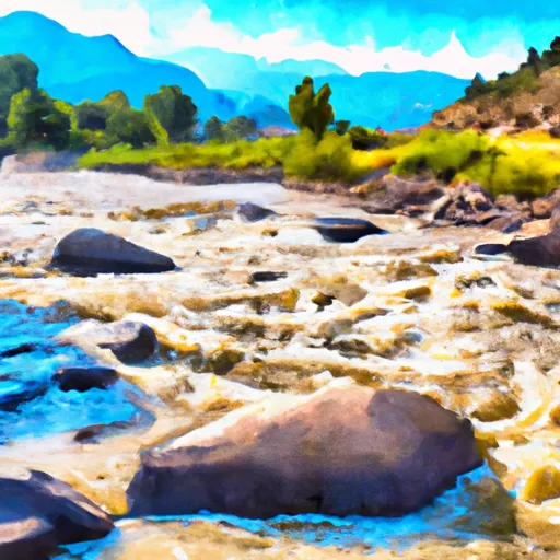
Some of the specific river rapids and obstacles that paddlers can expect to encounter include "Big Drop," "S-Turn," and "Toothache." These rapids require precise maneuvering and technical skills to navigate safely. Paddlers are advised to scout these rapids before attempting to run them.
There are specific regulations in place for this section of the Whitewater River. All paddlers are required to wear a US Coast Guard-approved personal flotation device (PFD) at all times while on the river. Additionally, paddlers are not allowed to remove or disturb any rocks or other natural features in the river. This is to help preserve the natural ecosystem of the river.
In conclusion, the Monitor Creek section of the Whitewater River is a challenging and technical run for advanced paddlers. With its steep gradient and numerous Class IV-V rapids, paddlers should approach this section of the river with caution and be prepared for the challenges ahead. It is important to follow all regulations and guidelines to ensure the safety of all paddlers and to help preserve the natural beauty of the river.
Plan your run down to the hour
Same weather feed Snoflo's iOS app uses -- updated continuously from NOAA / yr.no. Watch the precipitation column on the meteogram; rain ahead of a run typically lifts flows 12-48 hours later depending on the basin.
Next 5 days, hour by hour
Temperature line with weather symbols on top, snow + rain accumulation as columns, humidity as a dotted line.
5-day forecast table
Every 3 hours, broken out across temperature, snow, rain, humidity, and wind. Each cell is colour-coded relative to the column min/max.
| Time | Condition | Temp (°F) | Snow (in) | Rain (in) | Humidity (%) | Wind (mps) | Wind dir |
|---|---|---|---|---|---|---|---|
| Loading detailed forecast… | |||||||
15-day temperature & precipitation
Daily temperatures, snow, and rain projected over the next two weeks -- the upstream story that drives next week's flows.
Regional streamflow levels
USGS streamgauges around Monitor Creek -- useful for spotting upstream pulses and gauging which tributary is contributing what.
| Streamgauge | Discharge | View |
|---|---|---|
| Uncompahgre River At Delta | 107 cfs | → |
| Gunnison River At Delta | 328 cfs | → |
| San Miguel River At Brooks Bridge Near Nucla Co | 16 cfs | → |
| San Miguel River At Uravan | 7 cfs | → |
| North Fk Gunnison River Above Mouth Nr Lazear | 54 cfs | → |
| Dolores River Near Bedrock | 7 cfs | → |
Plan a longer trip
The closest boat launches, other paddle runs, and campgrounds so a day on the water can grow into a full weekend.
Other river runs
- Potter Creek
- Cottonwood Creek
- Roubideau Creek Segment 1
- Roubideau Creek Segment 2
- Tabeguache Creek Segment 1
Campgrounds
- Columbine Campground - Ouray Rd
- Columbine Campground
- Escalante Potholes Rec Site
- Iron Springs
- Iron Springs Campground - Ouray Rd
- Iron Springs Campground
Whitewater safety
- Check the flow before you run
- Use the linked-gauge card and Regional Flow panel above. Class ratings change with flow -- a Class III at low water can become Class IV+ at high water.
- Know your skill ceiling
- Pick runs comfortably below your ceiling. Cold-water and big-water runs raise the consequences of any mistake.
- Wear the right gear
- Helmet, PFD, drysuit / wetsuit when water is below 60°F. Throw bag, knife, and whistle on your person, not in the boat.
- Scout, set safety, and run with a team
- Scout new rapids on foot, set safety with throw bags above the consequence pool, and run with at least one other competent paddler.
- Respect the river
- Strainers, undercuts, low-head dams, and wood can kill at any class rating. When in doubt, portage.
Set push alerts in the Snoflo app
Save Monitor Creek as a favorite, set a discharge threshold (e.g. "alert me when flow hits 600 cfs"), and the iOS app pushes the moment the linked gauge crosses.
About Monitor Creek
What's the optimal flow for Monitor Creek?
The optimal flow depends on the section and the craft. Check the Run Details panel for the linked gauge and current status.
How fresh is the cfs reading on this page?
The linked USGS streamgauge reports continuously (every 15 minutes); Snoflo refreshes throughout the day. Hover the streamflow sparkline to read individual datapoints.
What's the whitewater class?
See the Run Details panel for the class rating Snoflo tracks for this run. Class ratings change with flow -- a Class III at low water can become Class IV in high water.
Where do I put in / take out?
Tap Directions in the hero above to open driving directions to the put-in. For shuttle planning, check the Nearby Boat Launches panel and the river run operator's site.
Can I get alerts when flows hit the optimal range?
Yes -- alerts are managed in the Snoflo iOS app. Favorite this run, set a discharge threshold, and you'll get a push the moment the gauge crosses.
Other runs near here
Snoflo-tracked paddle runs within driving distance of Monitor Creek.