Make an Announcement

Communicate warnings, disperse advice, and share.


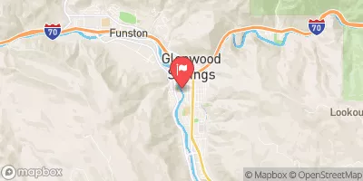
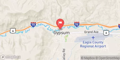
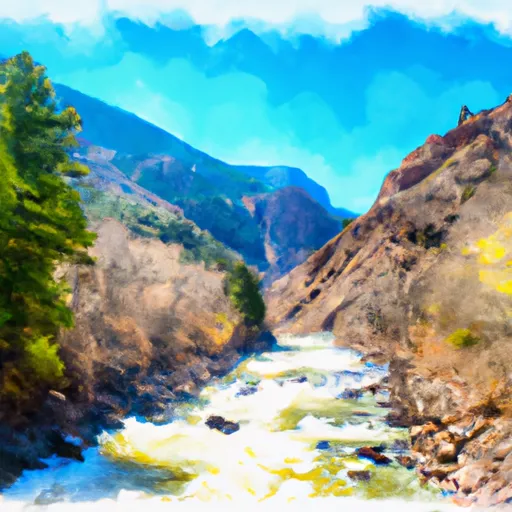
SHOSHONE (POWER PLANT TO GRIZZLY CREEK)

Whitewater River Run


Colorado Colorado River

Shoshone (Power Plant To Grizzly Creek)

Class III- TO IV Easy

816 CFS

Runnable
27°, Chance Snow Showers And Breezy

Suggested river levels for paddling this section of the Colorado River are between a bare minimum of 500cfs and a high of 10,000cfs. River conditions sourced from USGS 09070500, the Colorado River Near Dotsero Remember only watercraft are permitted at Shoshone (Power Plant to Grizzly Creek).

Status Runnable
Class Level III- to IV
Elevation 6,113 ft
Run Length 1.7 Mi
Gradient 49 FPM
Streamflow Discharge 816 cfs
Gage Height 2.1 ft
Reporting Streamgage Colorado River Near Dotsero
USGS 09070500

Nearby Snowpack and Water Data

Gauge Streamflow Stage
Hubbard Creek At Highway 133 At Mouth Nr Bowie
USGS 09132960
3 cfs 0.3 ft
Smith Fork Near Lazear
USGS 09129600
0 cfs 2.7 ft
Taylor River Below Taylor Park Reservoir
USGS 09109000
88 cfs 3.4 ft
Fryingpan River Near Ruedi
USGS 09080400
48 cfs 1.0 ft
Crystal River Ab Avalanche C
USGS 09081600
60 cfs 0.7 ft
Elk River Near Milner
USGS 09242500
27 cfs 1.4 ft
White River Near Meeker
USGS 09304500
281 cfs 2.5 ft
Muddy Creek At Bardine
USGS 09131500
-999 cfs 3.8 ft
North Fork Gunnison River Near Somerset
USGS 09132500
76 cfs 3.6 ft
Fish Cr At Upper Sta Nr Steamboat Springs
USGS 09238900
5 cfs 0.3 ft
Snotel Site Snowpack 24hr Change
Mc Clure Pass
SNOTEL 618
84" 4"
Independence Pass
SNOTEL 542
63" 2"
Burro Mountain
SNOTEL 378
68" -1"
Idarado
SNOTEL 538
67" 3"
Old Battle
SNOTEL 673
132" 0"
hayden coop
SNOTEL HAYC2
40" -1"
Overland Res.
SNOTEL 675
87" 2"
Bear River
SNOTEL 1061
48" 0"
Kiln
SNOTEL 556
53" 0"
Blackhall Mtn
SNOTEL 1119
113" 1"
Crosho
SNOTEL 426
61" -59"
Battle Mountain
SNOTEL 317
64" -1"
Mineral Creek
SNOTEL 629
65" 0"
Chapman Tunnel
SNOTEL 1101
58" 1"
Cochetopa Pass
SNOTEL 1059
26" 1"
Rabbit Ears
SNOTEL 709
88" 4"
Elk River
SNOTEL 467
83" 1"
Sandstone Rs
SNOTEL 732
75" 0"
Divide Peak
SNOTEL 449
83" 2"
Upper Taylor
SNOTEL 1141
75" 1"
Zirkel
SNOTEL 1033
93" -1"
Webber Springs
SNOTEL 852
94" 0"
Schofield Pass
SNOTEL 737
146" 6"
Trapper Lake
SNOTEL 827
38" 0"
Ripple Creek
SNOTEL 717
115" 4"
Dry Lake
SNOTEL 457
91" 4"
Wager Gulch
SNOTEL 1188
44" 0"
Bison Lake
SNOTEL 345
120" 1"
North Lost Trail
SNOTEL 669
95" 5"
Red Mountain Pass
SNOTEL 713
101" 0"
Lynx Pass
SNOTEL 607
49" 0"

Popular Destinations

Campground Campsites Reservations Toilets Showers Elevation
Coffee Pot Spring 10 10,084 ft
Supply Basin 7 10,767 ft
Deep Lake 35 10,475 ft
Redstone 17 7,299 ft
Sweetwater Lake 9 7,739 ft
Trappers Lake 35 9,747 ft
White Owl 6 10,705 ft
Avalanche 13 7,320 ft
McClure 8 8,187 ft
Bogan Flats 36 7,609 ft
Himes Peak 11 8,794 ft
Ski Area Snowpack Air Temperature 5 Day Forecast
Snowmass 75" 14° 2.68"
Sunlight Mountain Resort 84" 19° 3.91"
Crested Butte Mountain Resort 77" 14° 2.96"
River Run Streamflow Length Class
Riverbend (Tibbet's) to New Castle 2290.0cfs 3.25 Mi II
Bogan Canyon 59.8cfs 6.85 Mi III to III+
Avalanche Down 59.8cfs 12.0 Mi III
Waterfall to Confluence 401.0cfs 1.0 Mi V-
Grizzly Creek to Two Rivers Park 1380.0cfs 6.0 Mi II to III
South Canyon to Riverbend (Tibbet's) 2290.0cfs 3.5 Mi II to III
Catherine Store Section 401.0cfs 4.0 Mi II to II+
South Canyon to Riverbend (Tibbet's) 2290.0cfs 3.5 Mi II to III
New Castle to Silt 2290.0cfs 7.6 Mi II
South Canyon to Riverbend (Tibbet's) 2290.0cfs 3.5 Mi II to III
Carbondale to Westbank (Pink to Black) 901.0cfs 7.0 Mi II
Burns to Dotsero 816.0cfs 29.0 Mi I to IV
Shoshone (Power Plant to Grizzly Creek) 1380.0cfs 1.7 Mi III- to IV
South Canyon to Riverbend (Tibbet's) 2290.0cfs 3.5 Mi II to III
Oh Be Joyful 653.0cfs 1.0 Mi V
Riverbend (Tibbet's) to New Castle 2290.0cfs 3.25 Mi II
Barrel Springs 816.0cfs 4.0 Mi IV+ to V+
Shoshone (Power Plant to Grizzly Creek) 1380.0cfs 1.7 Mi III- to IV
Two Rivers to South Canyon 2290.0cfs 5.0 Mi II+ to III
Glenwood Springs Whitewater Park 2290.0cfs 0.25 Mi II to IV-
Crystal Mill Falls 310.0cfs None Mi V- to V
Cemetery 901.0cfs 12.0 Mi II+ to III+
Barrel Springs 816.0cfs 4.0 Mi IV+ to V+
South Canyon to Riverbend (Tibbet's) 2290.0cfs 3.5 Mi II to III

Log Your Visit

When was your last visit to Shoshone (Power Plant to Grizzly Creek)?

Add a Photo

How was it? How were conditions?

Rate the paddle


Submit

Leave A Review

Shoshone (Power Plant To Grizzly Creek)

Submit

Upload an Image

Shoshone (Power Plant To Grizzly Creek)
Login

Need an Account?

Forgot Your Password?

Delete User Account

Welcome to Snoflo


Continue with a free account

Already Have an Account?


Snoflo Premium

Your first week's free. Cancel anytime

Have a Promo Code?


Already Have an Account?

Signup for Basic Access


Welcome to Snoflo


Continue with a free account

Add Snoflo Premium


Already Have an Account?


Please Verify Your Account

Favorite Limit Reached
Signup for a Free Account

Already Have an Account?