Old Turnpike Crossing To Martin Branch Bridge River Run
Community Reviews
Been here? Share the conditions.
Reviews, ratings & photos are added in the free Snoflo iOS app — rate a spot, tag the conditions, and your visit is verified by location. Add or manage your reviews from the app.
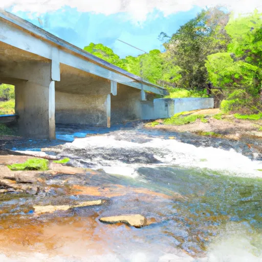
Old Turnpike Crossing To Martin Branch Bridge
It is important to note that this section of the river is located within Chattahoochee-Oconee National Forests, and therefore, specific regulations must be followed. These regulations include a maximum group size of 10 individuals, no campfires within 100 feet of the river, and a pack-in, pack-out policy for all trash and waste.
Overall, the Whitewater River Run from Old Turnpike Crossing to Martin Branch Bridge is a popular and exciting whitewater run that offers a fun challenge for experienced paddlers. It is important to always check current streamflow levels and adhere to all regulations to ensure a safe and enjoyable experience.
Plan your run down to the hour
Same weather feed Snoflo's iOS app uses -- updated continuously from NOAA / yr.no. Watch the precipitation column on the meteogram; rain ahead of a run typically lifts flows 12-48 hours later depending on the basin.
Next 5 days, hour by hour
Temperature line with weather symbols on top, snow + rain accumulation as columns, humidity as a dotted line.
5-day forecast table
Every 3 hours, broken out across temperature, snow, rain, humidity, and wind. Each cell is colour-coded relative to the column min/max.
| Time | Condition | Temp (°F) | Snow (in) | Rain (in) | Humidity (%) | Wind (mps) | Wind dir |
|---|---|---|---|---|---|---|---|
| Loading detailed forecast… | |||||||
15-day temperature & precipitation
Daily temperatures, snow, and rain projected over the next two weeks -- the upstream story that drives next week's flows.
Regional streamflow levels
USGS streamgauges around Old Turnpike Crossing To Martin Branch Bridge -- useful for spotting upstream pulses and gauging which tributary is contributing what.
| Streamgauge | Discharge | View |
|---|---|---|
| Chattahoochee River At Helen | 74 cfs | → |
| Nottely River Near Blairsville | 131 cfs | → |
| Tallulah River Near Clayton | 122 cfs | → |
| Chattahoochee River Near Leaf | 261 cfs | → |
| Chattahoochee River Near Cornelia | 483 cfs | → |
| Chestatee River Near Dahlonega | 233 cfs | → |
Plan a longer trip
The closest boat launches, other paddle runs, and campgrounds so a day on the water can grow into a full weekend.
Boat launches
- Mountain Shadows Drive White County
- Mayor's Park
- Upper Chatuge Lloyds Landing
- Boundary Waters Resort & Marina
- Lake Chatuge Towns County
- Moccasin Creek
Other river runs
- Mark Trail Wilderness Boundry To Old Turnpike Crossing Near Vandiver Branch
- Source Near Chattahoochee Gap To Mark Trail Wilderness Boundary
- Martin Branch Bridge To Robertsontown Bridge On Ga Highway 356
- Headwaters In Standing Indian Basin To Slackwater Of Natahala Lake
- Confluence Of Brasstown Creek And Little Brasstown Creek Just South Of Brasstown Falls Road (Fs 751) To Confluence Of Mill Branch, Brasstown Creek And Boatwright Creek Near Boatwright Road (Fs 753)
Campgrounds
- Upper Chattahoochee River Campground
- Upper Chattahoochee River
- Low Gap Creek
- Low Gap Campground
- Andrews Cove Campground
- Andrews Cove
Fishing spots
Whitewater safety
- Check the flow before you run
- Use the linked-gauge card and Regional Flow panel above. Class ratings change with flow -- a Class III at low water can become Class IV+ at high water.
- Know your skill ceiling
- Pick runs comfortably below your ceiling. Cold-water and big-water runs raise the consequences of any mistake.
- Wear the right gear
- Helmet, PFD, drysuit / wetsuit when water is below 60°F. Throw bag, knife, and whistle on your person, not in the boat.
- Scout, set safety, and run with a team
- Scout new rapids on foot, set safety with throw bags above the consequence pool, and run with at least one other competent paddler.
- Respect the river
- Strainers, undercuts, low-head dams, and wood can kill at any class rating. When in doubt, portage.
Set push alerts in the Snoflo app
Save Old Turnpike Crossing To Martin Branch Bridge as a favorite, set a discharge threshold (e.g. "alert me when flow hits 600 cfs"), and the iOS app pushes the moment the linked gauge crosses.
About Old Turnpike Crossing To Martin Branch Bridge
What's the optimal flow for Old Turnpike Crossing To Martin Branch Bridge?
The optimal flow depends on the section and the craft. Check the Run Details panel for the linked gauge and current status.
How fresh is the cfs reading on this page?
The linked USGS streamgauge reports continuously (every 15 minutes); Snoflo refreshes throughout the day. Hover the streamflow sparkline to read individual datapoints.
What's the whitewater class?
See the Run Details panel for the class rating Snoflo tracks for this run. Class ratings change with flow -- a Class III at low water can become Class IV in high water.
Where do I put in / take out?
Tap Directions in the hero above to open driving directions to the put-in. For shuttle planning, check the Nearby Boat Launches panel and the river run operator's site.
Can I get alerts when flows hit the optimal range?
Yes -- alerts are managed in the Snoflo iOS app. Favorite this run, set a discharge threshold, and you'll get a push the moment the gauge crosses.
Other runs near here
Snoflo-tracked paddle runs within driving distance of Old Turnpike Crossing To Martin Branch Bridge.