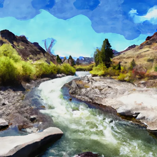
Long Gulch To Boise Nf Boundary River Run
Community Reviews
Been here? Share the conditions.
Reviews, ratings & photos are added in the free Snoflo iOS app — rate a spot, tag the conditions, and your visit is verified by location. Add or manage your reviews from the app.
Long Gulch To Boise Nf Boundary
One of the significant rapids on this run is the Staircase, which is a series of drops and pools that require precise maneuvering. The Pearly Gates is another challenging rapid on this run that requires proper scouting and skillful navigation. Other notable rapids on this run include the Ledges, Smokey Falls, and Devil's Slide.
There are specific regulations that must be adhered to when running this river. For instance, all boaters must wear a personal flotation device at all times, and all equipment must be in good working condition. Additionally, motorized boats are not permitted on this run, and all boaters must follow Leave No Trace principles to protect the environment.
In conclusion, the Whitewater River Run from Long Gulch to Boise National Forest Boundary in Idaho is a thrilling run that requires skillful navigation. The ideal streamflow range is between 700 and 3000 cfs, with class III and IV rapids. Boaters must adhere to specific regulations and follow Leave No Trace principles to protect the environment.
Plan your run down to the hour
Same weather feed Snoflo's iOS app uses -- updated continuously from NOAA / yr.no. Watch the precipitation column on the meteogram; rain ahead of a run typically lifts flows 12-48 hours later depending on the basin.
Next 5 days, hour by hour
Temperature line with weather symbols on top, snow + rain accumulation as columns, humidity as a dotted line.
5-day forecast table
Every 3 hours, broken out across temperature, snow, rain, humidity, and wind. Each cell is colour-coded relative to the column min/max.
| Time | Condition | Temp (°F) | Snow (in) | Rain (in) | Humidity (%) | Wind (mps) | Wind dir |
|---|---|---|---|---|---|---|---|
| Loading detailed forecast… | |||||||
15-day temperature & precipitation
Daily temperatures, snow, and rain projected over the next two weeks -- the upstream story that drives next week's flows.
Regional streamflow levels
USGS streamgauges around Long Gulch To Boise Nf Boundary -- useful for spotting upstream pulses and gauging which tributary is contributing what.
| Streamgauge | Discharge | View |
|---|---|---|
| Middle Fork Payette River Nr Crouch Id | 128 cfs | → |
| Nf Payette River Nr Banks Id | 1,410 cfs | → |
| Sf Payette River At Lowman Id | 500 cfs | → |
| Payette River Nr Horseshoe Bend Id | 2,980 cfs | → |
| Deadwood River Bl Deadwood Res Nr Lowman Id | 848 cfs | → |
| Payette River Nr Emmett Id | 1,560 cfs | → |
Plan a longer trip
The closest boat launches, other paddle runs, and campgrounds so a day on the water can grow into a full weekend.
Boat launches
Other river runs
- South Fork Payette
- Boise Nf Boundary To Confluence With Payette River
- Boise Nf Boundary (1 Mile East Of Banks) To Boise Nf Boundary (1 Mile South Of Banks)
- Pine Flats Creek To Long Gulch
- Confluence With Bell Creek To Boiling Springs Cabin
Whitewater safety
- Check the flow before you run
- Use the linked-gauge card and Regional Flow panel above. Class ratings change with flow -- a Class III at low water can become Class IV+ at high water.
- Know your skill ceiling
- Pick runs comfortably below your ceiling. Cold-water and big-water runs raise the consequences of any mistake.
- Wear the right gear
- Helmet, PFD, drysuit / wetsuit when water is below 60°F. Throw bag, knife, and whistle on your person, not in the boat.
- Scout, set safety, and run with a team
- Scout new rapids on foot, set safety with throw bags above the consequence pool, and run with at least one other competent paddler.
- Respect the river
- Strainers, undercuts, low-head dams, and wood can kill at any class rating. When in doubt, portage.
Set push alerts in the Snoflo app
Save Long Gulch To Boise Nf Boundary as a favorite, set a discharge threshold (e.g. "alert me when flow hits 600 cfs"), and the iOS app pushes the moment the linked gauge crosses.
About Long Gulch To Boise Nf Boundary
What's the optimal flow for Long Gulch To Boise Nf Boundary?
The optimal flow depends on the section and the craft. Check the Run Details panel for the linked gauge and current status.
How fresh is the cfs reading on this page?
The linked USGS streamgauge reports continuously (every 15 minutes); Snoflo refreshes throughout the day. Hover the streamflow sparkline to read individual datapoints.
What's the whitewater class?
See the Run Details panel for the class rating Snoflo tracks for this run. Class ratings change with flow -- a Class III at low water can become Class IV in high water.
Where do I put in / take out?
Tap Directions in the hero above to open driving directions to the put-in. For shuttle planning, check the Nearby Boat Launches panel and the river run operator's site.
Can I get alerts when flows hit the optimal range?
Yes -- alerts are managed in the Snoflo iOS app. Favorite this run, set a discharge threshold, and you'll get a push the moment the gauge crosses.
Other runs near here
Snoflo-tracked paddle runs within driving distance of Long Gulch To Boise Nf Boundary.