Boundary Proposed Addition Cabinet Mtns Wilderness, Sec. To Cabinet Gorge Reservoir River Run
Community Reviews
Been here? Share the conditions.
Reviews, ratings & photos are added in the free Snoflo iOS app — rate a spot, tag the conditions, and your visit is verified by location. Add or manage your reviews from the app.
Boundary Proposed Addition Cabinet Mtns Wilderness, Sec. To Cabinet Gorge Reservoir
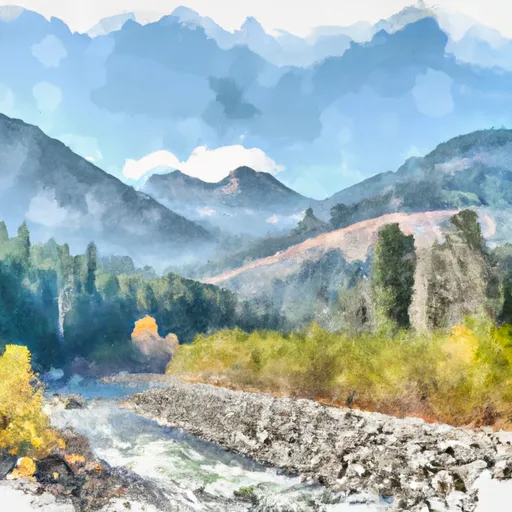
The specific river rapids and obstacles along this stretch include the "Guardrail" rapid, which is a technical Class IV drop with a narrow chute and a tight turn. Another prominent feature is the "Super Slide" rapid, where paddlers must navigate through a steep, narrow chute. Along with rapids, paddlers must also navigate around rocks and boulders.
There are specific regulations for this area that must be followed, including obtaining a permit for overnight camping, adhering to Leave No Trace principles, and respecting the wildlife and natural resources in the area. Additionally, the use of motorized equipment is prohibited in the wilderness area.
Plan your run down to the hour
Same weather feed Snoflo's iOS app uses -- updated continuously from NOAA / yr.no. Watch the precipitation column on the meteogram; rain ahead of a run typically lifts flows 12-48 hours later depending on the basin.
Next 5 days, hour by hour
Temperature line with weather symbols on top, snow + rain accumulation as columns, humidity as a dotted line.
5-day forecast table
Every 3 hours, broken out across temperature, snow, rain, humidity, and wind. Each cell is colour-coded relative to the column min/max.
| Time | Condition | Temp (°F) | Snow (in) | Rain (in) | Humidity (%) | Wind (mps) | Wind dir |
|---|---|---|---|---|---|---|---|
| Loading detailed forecast… | |||||||
15-day temperature & precipitation
Daily temperatures, snow, and rain projected over the next two weeks -- the upstream story that drives next week's flows.
Regional streamflow levels
USGS streamgauges around Boundary Proposed Addition Cabinet Mtns Wilderness, Sec. To Cabinet Gorge Reservoir -- useful for spotting upstream pulses and gauging which tributary is contributing what.
| Streamgauge | Discharge | View |
|---|---|---|
| Clark Fork River Below Cabinet Gorge Dam Id | 6,210 cfs | → |
| Lightning Creek At Clark Fork Id | 12 cfs | → |
| Nf Coeur D Alene R Ab Shoshone Ck Nr Prichard Id | 79 cfs | → |
| Fisher River Near Libby Mt | 84 cfs | → |
| Kootenai River Bl Libby Dam Nr Libby Mt | 8,980 cfs | → |
| Sf Coeur D Alene At Elizabeth Park Nr Kellogg Id | 89 cfs | → |
Plan a longer trip
The closest boat launches, other paddle runs, and campgrounds so a day on the water can grow into a full weekend.
Boat launches
- Dam Site
- Usfs Road 2229 Sanders County
- North Shore Road Trout Creek;Trout Creek Post Office
- Dorr Skeels Road Lincoln County
- Trout Creek
Other river runs
- Cabinet Mtns Wilderness Boundary, Sec. 3, T27n, R32w To Bull River, Sec. 12, T27n, R33w
- East Fork Bull River, Headwaters, Sec. 13, T27n, R32w To Cabinet Mountains Wilderness Boundary, Sec. 3, T27n, R32w
- Middle Fork Bull River, Sec. 9, T28n, R33w To Proposed Addition To Cabinet Mtns Wilderness, Sec. 12, T28n, R33w
- North Fork Bull River, Sec. 32, T29n, R32w To Proposed Cabinet Mtns Wilderness Boundary, Sec. 1, T28n, R32w
- Willow Creek, Sec. 32, T24n, R29w To Noxon Reservoir, Sec. 14, T24n, R31w
Whitewater safety
- Check the flow before you run
- Use the linked-gauge card and Regional Flow panel above. Class ratings change with flow -- a Class III at low water can become Class IV+ at high water.
- Know your skill ceiling
- Pick runs comfortably below your ceiling. Cold-water and big-water runs raise the consequences of any mistake.
- Wear the right gear
- Helmet, PFD, drysuit / wetsuit when water is below 60°F. Throw bag, knife, and whistle on your person, not in the boat.
- Scout, set safety, and run with a team
- Scout new rapids on foot, set safety with throw bags above the consequence pool, and run with at least one other competent paddler.
- Respect the river
- Strainers, undercuts, low-head dams, and wood can kill at any class rating. When in doubt, portage.
Set push alerts in the Snoflo app
Save Boundary Proposed Addition Cabinet Mtns Wilderness, Sec. To Cabinet Gorge Reservoir as a favorite, set a discharge threshold (e.g. "alert me when flow hits 600 cfs"), and the iOS app pushes the moment the linked gauge crosses.
About Boundary Proposed Addition Cabinet Mtns Wilderness, Sec. To Cabinet Gorge Reservoir
What's the optimal flow for Boundary Proposed Addition Cabinet Mtns Wilderness, Sec. To Cabinet Gorge Reservoir?
The optimal flow depends on the section and the craft. Check the Run Details panel for the linked gauge and current status.
How fresh is the cfs reading on this page?
The linked USGS streamgauge reports continuously (every 15 minutes); Snoflo refreshes throughout the day. Hover the streamflow sparkline to read individual datapoints.
What's the whitewater class?
See the Run Details panel for the class rating Snoflo tracks for this run. Class ratings change with flow -- a Class III at low water can become Class IV in high water.
Where do I put in / take out?
Tap Directions in the hero above to open driving directions to the put-in. For shuttle planning, check the Nearby Boat Launches panel and the river run operator's site.
Can I get alerts when flows hit the optimal range?
Yes -- alerts are managed in the Snoflo iOS app. Favorite this run, set a discharge threshold, and you'll get a push the moment the gauge crosses.
Other runs near here
Snoflo-tracked paddle runs within driving distance of Boundary Proposed Addition Cabinet Mtns Wilderness, Sec. To Cabinet Gorge Reservoir.