Teton River River Run
Community Reviews
Been here? Share the conditions.
Reviews, ratings & photos are added in the free Snoflo iOS app — rate a spot, tag the conditions, and your visit is verified by location. Add or manage your reviews from the app.
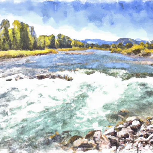
Teton River
The Teton River has a class rating of II-III, with certain sections having rapids that can reach up to class IV. The segment mileage for this river run is approximately 13 miles from the put-in at Bates Bridge to the take-out at the confluence with the Henrys Fork River.
Some of the specific rapids and obstacles on this river include the Teton Dam Rapid, a class III rapid with a large wave train, and the Launch Pad Rapid, a class IV rapid with a steep drop. There are also several other rapids and waves throughout the run that offer exciting challenges for experienced paddlers.
To ensure the safety of all participants, there are specific regulations in place for this area. All boaters must wear a personal flotation device (PFD) at all times, and no alcohol or drugs are allowed on the river. Additionally, there are regulations regarding parking and camping in the area, so it is important to check with the local authorities before planning a trip.
Overall, the Teton River in Idaho offers a thrilling whitewater experience with exciting rapids and challenges for experienced paddlers. It is important to be aware of the ideal streamflow range, class rating, segment mileage, specific river rapids/obstacles, and regulations before embarking on a trip to this area to ensure a safe and enjoyable experience.
Plan your run down to the hour
Same weather feed Snoflo's iOS app uses -- updated continuously from NOAA / yr.no. Watch the precipitation column on the meteogram; rain ahead of a run typically lifts flows 12-48 hours later depending on the basin.
Next 5 days, hour by hour
Temperature line with weather symbols on top, snow + rain accumulation as columns, humidity as a dotted line.
5-day forecast table
Every 3 hours, broken out across temperature, snow, rain, humidity, and wind. Each cell is colour-coded relative to the column min/max.
| Time | Condition | Temp (°F) | Snow (in) | Rain (in) | Humidity (%) | Wind (mps) | Wind dir |
|---|---|---|---|---|---|---|---|
| Loading detailed forecast… | |||||||
15-day temperature & precipitation
Daily temperatures, snow, and rain projected over the next two weeks -- the upstream story that drives next week's flows.
Regional streamflow levels
USGS streamgauges around Teton River -- useful for spotting upstream pulses and gauging which tributary is contributing what.
| Streamgauge | Discharge | View |
|---|---|---|
| Teton River Ab South Leigh Creek Nr Driggs Id | 277 cfs | → |
| Falls River Nr Ashton Id | 440 cfs | → |
| Falls River Nr Squirrel Id | 226 cfs | → |
| Falls River Ab Yellowstone Canal Nr Squirrel Id | 493 cfs | → |
| Henrys Fork Nr Ashton Id | 1,580 cfs | → |
| Falls River Nr Chester Id | 285 cfs | → |
Plan a longer trip
The closest boat launches, other paddle runs, and campgrounds so a day on the water can grow into a full weekend.
Boat launches
Other river runs
Campgrounds
- Aspen Acres Rv Park And Golf Course
- Jolley Camper
- Warm River Campground
- Warm River
- Squirrel Meadows Guard Station
- Grandview
Points of interest
Whitewater safety
- Check the flow before you run
- Use the linked-gauge card and Regional Flow panel above. Class ratings change with flow -- a Class III at low water can become Class IV+ at high water.
- Know your skill ceiling
- Pick runs comfortably below your ceiling. Cold-water and big-water runs raise the consequences of any mistake.
- Wear the right gear
- Helmet, PFD, drysuit / wetsuit when water is below 60°F. Throw bag, knife, and whistle on your person, not in the boat.
- Scout, set safety, and run with a team
- Scout new rapids on foot, set safety with throw bags above the consequence pool, and run with at least one other competent paddler.
- Respect the river
- Strainers, undercuts, low-head dams, and wood can kill at any class rating. When in doubt, portage.
Set push alerts in the Snoflo app
Save Teton River as a favorite, set a discharge threshold (e.g. "alert me when flow hits 600 cfs"), and the iOS app pushes the moment the linked gauge crosses.
About Teton River
What's the optimal flow for Teton River?
The optimal flow depends on the section and the craft. Check the Run Details panel for the linked gauge and current status.
How fresh is the cfs reading on this page?
The linked USGS streamgauge reports continuously (every 15 minutes); Snoflo refreshes throughout the day. Hover the streamflow sparkline to read individual datapoints.
What's the whitewater class?
See the Run Details panel for the class rating Snoflo tracks for this run. Class ratings change with flow -- a Class III at low water can become Class IV in high water.
Where do I put in / take out?
Tap Directions in the hero above to open driving directions to the put-in. For shuttle planning, check the Nearby Boat Launches panel and the river run operator's site.
Can I get alerts when flows hit the optimal range?
Yes -- alerts are managed in the Snoflo iOS app. Favorite this run, set a discharge threshold, and you'll get a push the moment the gauge crosses.
Other runs near here
Snoflo-tracked paddle runs within driving distance of Teton River.