Salmon River River Run
Community Reviews
Been here? Share the conditions.
Reviews, ratings & photos are added in the free Snoflo iOS app — rate a spot, tag the conditions, and your visit is verified by location. Add or manage your reviews from the app.
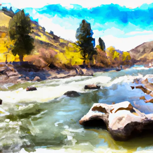
Salmon River
The Middle Fork has several notable rapids, including Velvet Falls, which is a Class IV rapid that requires skilled maneuvering through narrow channels. Other notable rapids include Pistol Creek Rapids, Haystack Rapid, and Cliffside Rapid. Boaters should be aware of several major obstacles on the river, including strainers, sweepers, and logjams.
The Salmon River is regulated by the United States Forest Service, which sets rules and regulations for boaters. These regulations include the use of personal flotation devices (PFDs), the prohibition of glass containers, and the requirement to pack out all trash. Additionally, boaters must obtain a permit to run the river, which is issued through a lottery system.
Overall, the Salmon River in Idaho offers a thrilling and challenging whitewater experience for experienced boaters. Boaters should always be aware of the current streamflow and should take necessary safety precautions to ensure a safe and enjoyable trip.
Plan your run down to the hour
Same weather feed Snoflo's iOS app uses -- updated continuously from NOAA / yr.no. Watch the precipitation column on the meteogram; rain ahead of a run typically lifts flows 12-48 hours later depending on the basin.
Next 5 days, hour by hour
Temperature line with weather symbols on top, snow + rain accumulation as columns, humidity as a dotted line.
5-day forecast table
Every 3 hours, broken out across temperature, snow, rain, humidity, and wind. Each cell is colour-coded relative to the column min/max.
| Time | Condition | Temp (°F) | Snow (in) | Rain (in) | Humidity (%) | Wind (mps) | Wind dir |
|---|---|---|---|---|---|---|---|
| Loading detailed forecast… | |||||||
15-day temperature & precipitation
Daily temperatures, snow, and rain projected over the next two weeks -- the upstream story that drives next week's flows.
Regional streamflow levels
USGS streamgauges around Salmon River -- useful for spotting upstream pulses and gauging which tributary is contributing what.
| Streamgauge | Discharge | View |
|---|---|---|
| Lemhi River Nr Lemhi Id | 123 cfs | → |
| Pahsimeroi River At Ellis Id | 123 cfs | → |
| Lemhi River Below L5 Diversion Near Salmon | 60 cfs | → |
| Blackbird Creek Near Cobalt | 12 cfs | → |
| Salmon River At Salmon Id | 1,460 cfs | → |
| Napias Creek Below Arnett Creek Near Leesburg | 31 cfs | → |
Plan a longer trip
The closest boat launches, other paddle runs, and campgrounds so a day on the water can grow into a full weekend.
Boat launches
Other river runs
- Colston To The Town Of Salmon
- Cow Creek
- Pahsimeroi To Royal Gorge
- Bear Valley Lake To Trailhead
- Wade Creek To Nf Boundary
Whitewater safety
- Check the flow before you run
- Use the linked-gauge card and Regional Flow panel above. Class ratings change with flow -- a Class III at low water can become Class IV+ at high water.
- Know your skill ceiling
- Pick runs comfortably below your ceiling. Cold-water and big-water runs raise the consequences of any mistake.
- Wear the right gear
- Helmet, PFD, drysuit / wetsuit when water is below 60°F. Throw bag, knife, and whistle on your person, not in the boat.
- Scout, set safety, and run with a team
- Scout new rapids on foot, set safety with throw bags above the consequence pool, and run with at least one other competent paddler.
- Respect the river
- Strainers, undercuts, low-head dams, and wood can kill at any class rating. When in doubt, portage.
Set push alerts in the Snoflo app
Save Salmon River as a favorite, set a discharge threshold (e.g. "alert me when flow hits 600 cfs"), and the iOS app pushes the moment the linked gauge crosses.
About Salmon River
What's the optimal flow for Salmon River?
The optimal flow depends on the section and the craft. Check the Run Details panel for the linked gauge and current status.
How fresh is the cfs reading on this page?
The linked USGS streamgauge reports continuously (every 15 minutes); Snoflo refreshes throughout the day. Hover the streamflow sparkline to read individual datapoints.
What's the whitewater class?
See the Run Details panel for the class rating Snoflo tracks for this run. Class ratings change with flow -- a Class III at low water can become Class IV in high water.
Where do I put in / take out?
Tap Directions in the hero above to open driving directions to the put-in. For shuttle planning, check the Nearby Boat Launches panel and the river run operator's site.
Can I get alerts when flows hit the optimal range?
Yes -- alerts are managed in the Snoflo iOS app. Favorite this run, set a discharge threshold, and you'll get a push the moment the gauge crosses.
Other runs near here
Snoflo-tracked paddle runs within driving distance of Salmon River.