Headwaters, Sec. 17, T19n, R15w To Seeley Lake, Sec. 20, T17n, R15w River Run
Community Reviews
Been here? Share the conditions.
Reviews, ratings & photos are added in the free Snoflo iOS app — rate a spot, tag the conditions, and your visit is verified by location. Add or manage your reviews from the app.
Headwaters, Sec. 17, T19n, R15w To Seeley Lake, Sec. 20, T17n, R15w
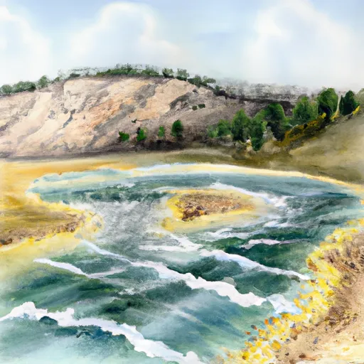
This section of the river is classified as a class II-III, which means that it has moderate to difficult rapids with moderate to high waves. The segment mileage from Headwaters to Seeley Lake is approximately 30 miles, with several notable rapids and obstacles, including Wilderness Rapid, Split Rock Rapid, and Fang Rapid.
There are several regulations that apply to this area, including a requirement for a Montana fishing license if fishing in the river. Additionally, there may be restrictions on the use of motorized boats or certain types of equipment in certain sections of the river. It is important to check with local authorities or guide services for specific regulations and requirements before embarking on a trip down the Whitewater River run.
Overall, the Whitewater River run is a challenging and exciting adventure for experienced kayakers and whitewater rafters. It is important to always use caution and follow safety protocols while on the river to ensure a safe and enjoyable experience.
Plan your run down to the hour
Same weather feed Snoflo's iOS app uses -- updated continuously from NOAA / yr.no. Watch the precipitation column on the meteogram; rain ahead of a run typically lifts flows 12-48 hours later depending on the basin.
Next 5 days, hour by hour
Temperature line with weather symbols on top, snow + rain accumulation as columns, humidity as a dotted line.
5-day forecast table
Every 3 hours, broken out across temperature, snow, rain, humidity, and wind. Each cell is colour-coded relative to the column min/max.
| Time | Condition | Temp (°F) | Snow (in) | Rain (in) | Humidity (%) | Wind (mps) | Wind dir |
|---|---|---|---|---|---|---|---|
| Loading detailed forecast… | |||||||
15-day temperature & precipitation
Daily temperatures, snow, and rain projected over the next two weeks -- the upstream story that drives next week's flows.
Regional streamflow levels
USGS streamgauges around Headwaters, Sec. 17, T19n, R15w To Seeley Lake, Sec. 20, T17n, R15w -- useful for spotting upstream pulses and gauging which tributary is contributing what.
| Streamgauge | Discharge | View |
|---|---|---|
| South Fork Jocko River Near Arlee Mt | 51 cfs | → |
| Mission Cr Ab Reservoir Nr St Ignatius Mt | 104 cfs | → |
| Blackfoot River Near Bonner Mt | 1,000 cfs | → |
| Nf Blackfoot R Ab Dry Gulch Nr Ovando Mt | 328 cfs | → |
| South Crow Creek Near Ronan Mt | 9 cfs | → |
| Clark Fork Above Missoula Mt | 1,830 cfs | → |
Plan a longer trip
The closest boat launches, other paddle runs, and campgrounds so a day on the water can grow into a full weekend.
Boat launches
- Placid Lake State Park
- Salmon Lake State Park
- South Holland Lake Road 232, 59826 Montana
- Harpers Lake
- Russell Gates Memorial
- Upsata Lake
Other river runs
- Morrell Falls, Sec. 24, T18n, R15w To Morrell Falls Trailhead, Sec. 36, T18n, R15w
- Headwaters, Sec. 7, T18n, R14w To Morrell Falls, Sec. 24, T18n, R15w
- Belmont Creek
Campgrounds
- Seeley Lake Campground
- Seeley Lake Complex
- River Point Campground
- River Point Complex
- Big Larch Complex
- Big Larch Campground
Fishing spots
Whitewater safety
- Check the flow before you run
- Use the linked-gauge card and Regional Flow panel above. Class ratings change with flow -- a Class III at low water can become Class IV+ at high water.
- Know your skill ceiling
- Pick runs comfortably below your ceiling. Cold-water and big-water runs raise the consequences of any mistake.
- Wear the right gear
- Helmet, PFD, drysuit / wetsuit when water is below 60°F. Throw bag, knife, and whistle on your person, not in the boat.
- Scout, set safety, and run with a team
- Scout new rapids on foot, set safety with throw bags above the consequence pool, and run with at least one other competent paddler.
- Respect the river
- Strainers, undercuts, low-head dams, and wood can kill at any class rating. When in doubt, portage.
Set push alerts in the Snoflo app
Save Headwaters, Sec. 17, T19n, R15w To Seeley Lake, Sec. 20, T17n, R15w as a favorite, set a discharge threshold (e.g. "alert me when flow hits 600 cfs"), and the iOS app pushes the moment the linked gauge crosses.
About Headwaters, Sec. 17, T19n, R15w To Seeley Lake, Sec. 20, T17n, R15w
What's the optimal flow for Headwaters, Sec. 17, T19n, R15w To Seeley Lake, Sec. 20, T17n, R15w?
The optimal flow depends on the section and the craft. Check the Run Details panel for the linked gauge and current status.
How fresh is the cfs reading on this page?
The linked USGS streamgauge reports continuously (every 15 minutes); Snoflo refreshes throughout the day. Hover the streamflow sparkline to read individual datapoints.
What's the whitewater class?
See the Run Details panel for the class rating Snoflo tracks for this run. Class ratings change with flow -- a Class III at low water can become Class IV in high water.
Where do I put in / take out?
Tap Directions in the hero above to open driving directions to the put-in. For shuttle planning, check the Nearby Boat Launches panel and the river run operator's site.
Can I get alerts when flows hit the optimal range?
Yes -- alerts are managed in the Snoflo iOS app. Favorite this run, set a discharge threshold, and you'll get a push the moment the gauge crosses.
Other runs near here
Snoflo-tracked paddle runs within driving distance of Headwaters, Sec. 17, T19n, R15w To Seeley Lake, Sec. 20, T17n, R15w.