2026-02-19T10:00:00-08:00
* WHAT...For the Winter Weather Advisory below 1500 ft, wet snow expected. Additional snow accumulations of 1 to 3 inches. For the Winter Storm Warning above 1500 ft, heavy snow expected. Additional snow accumulations 3 to 6 inches for the passes north of I-5, and the Illinois Valley except up to 10 inches for the southern portions of the Illinois Valley. 1 to 2 ft in the Kalmiopsis Wilderness region. * WHERE...For the Winter Weather Advisory below 1500 ft, this includes Grants Pass, Wilderville, Merlin, Galice and Agness as well as portions of I-5 and Highway 199. For the Winter Storm Warning above 1500 ft, this includes Cave Junction, Obrien, Selma and Wolf Creek. This also includes portions of I-5 and Highway 199 and the Sexton Pass, Smith Hill and Stage Pass on I-5, Hayes Hill on Highway 199 and Bear Camp road in the Kalmiopsis Wilderness. * WHEN...Until 10 AM PST Thursday. * IMPACTS...Travel may be very difficult to impossible. The hazardous conditions could impact the evening and morning commutes. * ADDITIONAL DETAILS...Precipitation will be lighter and more showery tonight into Wednesday with mostly light accumulations. Another round of heavier snowfall is expected Wednesday night into Thursday. Visit weather.gov/mfr/winter for additional snow probabilities
Summary
The ideal streamflow range for the river is between 500 and 1,500 cubic feet per second (cfs) during the spring and early summer months. It is classified as a Class III-IV rapid, with some sections reaching Class V during high water.
The segment mileage for Riffle Creek is approximately 11 miles, with some sections requiring portaging due to dangerous obstacles such as logjams and tight canyons. The river features several notable rapids, including Charlie's and Tumbleweed, which are known for their technicality and difficulty.
There are specific regulations in place for Riffle Creek, including a permit requirement for commercial river guides and restrictions on camping and fires along the river banks. It is important for visitors to review and adhere to these regulations to ensure the safety of themselves and others.
Overall, Riffle Creek offers a challenging and exhilarating river run for experienced kayakers and rafters. It is important to check current streamflow levels and weather conditions before attempting the run, as water levels can fluctuate rapidly.
°F
°F
mph
Wind
%
Humidity
15-Day Weather Outlook
River Run Details
| Last Updated | 2025-06-28 |
| River Levels | 30 cfs (2.66 ft) |
| Percent of Normal | 69% |
| Status | |
| Class Level | iii-iv |
| Elevation | ft |
| Streamflow Discharge | cfs |
| Gauge Height | ft |
| Reporting Streamgage | USGS 14309500 |
5-Day Hourly Forecast Detail
Nearby Streamflow Levels
 West Fork Cow Creek Near Glendale
|
101cfs |
 Cow Creek Near Riddle
|
314cfs |
 Rogue River Near Agness
|
3310cfs |
 Cow Creek Near Azalea
|
49cfs |
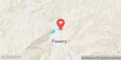 South Fork Coquille River At Powers
|
366cfs |
 Rogue River At Grants Pass
|
1790cfs |
Area Campgrounds
| Location | Reservations | Toilets |
|---|---|---|
 Skull Creek Campground
|
||
 Skull Creek
|
||
 Lower Whisky (R3.16R)
|
||
 Cave Rock (R3.25L)
|
||
 BLS (R3.22L)
|
||
 Fawn (R3.51R)
|


 Grave Creek
 Grave Creek Boat Ramp
 Argo Recreation Site and Boat Ramp
 Riffle Creek
 Grave Creek to Foster Bar
 Howard Creek Seg B
 Elk Valley Creek
 Howard Creek Seg A