Left Fork Foots Creek River Run
Community Reviews
Been here? Share the conditions.
Reviews, ratings & photos are added in the free Snoflo iOS app — rate a spot, tag the conditions, and your visit is verified by location. Add or manage your reviews from the app.
Left Fork Foots Creek
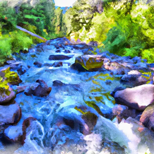
The Left Fork Foots Creek is rated as a Class III-IV river, offering intermediate to advanced level challenges for kayakers and rafters. The segment mileage of the river run is approximately 6.5 miles, starting at 3,200 feet elevation and descending to 2,600 feet.
Some of the notable rapids and obstacles in this river run include the Class III+ Drop, Class IV Rapid, and Class III+ Rockpile. The Drop features a steep and narrow chute, while the Rapid is a long and technical section with multiple smaller drops. The Rockpile is a technical rapid with multiple channels that require precise maneuvering.
To ensure the safety and preservation of the river ecosystem, there are specific regulations in place for the Left Fork Foots Creek. These include a permit requirement for commercial use, a carry-in and carry-out policy for all trash and equipment, and a prohibition of camping and fires within 500 feet of the river.
Overall, the Left Fork Foots Creek in Oregon offers a challenging and exciting whitewater river run with specific streamflow ranges, class ratings, segment mileage, rapids and obstacles, and regulations to ensure safety and preservation.
Plan your run down to the hour
Same weather feed Snoflo's iOS app uses -- updated continuously from NOAA / yr.no. Watch the precipitation column on the meteogram; rain ahead of a run typically lifts flows 12-48 hours later depending on the basin.
Next 5 days, hour by hour
Temperature line with weather symbols on top, snow + rain accumulation as columns, humidity as a dotted line.
5-day forecast table
Every 3 hours, broken out across temperature, snow, rain, humidity, and wind. Each cell is colour-coded relative to the column min/max.
| Time | Condition | Temp (°F) | Snow (in) | Rain (in) | Humidity (%) | Wind (mps) | Wind dir |
|---|---|---|---|---|---|---|---|
| Loading detailed forecast… | |||||||
15-day temperature & precipitation
Daily temperatures, snow, and rain projected over the next two weeks -- the upstream story that drives next week's flows.
Regional streamflow levels
USGS streamgauges around Left Fork Foots Creek -- useful for spotting upstream pulses and gauging which tributary is contributing what.
| Streamgauge | Discharge | View |
|---|---|---|
| Applegate River Near Applegate | 95 cfs | → |
| Rogue River At Raygold Near Central Point | 1,390 cfs | → |
| Bear Creek At Medford | 32 cfs | → |
| Star Gulch Near Ruch | 0 cfs | → |
| Rogue River At Grants Pass | 1,190 cfs | → |
| Applegate River Near Wilderville | 73 cfs | → |
Plan a longer trip
The closest boat launches, other paddle runs, and campgrounds so a day on the water can grow into a full weekend.
Boat launches
Other river runs
- Gold Ray Dam To Grants Pass
- Grants Pass To Grave Creek
- Sams Creek
- Applegate River
- Headwaters To Forest Road 960
Campgrounds
- Valley Of The Rogue State Park
- Drifters
- Gold Hill Koa
- Cantrell Buckley Park
- Chinook Winds Rv
- Rogue River Campground
Whitewater safety
- Check the flow before you run
- Use the linked-gauge card and Regional Flow panel above. Class ratings change with flow -- a Class III at low water can become Class IV+ at high water.
- Know your skill ceiling
- Pick runs comfortably below your ceiling. Cold-water and big-water runs raise the consequences of any mistake.
- Wear the right gear
- Helmet, PFD, drysuit / wetsuit when water is below 60°F. Throw bag, knife, and whistle on your person, not in the boat.
- Scout, set safety, and run with a team
- Scout new rapids on foot, set safety with throw bags above the consequence pool, and run with at least one other competent paddler.
- Respect the river
- Strainers, undercuts, low-head dams, and wood can kill at any class rating. When in doubt, portage.
Set push alerts in the Snoflo app
Save Left Fork Foots Creek as a favorite, set a discharge threshold (e.g. "alert me when flow hits 600 cfs"), and the iOS app pushes the moment the linked gauge crosses.
About Left Fork Foots Creek
What's the optimal flow for Left Fork Foots Creek?
The optimal flow depends on the section and the craft. Check the Run Details panel for the linked gauge and current status.
How fresh is the cfs reading on this page?
The linked USGS streamgauge reports continuously (every 15 minutes); Snoflo refreshes throughout the day. Hover the streamflow sparkline to read individual datapoints.
What's the whitewater class?
See the Run Details panel for the class rating Snoflo tracks for this run. Class ratings change with flow -- a Class III at low water can become Class IV in high water.
Where do I put in / take out?
Tap Directions in the hero above to open driving directions to the put-in. For shuttle planning, check the Nearby Boat Launches panel and the river run operator's site.
Can I get alerts when flows hit the optimal range?
Yes -- alerts are managed in the Snoflo iOS app. Favorite this run, set a discharge threshold, and you'll get a push the moment the gauge crosses.
Other runs near here
Snoflo-tracked paddle runs within driving distance of Left Fork Foots Creek.