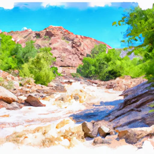
Mineral Gulch Segment 35-38 River Run
Community Reviews
Been here? Share the conditions.
Reviews, ratings & photos are added in the free Snoflo iOS app — rate a spot, tag the conditions, and your visit is verified by location. Add or manage your reviews from the app.
Mineral Gulch Segment 35-38
There are several rapids and obstacles that kayakers and rafters encounter on the Mineral Gulch segment, including the Class III "Pinball," "Jaws," and "Boulder Garden" rapids, as well as the Class IV "The Narrows" rapid. It is important for kayakers and rafters to be aware of the hazards, especially during high water levels, as the rapids can be more challenging and dangerous.
The Mineral Gulch segment is managed by the Bureau of Land Management (BLM) and has specific regulations that visitors must follow. Some of these regulations include obtaining a permit before launching, wearing a personal flotation device, and carrying a first aid kit. Visitors are also required to pack out all trash and leave the area as they found it.
Overall, the Mineral Gulch segment of the Whitewater River Run is a thrilling and challenging destination for kayakers and rafters. Visitors should be aware of the ideal streamflow range, class rating, specific rapids and obstacles, and regulations in the area to ensure a safe and enjoyable trip.
Plan your run down to the hour
Same weather feed Snoflo's iOS app uses -- updated continuously from NOAA / yr.no. Watch the precipitation column on the meteogram; rain ahead of a run typically lifts flows 12-48 hours later depending on the basin.
Next 5 days, hour by hour
Temperature line with weather symbols on top, snow + rain accumulation as columns, humidity as a dotted line.
5-day forecast table
Every 3 hours, broken out across temperature, snow, rain, humidity, and wind. Each cell is colour-coded relative to the column min/max.
| Time | Condition | Temp (°F) | Snow (in) | Rain (in) | Humidity (%) | Wind (mps) | Wind dir |
|---|---|---|---|---|---|---|---|
| Loading detailed forecast… | |||||||
15-day temperature & precipitation
Daily temperatures, snow, and rain projected over the next two weeks -- the upstream story that drives next week's flows.
Regional streamflow levels
USGS streamgauges around Mineral Gulch Segment 35-38 -- useful for spotting upstream pulses and gauging which tributary is contributing what.
| Streamgauge | Discharge | View |
|---|---|---|
| East Fork Virgin River Near Springdale | 44 cfs | → |
| North Fork Virgin River Near Springdale | 37 cfs | → |
| East Fork Virgin River Near Glendale | 5 cfs | → |
| Kanab Creek Near Kanab | 4 cfs | → |
| Virgin River At Virgin | 62 cfs | → |
| Virgin River Ab La Verkin Creek Nr La Verkin | 48 cfs | → |
Plan a longer trip
The closest boat launches, other paddle runs, and campgrounds so a day on the water can grow into a full weekend.
Other river runs
- Virgin River, East Fork Segment 37-40a
- Meadow Creek Segment 33-35
- Virgin River, East Fork Segment 40a-41
- Orderville Canyon Segment 44-45
- Nf-Zion Park-Satan's Staircase
Campgrounds
- Open Camp Spot
- Zion Scenic Byway Dispersed Camping
- Very Tight Dirt Road, Lots Of Branches Will Scratch Vehicle
- Camping Spot, Road Washed Out, Cation
- Zion Mountain Ranch Campground
- High Road Campground
Whitewater safety
- Check the flow before you run
- Use the linked-gauge card and Regional Flow panel above. Class ratings change with flow -- a Class III at low water can become Class IV+ at high water.
- Know your skill ceiling
- Pick runs comfortably below your ceiling. Cold-water and big-water runs raise the consequences of any mistake.
- Wear the right gear
- Helmet, PFD, drysuit / wetsuit when water is below 60°F. Throw bag, knife, and whistle on your person, not in the boat.
- Scout, set safety, and run with a team
- Scout new rapids on foot, set safety with throw bags above the consequence pool, and run with at least one other competent paddler.
- Respect the river
- Strainers, undercuts, low-head dams, and wood can kill at any class rating. When in doubt, portage.
Set push alerts in the Snoflo app
Save Mineral Gulch Segment 35-38 as a favorite, set a discharge threshold (e.g. "alert me when flow hits 600 cfs"), and the iOS app pushes the moment the linked gauge crosses.
About Mineral Gulch Segment 35-38
What's the optimal flow for Mineral Gulch Segment 35-38?
The optimal flow depends on the section and the craft. Check the Run Details panel for the linked gauge and current status.
How fresh is the cfs reading on this page?
The linked USGS streamgauge reports continuously (every 15 minutes); Snoflo refreshes throughout the day. Hover the streamflow sparkline to read individual datapoints.
What's the whitewater class?
See the Run Details panel for the class rating Snoflo tracks for this run. Class ratings change with flow -- a Class III at low water can become Class IV in high water.
Where do I put in / take out?
Tap Directions in the hero above to open driving directions to the put-in. For shuttle planning, check the Nearby Boat Launches panel and the river run operator's site.
Can I get alerts when flows hit the optimal range?
Yes -- alerts are managed in the Snoflo iOS app. Favorite this run, set a discharge threshold, and you'll get a push the moment the gauge crosses.
Other runs near here
Snoflo-tracked paddle runs within driving distance of Mineral Gulch Segment 35-38.