2026-02-19T05:00:00-07:00
* WHAT...Heavy snow. Total snow accumulations between 1 and 2 feet with locally higher accumulations up to 30 inches across the upper Cottonwoods. Winds gusting as high as 60 mph. * WHERE...The Wasatch Mountains and Western Uinta Mountains. * WHEN...Until 5 AM MST Thursday. * IMPACTS...Winter driving conditions can be expected on all mountain routes. Traction restrictions are likely. * ADDITIONAL DETAILS...A period of heavy snow is expected between roughly 5 AM to 11 AM, with snowfall rates generally 1 to 2 inches per hour likely, except exceeding 2 inches per hour in the Upper Cottonwoods. Northwesterly flow prevailing behind a frontal passage will result in lingering showers through the end of the day Wednesday.
Summary
The best time to float this section of water is during the summer months, when the water levels are higher and more consistent. The ideal CFS for this section is between 200-600. There are several river obstacles, including a few small rapids and some tight turns. Overall, this section of river is a great option for those looking for a scenic and enjoyable float trip.
°F
°F
mph
Wind
%
Humidity
15-Day Weather Outlook
River Run Details
| Last Updated | 2023-06-13 |
| River Levels | 199 cfs (2.88 ft) |
| Percent of Normal | 187% |
| Optimal Range | 350-1000 cfs |
| Status | Too Low |
| Class Level | II+ to III |
| Elevation | 4,697 ft |
| Gradient | 60 FPM |
| Streamflow Discharge | 103 cfs |
| Gauge Height | 2.6 ft |
| Reporting Streamgage | USGS 10109000 |
5-Day Hourly Forecast Detail
Nearby Streamflow Levels
 Logan
Logan
|
0cfs |
 Logan River Above State Dam
|
103cfs |
 Blacksmith Fork Ab U.P.&L. Co
|
64cfs |
 Little Bear River At Paradise
|
48cfs |
 Bear River At Idaho-Utah State Line
|
473cfs |
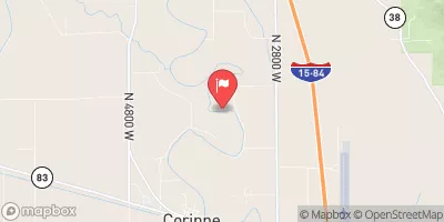 Bear River Near Corinne
|
1030cfs |
Area Campgrounds
| Location | Reservations | Toilets |
|---|---|---|
 Logan, free camping
|
||
 Spring Hollow Campground
|
||
 Bridger Campground
|
||
 Guinavah - Malibu Campground
|
||
 Preston Valley Campground
|
||
 Wood Camp Campground
|


 3rd Dam to 2nd Dam
 Confluence With Beaver Creek To Bridge In Guinavah-Malibu Campground
 Staircase Section - 2nd Dam to 1st Dam
 Logan Town Run
 Source To Mouth
 Elk Ridge Park
 River Hollow Park
 Denzil Stewart Nature Park
 Merlin Olsen Central Park
 Braegger Park