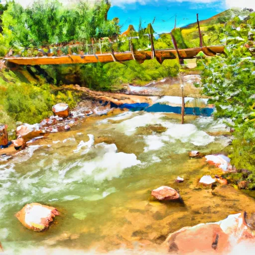
Confluence With Beaver Creek To Bridge In Guinavah-Malibu Campground River Run
Community Reviews
Been here? Share the conditions.
Reviews, ratings & photos are added in the free Snoflo iOS app — rate a spot, tag the conditions, and your visit is verified by location. Add or manage your reviews from the app.
Confluence With Beaver Creek To Bridge In Guinavah-Malibu Campground
The segment mileage for this stretch of the river is approximately 7 miles, and it features several notable rapids and obstacles, including "The Squeeze," "The Nozzle," and "The Boneyard." These rapids require technical maneuvering and are known for their steep drops and challenging eddy lines.
In terms of regulations, all boaters are required to wear personal flotation devices (PFDs) at all times while on the river. Additionally, motorized watercraft are not allowed on this stretch of the river, and camping is only permitted in designated campgrounds.
Plan your run down to the hour
Same weather feed Snoflo's iOS app uses -- updated continuously from NOAA / yr.no. Watch the precipitation column on the meteogram; rain ahead of a run typically lifts flows 12-48 hours later depending on the basin.
Next 5 days, hour by hour
Temperature line with weather symbols on top, snow + rain accumulation as columns, humidity as a dotted line.
5-day forecast table
Every 3 hours, broken out across temperature, snow, rain, humidity, and wind. Each cell is colour-coded relative to the column min/max.
| Time | Condition | Temp (°F) | Snow (in) | Rain (in) | Humidity (%) | Wind (mps) | Wind dir |
|---|---|---|---|---|---|---|---|
| Loading detailed forecast… | |||||||
15-day temperature & precipitation
Daily temperatures, snow, and rain projected over the next two weeks -- the upstream story that drives next week's flows.
Regional streamflow levels
USGS streamgauges around Confluence With Beaver Creek To Bridge In Guinavah-Malibu Campground -- useful for spotting upstream pulses and gauging which tributary is contributing what.
| Streamgauge | Discharge | View |
|---|---|---|
| Logan | 64 cfs | → |
| Logan River Above State Dam | 79 cfs | → |
| Blacksmith Fork Ab U.P.&L. Co | 52 cfs | → |
| Little Bear River At Paradise | 14 cfs | → |
| Bear River At Idaho-Utah State Line | 931 cfs | → |
| Bear River Near Corinne | 324 cfs | → |
Plan a longer trip
The closest boat launches, other paddle runs, and campgrounds so a day on the water can grow into a full weekend.
Boat launches
- North 3000 West Cache County
- Hyrum State Park
- West 3000 North 4507, Cache County
- Highway 30 Cache County
- West 6200 North 6484, Cache County
Other river runs
Campgrounds
- Guinavah - Malibu Campground
- Spring Hollow Campground
- Logan, Free Camping
- Bridger Campground
- Wood Camp Campground
- Preston Valley Campground
Whitewater safety
- Check the flow before you run
- Use the linked-gauge card and Regional Flow panel above. Class ratings change with flow -- a Class III at low water can become Class IV+ at high water.
- Know your skill ceiling
- Pick runs comfortably below your ceiling. Cold-water and big-water runs raise the consequences of any mistake.
- Wear the right gear
- Helmet, PFD, drysuit / wetsuit when water is below 60°F. Throw bag, knife, and whistle on your person, not in the boat.
- Scout, set safety, and run with a team
- Scout new rapids on foot, set safety with throw bags above the consequence pool, and run with at least one other competent paddler.
- Respect the river
- Strainers, undercuts, low-head dams, and wood can kill at any class rating. When in doubt, portage.
Set push alerts in the Snoflo app
Save Confluence With Beaver Creek To Bridge In Guinavah-Malibu Campground as a favorite, set a discharge threshold (e.g. "alert me when flow hits 600 cfs"), and the iOS app pushes the moment the linked gauge crosses.
About Confluence With Beaver Creek To Bridge In Guinavah-Malibu Campground
What's the optimal flow for Confluence With Beaver Creek To Bridge In Guinavah-Malibu Campground?
The optimal flow depends on the section and the craft. Check the Run Details panel for the linked gauge and current status.
How fresh is the cfs reading on this page?
The linked USGS streamgauge reports continuously (every 15 minutes); Snoflo refreshes throughout the day. Hover the streamflow sparkline to read individual datapoints.
What's the whitewater class?
See the Run Details panel for the class rating Snoflo tracks for this run. Class ratings change with flow -- a Class III at low water can become Class IV in high water.
Where do I put in / take out?
Tap Directions in the hero above to open driving directions to the put-in. For shuttle planning, check the Nearby Boat Launches panel and the river run operator's site.
Can I get alerts when flows hit the optimal range?
Yes -- alerts are managed in the Snoflo iOS app. Favorite this run, set a discharge threshold, and you'll get a push the moment the gauge crosses.
Other runs near here
Snoflo-tracked paddle runs within driving distance of Confluence With Beaver Creek To Bridge In Guinavah-Malibu Campground.