Headwaters- Includes All Tributaries To Confluence With Dosewallips River River Run
Community Reviews
Been here? Share the conditions.
Reviews, ratings & photos are added in the free Snoflo iOS app — rate a spot, tag the conditions, and your visit is verified by location. Add or manage your reviews from the app.
Headwaters- Includes All Tributaries To Confluence With Dosewallips River
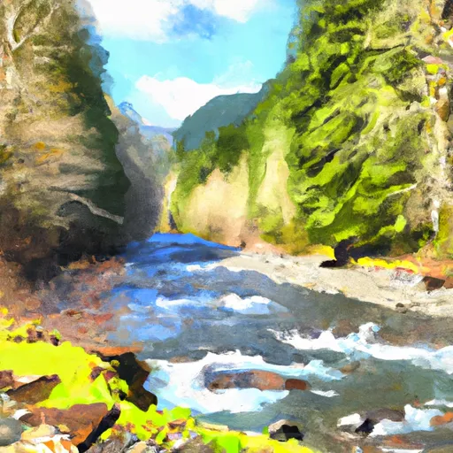
There are specific river rapids and obstacles that paddlers need to be aware of, including the S-Turn, the Slot, the Ledges, and the Potholes. The S-Turn is a Class III rapid that requires precise maneuvering between rocks and boulders. The Slot is a Class IV rapid that requires navigating through a narrow gap between two large boulders. The Ledges are a series of Class III rapids that require quick and precise maneuvering. The Potholes are a Class V rapid that features a steep drop and a large hole at the bottom.
There are specific regulations to the area that paddlers need to follow, including obtaining a permit from the Olympic National Park, which is required for all river users. Additionally, paddlers must adhere to the park's regulations regarding camping and campfires.
Overall, the Whitewater River Run is a thrilling adventure for experienced and intermediate paddlers. With its ideal streamflow range, class rating, segment mileage, specific river rapids/obstacles, and specific regulations to the area, it is a must-visit destination for anyone looking for an exciting whitewater experience in Washington state.
Plan your run down to the hour
Same weather feed Snoflo's iOS app uses -- updated continuously from NOAA / yr.no. Watch the precipitation column on the meteogram; rain ahead of a run typically lifts flows 12-48 hours later depending on the basin.
Next 5 days, hour by hour
Temperature line with weather symbols on top, snow + rain accumulation as columns, humidity as a dotted line.
5-day forecast table
Every 3 hours, broken out across temperature, snow, rain, humidity, and wind. Each cell is colour-coded relative to the column min/max.
| Time | Condition | Temp (°F) | Snow (in) | Rain (in) | Humidity (%) | Wind (mps) | Wind dir |
|---|---|---|---|---|---|---|---|
| Loading detailed forecast… | |||||||
15-day temperature & precipitation
Daily temperatures, snow, and rain projected over the next two weeks -- the upstream story that drives next week's flows.
Regional streamflow levels
USGS streamgauges around Headwaters- Includes All Tributaries To Confluence With Dosewallips River -- useful for spotting upstream pulses and gauging which tributary is contributing what.
| Streamgauge | Discharge | View |
|---|---|---|
| Duckabush River Near Brinnon | 48 cfs | → |
| Big Quilcene River Below Diversion Nr Quilcene | 26 cfs | → |
| Nf Skokomish R Bl Staircase Rpds Nr Hoodsport | 37 cfs | → |
| Dungeness River Near Sequim | 106 cfs | → |
| South Fork Skokomish River Near Union | 116 cfs | → |
| Elwha River Above Lake Mills Nr Port Angeles | 725 cfs | → |
Plan a longer trip
The closest boat launches, other paddle runs, and campgrounds so a day on the water can grow into a full weekend.
Boat launches
- Triton Cove
- Pleasant Harbor
- Mike's Beach Resort
- Point Whitney Road 1099, Brinnon
- Quilcene Marina
- Indian George Creek
Other river runs
- Headwaters- Includes All Tributaries (Upstream From Station Creek) To Confluence With Dosewallips River
- Confluence With Station Creek To Eastern Boundary Of Olympic National Park
Campgrounds
Whitewater safety
- Check the flow before you run
- Use the linked-gauge card and Regional Flow panel above. Class ratings change with flow -- a Class III at low water can become Class IV+ at high water.
- Know your skill ceiling
- Pick runs comfortably below your ceiling. Cold-water and big-water runs raise the consequences of any mistake.
- Wear the right gear
- Helmet, PFD, drysuit / wetsuit when water is below 60°F. Throw bag, knife, and whistle on your person, not in the boat.
- Scout, set safety, and run with a team
- Scout new rapids on foot, set safety with throw bags above the consequence pool, and run with at least one other competent paddler.
- Respect the river
- Strainers, undercuts, low-head dams, and wood can kill at any class rating. When in doubt, portage.
Set push alerts in the Snoflo app
Save Headwaters- Includes All Tributaries To Confluence With Dosewallips River as a favorite, set a discharge threshold (e.g. "alert me when flow hits 600 cfs"), and the iOS app pushes the moment the linked gauge crosses.
About Headwaters- Includes All Tributaries To Confluence With Dosewallips River
What's the optimal flow for Headwaters- Includes All Tributaries To Confluence With Dosewallips River?
The optimal flow depends on the section and the craft. Check the Run Details panel for the linked gauge and current status.
How fresh is the cfs reading on this page?
The linked USGS streamgauge reports continuously (every 15 minutes); Snoflo refreshes throughout the day. Hover the streamflow sparkline to read individual datapoints.
What's the whitewater class?
See the Run Details panel for the class rating Snoflo tracks for this run. Class ratings change with flow -- a Class III at low water can become Class IV in high water.
Where do I put in / take out?
Tap Directions in the hero above to open driving directions to the put-in. For shuttle planning, check the Nearby Boat Launches panel and the river run operator's site.
Can I get alerts when flows hit the optimal range?
Yes -- alerts are managed in the Snoflo iOS app. Favorite this run, set a discharge threshold, and you'll get a push the moment the gauge crosses.
Other runs near here
Snoflo-tracked paddle runs within driving distance of Headwaters- Includes All Tributaries To Confluence With Dosewallips River.