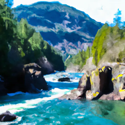
Confluence Of Canyon And Granite Creeks To Ross Lake National Recreation Area Boundary River Run
Community Reviews
Been here? Share the conditions.
Reviews, ratings & photos are added in the free Snoflo iOS app — rate a spot, tag the conditions, and your visit is verified by location. Add or manage your reviews from the app.
Confluence Of Canyon And Granite Creeks To Ross Lake National Recreation Area Boundary
The Whitewater River Run from the Confluence of Canyon and Granite Creeks to the Ross Lake National Recreation Area Boundary is a popular destination for whitewater enthusiasts in Washington. The ideal streamflow range for this segment is between 2000 and 5000 cfs, which provides a good balance of challenge and safety for experienced paddlers. The class rating for this section of the river is generally considered to be Class III, with some sections reaching Class IV in high water. The segment mileage is approximately 10 miles, and includes several notable rapids and obstacles, including Boulder Drop, The Wave, and The Jaws. It is important for visitors to familiarize themselves with these rapids and obstacles before attempting the run, and to exercise caution when navigating them.
Specific regulations to the area include a permit requirement for all visitors to the Ross Lake National Recreation Area, which can be obtained through the National Park Service. Additionally, visitors are required to follow Leave No Trace principles and to pack out all waste. It is also important to note that there are no facilities or services available along the river, so visitors must bring all necessary supplies with them. Overall, the Whitewater River Run is a challenging and exciting adventure for experienced paddlers, but should only be attempted with proper preparation and caution.
Plan your run down to the hour
Same weather feed Snoflo's iOS app uses -- updated continuously from NOAA / yr.no. Watch the precipitation column on the meteogram; rain ahead of a run typically lifts flows 12-48 hours later depending on the basin.
Next 5 days, hour by hour
Temperature line with weather symbols on top, snow + rain accumulation as columns, humidity as a dotted line.
5-day forecast table
Every 3 hours, broken out across temperature, snow, rain, humidity, and wind. Each cell is colour-coded relative to the column min/max.
| Time | Condition | Temp (°F) | Snow (in) | Rain (in) | Humidity (%) | Wind (mps) | Wind dir |
|---|---|---|---|---|---|---|---|
| Loading detailed forecast… | |||||||
15-day temperature & precipitation
Daily temperatures, snow, and rain projected over the next two weeks -- the upstream story that drives next week's flows.
Regional streamflow levels
USGS streamgauges around Confluence Of Canyon And Granite Creeks To Ross Lake National Recreation Area Boundary -- useful for spotting upstream pulses and gauging which tributary is contributing what.
| Streamgauge | Discharge | View |
|---|---|---|
| Thunder Creek Near Newhalem | 1,410 cfs | → |
| Newhalem Creek Near Newhalem | 32 cfs | → |
| Skagit River At Newhalem | 3,310 cfs | → |
| Bacon Creek Below Oakes Creek Near Marblemount | 174 cfs | → |
| Salix Creek At S Cascade Gl Near Marblemount | 0 cfs | → |
| Cascade River At Marblemount | 794 cfs | → |
Plan a longer trip
The closest boat launches, other paddle runs, and campgrounds so a day on the water can grow into a full weekend.
Other river runs
- Ross Lake National Recreation Area Boundary To Slack Water Of Ross Lake
- Point On Range Line To Ruby Creek
- Pasayten Wilderness Boundary To Point On Range Line Between Sec 12, R14e And Sec 17, R16e
- Headwaters To Confluence With Thunder Creek
- Begins Below Gorge Powerhouse To Ross Lake National Recreation Area Boundary
Campgrounds
Whitewater safety
- Check the flow before you run
- Use the linked-gauge card and Regional Flow panel above. Class ratings change with flow -- a Class III at low water can become Class IV+ at high water.
- Know your skill ceiling
- Pick runs comfortably below your ceiling. Cold-water and big-water runs raise the consequences of any mistake.
- Wear the right gear
- Helmet, PFD, drysuit / wetsuit when water is below 60°F. Throw bag, knife, and whistle on your person, not in the boat.
- Scout, set safety, and run with a team
- Scout new rapids on foot, set safety with throw bags above the consequence pool, and run with at least one other competent paddler.
- Respect the river
- Strainers, undercuts, low-head dams, and wood can kill at any class rating. When in doubt, portage.
Set push alerts in the Snoflo app
Save Confluence Of Canyon And Granite Creeks To Ross Lake National Recreation Area Boundary as a favorite, set a discharge threshold (e.g. "alert me when flow hits 600 cfs"), and the iOS app pushes the moment the linked gauge crosses.
About Confluence Of Canyon And Granite Creeks To Ross Lake National Recreation Area Boundary
What's the optimal flow for Confluence Of Canyon And Granite Creeks To Ross Lake National Recreation Area Boundary?
The optimal flow depends on the section and the craft. Check the Run Details panel for the linked gauge and current status.
How fresh is the cfs reading on this page?
The linked USGS streamgauge reports continuously (every 15 minutes); Snoflo refreshes throughout the day. Hover the streamflow sparkline to read individual datapoints.
What's the whitewater class?
See the Run Details panel for the class rating Snoflo tracks for this run. Class ratings change with flow -- a Class III at low water can become Class IV in high water.
Where do I put in / take out?
Tap Directions in the hero above to open driving directions to the put-in. For shuttle planning, check the Nearby Boat Launches panel and the river run operator's site.
Can I get alerts when flows hit the optimal range?
Yes -- alerts are managed in the Snoflo iOS app. Favorite this run, set a discharge threshold, and you'll get a push the moment the gauge crosses.
Other runs near here
Snoflo-tracked paddle runs within driving distance of Confluence Of Canyon And Granite Creeks To Ross Lake National Recreation Area Boundary.