Lower Green River Lake Outlet To Nf Boundary River Run
Community Reviews
Been here? Share the conditions.
Reviews, ratings & photos are added in the free Snoflo iOS app — rate a spot, tag the conditions, and your visit is verified by location. Add or manage your reviews from the app.
Lower Green River Lake Outlet To Nf Boundary
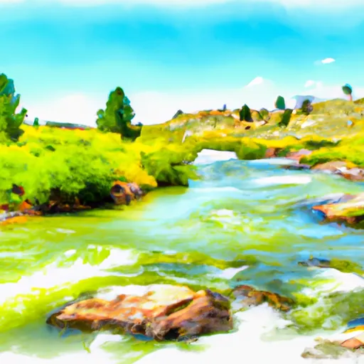
The Lower Green River Lake Outlet to Nf Boundary whitewater river run is located in the Bridger-Teton National Forest in western Wyoming. The ideal streamflow range for this segment is between 500-2000 cubic feet per second (cfs) during the late spring and early summer months. This stretch of the Green River is classified as a Class III-IV run, meaning it features powerful rapids and obstacles that require technical paddling skills and experience. The segment is approximately 8.5 miles long, and it offers a mix of continuous rapids and large drops that are sure to challenge even the most seasoned kayakers and rafters. Some of the notable rapids and obstacles include Hell's Half Mile, a steep drop that requires precise navigation, and the famous Big Kahuna, a large wave that can easily flip rafts and kayaks.
To ensure the safety of visitors to the area, there are specific regulations that must be followed. All boaters are required to wear a personal floatation device (PFD) and to carry a whistle and a throw rope. Additionally, all motorized watercraft must be registered with the Wyoming Game and Fish Department. Visitors are also expected to practice Leave No Trace principles by packing out all trash and avoiding damage to natural resources.
Plan your run down to the hour
Same weather feed Snoflo's iOS app uses -- updated continuously from NOAA / yr.no. Watch the precipitation column on the meteogram; rain ahead of a run typically lifts flows 12-48 hours later depending on the basin.
Next 5 days, hour by hour
Temperature line with weather symbols on top, snow + rain accumulation as columns, humidity as a dotted line.
5-day forecast table
Every 3 hours, broken out across temperature, snow, rain, humidity, and wind. Each cell is colour-coded relative to the column min/max.
| Time | Condition | Temp (°F) | Snow (in) | Rain (in) | Humidity (%) | Wind (mps) | Wind dir |
|---|---|---|---|---|---|---|---|
| Loading detailed forecast… | |||||||
15-day temperature & precipitation
Daily temperatures, snow, and rain projected over the next two weeks -- the upstream story that drives next week's flows.
Regional streamflow levels
USGS streamgauges around Lower Green River Lake Outlet To Nf Boundary -- useful for spotting upstream pulses and gauging which tributary is contributing what.
| Streamgauge | Discharge | View |
|---|---|---|
| Green River At Warren Bridge | 418 cfs | → |
| Pine Creek Above Fremont Lake | 176 cfs | → |
| Wind River Near Dubois | 135 cfs | → |
| Wind River Above Red Creek | 655 cfs | → |
| Dinwoody Creek Above Lakes | 388 cfs | → |
| Snake River Bl Flat Creek Nr Jackson Wy | 6,500 cfs | → |
Plan a longer trip
The closest boat launches, other paddle runs, and campgrounds so a day on the water can grow into a full weekend.
Boat launches
- Green River Access Site 12 Boat Ramp
- Green River Lake
- New Fork Lake
- Green River Access Site 8 Boat Launch
- Green River Access Site 6 Boat Launch
- Green River Access Site 5 Boat Ramp
Other river runs
Campgrounds
- Whiskey Grove
- Whiskey Grove Campground
- Green River Access Site 12 Campsite 1
- Green River Access Site 11 Campsite 1
- Green River Access Site 11 Campsite 2
- Green River Lake
Fishing spots
Whitewater safety
- Check the flow before you run
- Use the linked-gauge card and Regional Flow panel above. Class ratings change with flow -- a Class III at low water can become Class IV+ at high water.
- Know your skill ceiling
- Pick runs comfortably below your ceiling. Cold-water and big-water runs raise the consequences of any mistake.
- Wear the right gear
- Helmet, PFD, drysuit / wetsuit when water is below 60°F. Throw bag, knife, and whistle on your person, not in the boat.
- Scout, set safety, and run with a team
- Scout new rapids on foot, set safety with throw bags above the consequence pool, and run with at least one other competent paddler.
- Respect the river
- Strainers, undercuts, low-head dams, and wood can kill at any class rating. When in doubt, portage.
Set push alerts in the Snoflo app
Save Lower Green River Lake Outlet To Nf Boundary as a favorite, set a discharge threshold (e.g. "alert me when flow hits 600 cfs"), and the iOS app pushes the moment the linked gauge crosses.
About Lower Green River Lake Outlet To Nf Boundary
What's the optimal flow for Lower Green River Lake Outlet To Nf Boundary?
The optimal flow depends on the section and the craft. Check the Run Details panel for the linked gauge and current status.
How fresh is the cfs reading on this page?
The linked USGS streamgauge reports continuously (every 15 minutes); Snoflo refreshes throughout the day. Hover the streamflow sparkline to read individual datapoints.
What's the whitewater class?
See the Run Details panel for the class rating Snoflo tracks for this run. Class ratings change with flow -- a Class III at low water can become Class IV in high water.
Where do I put in / take out?
Tap Directions in the hero above to open driving directions to the put-in. For shuttle planning, check the Nearby Boat Launches panel and the river run operator's site.
Can I get alerts when flows hit the optimal range?
Yes -- alerts are managed in the Snoflo iOS app. Favorite this run, set a discharge threshold, and you'll get a push the moment the gauge crosses.
Other runs near here
Snoflo-tracked paddle runs within driving distance of Lower Green River Lake Outlet To Nf Boundary.